
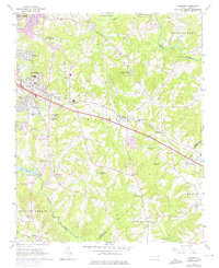
1964 Map of Garner
USGS Topo · Published 1965About this map
The Southern Railway cuts a distinct path through this mid-century landscape, linking the growing community of Garner with the smaller whistle-stops and rural hubs of Auburn and Cloverdale. This 1964 survey captures the township of St Marys as it transitions from a traditional agricultural rail corridor into a more developed suburban edge. Pockets of residential growth like Forest Hills and Emerald Village appear alongside long-standing rural institutions such as Ebenezer Ch and the Garner Consolidated High Sch.
Find a feature on this map
48 named features on this map. Tap any name to fly to it.
Don’t see what you’re looking for? This feature index may not catch every label — zoom into the map to look around manually.
Map Details
Editions of this 1964 Garner Map
4 editions found
Other maps of this area

1943 · Raleigh
USGS Topo · 1:62,500

1951 · Raleigh
USGS Topo · 1:62,500

1953 · Raleigh
USGS Topo · 1:250,000

1954 · Raleigh
USGS Topo · 1:250,000

1964 · Lake Wheeler
USGS Topo · 1:24,000

1964 · Selma
USGS Topo · 1:62,500

1964 · Angier
USGS Topo · 1:24,000

1964 · Clayton
USGS Topo · 1:24,000

1964 · Edmondson
USGS Topo · 1:24,000

1964 · Garner
USGS Topo · 1:62,500