Old Maps of Lee County, North Carolina
Explore 82 old maps of Lee County, spanning from 1953 to today. These high-resolution historic maps reveal how streets, neighborhoods, landmarks, and natural features evolved over time — perfect for genealogy, metal detecting, research, and local history exploration.
What you can do with these maps:
- See how Lee County changed over time: Compare historical maps to modern-day views to trace roads, homesites, rail lines & more.
- View detailed metadata: Each map includes creators, publishers, year, scale, and archive source.
- Overlay maps with satellite & LiDAR: Visualize the past alongside modern tools to explore terrain & human change.
- Trusted historical sources: Maps sourced from the USGS, Library of Congress, and other archives.
- Access maps your way: View online, download high-res files, or order prints for personal or research use.
Start exploring old maps of Lee County to uncover forgotten places, hidden landmarks, and the deep history beneath your feet.
Lee County, NC maps
(82)- 1953 Map of Raleigh, 1965 Print
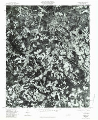
 1953 Raleigh1965 Print · USGSCentral North Carolina in the early sixties shows a landscape of growing towns and military hubs before the full expansion of the interstate system. Genealogists can trace family footprints across the Piedmont through Wake Forest, Siler City, and the large Fort Bragg Military Reservation.4 unique versions available
 - 1954 Map of Raleigh
 1954 Raleigh1954 Print · USGSThe North Carolina Piedmont and Sandhills are captured in the mid-fifties during a period of steady regional growth. Genealogists and historians can trace the development of towns like Siler City or locate landmarks such as Falls of Neuse and Camp Mackall.
 - 1957 Map of Murchisontown, 1958 Print
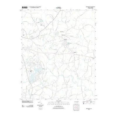
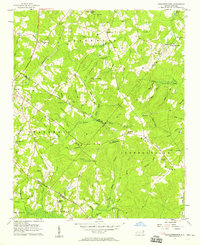 1957 Murchisontown1958 Print · USGSIn the late fifties, the rural borders of Harnett, Lee, and Moore Counties remained a landscape of timber and tobacco farms tied together by country churches. Researchers can locate numerous local landmarks including McIver Sch, Murchison Chapel, and an ancient Indian Mound near Huckleberry Pond.2 unique versions available
 - 1957 Map of Olivia, 1986 Print
 1957 Olivia1986 Print · USGSIn mid-century Harnett County, the Seaboard Coast Line Railroad connects the small farming and timber communities of central North Carolina. Genealogists and local historians can trace legacy sites like the Old Charter Cem, Benhaven High Sch, and the community at Johnsonville.
 - 1969 Map of New Hope Dam, 1973 Print
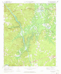 1969 New Hope Dam1973 Print · USGSChatham County is captured during the late sixties at a critical turning point as the New Hope Dam project begins to reshape the river valleys. Researchers can trace land tracts near Griffins Crossroads or locate old community hubs like Seaforth and Merry Oaks before the waters rose.2 unique versions available
 - 1970 Map of Goldston, 1972 Print
 1970 Goldston1972 Print · USGSChatham and Moore counties meet along the Deep River in the early seventies, where rail lines and river bends shaped local life. Genealogists can trace family footprints at Walters Sch, Mt Herman Ch, and the rural community of Goldston.3 unique versions available
 - 1970 Map of Colon, 1973 Print
 1970 Colon1973 Print · USGSLee and Chatham counties are shown at a time of local industrial and transit expansion in the early 1970s. Trace family roots and local history through features like Colon, the Farmville Cem, and numerous Claypits along the SEABOARD COAST LINE.2 unique versions available
 - 1970 Map of Moncure, 1973 Print
 1970 Moncure1973 Print · USGSThe confluence of the Deep and Haw Rivers defines this Chatham County landscape in the early seventies as industrial growth meets rural tradition. Trace the rail lines of the Seaboard Coast Line and find landmarks like Rose Hill Ch or the Copper Mine.2 unique versions available
 - 1974 Map of White Hill, 1976 Print
 1974 White Hill1976 Print · USGSThe rural countryside near the Moore and Lee County line is captured here in the mid-1970s. Genealogists can locate family landmarks like White Hill and several country churches, including Euphronia Ch and Poplar Springs Ch.
 - 1974 Map of Vass, 1976 Print
 1974 Vass1976 Print · USGSMoore County in the mid-seventies shows a landscape of established rail towns and emerging residential developments near the Lee County line. Genealogists and local historians can trace family-named sites like Henderson Cem, Stones Chapel, and the Seaboard Coast Line through Vass.
 - 1974 Map of Mamers, 1977 Print
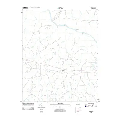
 1974 Mamers1977 Print · USGSHarnett County remains a rural landscape in the 1970s, defined by the winding course of the Cape Fear River and the newly established Raven Rock State Park. Researchers can trace the heritage of local crossroads like Mamers or locate family-named landmarks such as Antioch Ch and Boone Trail.2 unique versions available
 - 1974 Map of Cokesbury, 1977 Print
 1974 Cokesbury1977 Print · USGSHarnett and Wake counties show a landscape of rural crossroads and river drainage during the mid-seventies. Trace the Norfolk Southern rail corridor or locate family landmarks like Prince Chapel and the Buckhorn Dam.4 unique versions available
 - 1974 Map of Sanford, 1977 Print
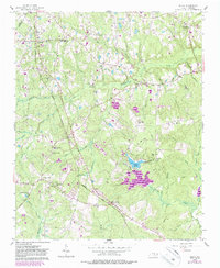
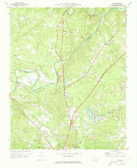
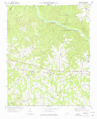
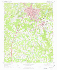 1974 Sanford1977 Print · USGSSanford and the surrounding Lee County countryside are captured here in the mid-seventies, showing a region defined by its busy railroad junctions and rural settlements. Genealogists and historians can trace local landmarks like Buffalo Cem, Shallow Well Ch, and the old Williams Sch.2 unique versions available
 - 1977 Map of Broadway
 1977 Broadway1977 Print · USGSThe rural borderlands of Lee and Harnett Counties are captured here in the late seventies, centered on the growing town of Broadway. Researchers can trace old family sites and transport routes through an Old Railroad Grade and numerous country churches like Morris Chapel and Juniper Springs Ch.3 unique versions available
 - 1980 Map of Sanford, 1983 Print
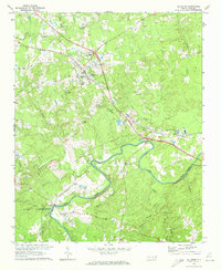
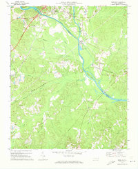
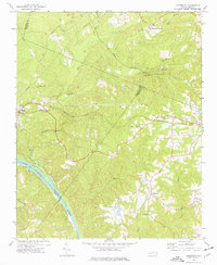
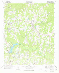
 1980 Sanford1983 Print · USGSSanford and the surrounding Lee County countryside are revealed in detailed aerial photography from the early 1980s. Trace the rural-to-urban transition between Sanford and smaller settlements like Tramway, Lemon Springs, and Cool Springs.
 - 1982 Map of Southern Pines, 1983 Print
 1982 Southern Pines1983 Print · USGSCentral North Carolina in the early eighties shows a landscape defined by military expansion and historic rail corridors. Researchers can trace the legacy of the Seaboard Coast Line through Pinehurst or locate landmarks like the Town Creek Indian Mound State Historic Site.
 - 1984 Map of Chapel Hill, 1985 Print
 1984 Chapel Hill1985 Print · USGSNorth Carolina’s Piedmont and the northern reaches of the Uwharrie Mountains are captured here in the mid-eighties. Genealogists can trace family roots through rural landmarks like Union Chapel or locate old rail stops along the Seaboard line.
 - 1984 Map of Raleigh, 1985 Print
 1984 Raleigh1985 Print · USGSThe North Carolina Research Triangle is shown during a decade of rapid growth, from the sprawl of Raleigh to the expanding waters of Falls Lake. Genealogists and historians can trace rail lines like the Seaboard Coast Line or locate landmark sites like Dorothea Dix State Hospital and Fuquay-Varina.
 - 1986 Map of Fayetteville
 1986 Fayetteville1986 Print · USGSThe North Carolina coastal plain appears in the mid-1980s as a bustling corridor of military installations and historic tobacco towns. Genealogists and historians can trace the footprints of Fort Bragg Military Reservation, Campbell University, and the rail lines of the Seaboard Coast Line RR.2 unique versions available
 - 1990 Map of Raleigh, 1991 Print
 1990 Raleigh1991 Print · USGSGreater Raleigh and the Research Triangle entered a period of significant suburban growth during the 1990s. Researchers can trace the development of towns like Fuquay-Varina and Wake Forest or locate landmarks such as the State Prison and Harris Reservoir.2 unique versions available
 - 1993 Map of Merry Oaks, 1999 Print
 1993 Merry Oaks1999 Print · USGSIn the early 1990s, the landscape of central North Carolina was defined by the waters of B. Everett Jordan Lake. Researchers can trace the heritage of rural communities through numerous local landmarks, from Banks Chapel and Merry Oaks Ch to the crossroads at Wilsonville.
 - 1993 Map of Moncure, 1999 Print
 1993 Moncure1999 Print · USGSThe headwaters of the Cape Fear River come into focus in the 1990s as the river-driven economy shifted toward modern utilities. Local historians can trace family roots through Rose Hill Cem and Memphis Ch or locate industrial sites like the Claypit near Brickhaven.
 - 1993 Map of Cokesbury, 1999 Print
 1993 Cokesbury1999 Print · USGSHarnett and Wake counties meet in this 1990s landscape, where the rising waters of a major reservoir reach into rural crossroads. Researchers can trace family sites near Hollemans Crossroads, Prince Chapel, and the historic Cokesbury Ch.
 - 2010 Map of Broadway, 2010 Print
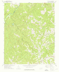
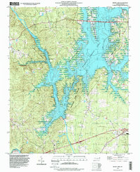
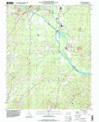
 2010 Broadway2010 Print · USGSCovers Lee County, including Sanford, Broadway, and other nearby areas
 - 2010 Map of Mamers, 2010 Print
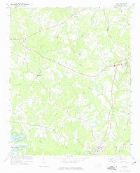
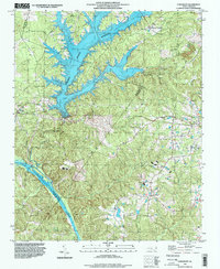
 2010 Mamers2010 Print · USGSCovers Lee County, including Mamers, Boone Trail, and other nearby areas
Showing maps 1-25 of 82
Top cities of Lee County
Frequently asked questions
- What are the different types of historical maps available for Lee County?
- What is the oldest map of Lee County?
- Where can I purchase historical maps of Lee County for my home or office?
- Where can I download high-res historical maps of Lee County?
- Are there historical topographic maps available for Lee County?
- Is there historical aerial imagery available for Lee County?
- Where are historical maps of Lee County sourced from?