1970s Maps of Lee County, North Carolina
Explore 9 historic maps of Lee County from the 1970s. These maps offer a rare glimpse into what life looked like during the 1970s — showing old roads, neighborhoods, homes, and landmarks that have changed or disappeared over time.
Whether you're researching your family's past, planning a metal detecting trip, or studying how Lee County's landscape evolved across the 1970s, these high-resolution maps are a powerful tool for exploring the history of this region.
- Focus on a specific era: All maps on this page are from the 1970s, giving you a focused view of this time period.
- See what’s changed: Compare century-old streets, trails, and buildings to today's modern landscape using overlays and satellite layers.
- Research with precision: Use these maps for genealogy, historical research, land use analysis, or educational projects.
- View, download, or print: Maps are fully viewable online in high resolution, and can be downloaded or printed for your own records.
Start exploring Lee County's history through authentic maps from the 1970s. This is your window into the past.
Lee County, NC maps
(9)- 1970 Map of Goldston, 1972 Print
 1970 Goldston1972 Print · USGSChatham and Moore counties meet along the Deep River in the early seventies, where rail lines and river bends shaped local life. Genealogists can trace family footprints at Walters Sch, Mt Herman Ch, and the rural community of Goldston.3 unique versions available
 - 1970 Map of Colon, 1973 Print
 1970 Colon1973 Print · USGSLee and Chatham counties are shown at a time of local industrial and transit expansion in the early 1970s. Trace family roots and local history through features like Colon, the Farmville Cem, and numerous Claypits along the SEABOARD COAST LINE.2 unique versions available
 - 1970 Map of Moncure, 1973 Print
 1970 Moncure1973 Print · USGSThe confluence of the Deep and Haw Rivers defines this Chatham County landscape in the early seventies as industrial growth meets rural tradition. Trace the rail lines of the Seaboard Coast Line and find landmarks like Rose Hill Ch or the Copper Mine.2 unique versions available
 - 1974 Map of White Hill, 1976 Print
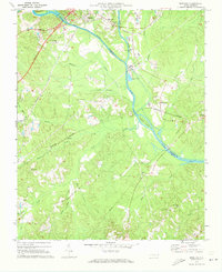
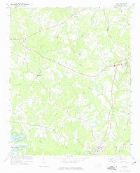
 1974 White Hill1976 Print · USGSThe rural countryside near the Moore and Lee County line is captured here in the mid-1970s. Genealogists can locate family landmarks like White Hill and several country churches, including Euphronia Ch and Poplar Springs Ch.
 - 1974 Map of Vass, 1976 Print
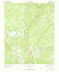
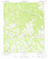
 1974 Vass1976 Print · USGSMoore County in the mid-seventies shows a landscape of established rail towns and emerging residential developments near the Lee County line. Genealogists and local historians can trace family-named sites like Henderson Cem, Stones Chapel, and the Seaboard Coast Line through Vass.
 - 1974 Map of Mamers, 1977 Print
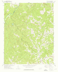
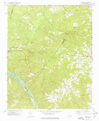
 1974 Mamers1977 Print · USGSHarnett County remains a rural landscape in the 1970s, defined by the winding course of the Cape Fear River and the newly established Raven Rock State Park. Researchers can trace the heritage of local crossroads like Mamers or locate family-named landmarks such as Antioch Ch and Boone Trail.2 unique versions available
 - 1974 Map of Cokesbury, 1977 Print
 1974 Cokesbury1977 Print · USGSHarnett and Wake counties show a landscape of rural crossroads and river drainage during the mid-seventies. Trace the Norfolk Southern rail corridor or locate family landmarks like Prince Chapel and the Buckhorn Dam.4 unique versions available
 - 1974 Map of Sanford, 1977 Print
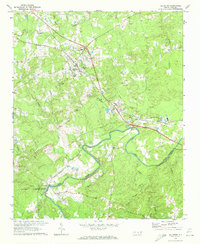
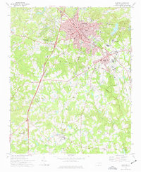 1974 Sanford1977 Print · USGSSanford and the surrounding Lee County countryside are captured here in the mid-seventies, showing a region defined by its busy railroad junctions and rural settlements. Genealogists and historians can trace local landmarks like Buffalo Cem, Shallow Well Ch, and the old Williams Sch.2 unique versions available
 - 1977 Map of Broadway
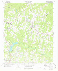 1977 Broadway1977 Print · USGSThe rural borderlands of Lee and Harnett Counties are captured here in the late seventies, centered on the growing town of Broadway. Researchers can trace old family sites and transport routes through an Old Railroad Grade and numerous country churches like Morris Chapel and Juniper Springs Ch.3 unique versions available
End of results
Showing maps 1-9 of 9
Top cities of Lee County
Frequently asked questions
- What are the different types of historical maps available for Lee County?
- What is the oldest map of Lee County?
- Where can I purchase historical maps of Lee County for my home or office?
- Where can I download high-res historical maps of Lee County?
- Are there historical topographic maps available for Lee County?
- Is there historical aerial imagery available for Lee County?
- Where are historical maps of Lee County sourced from?