1940s Maps of Rollins, Marshall
Explore 2 historic maps of Rollins from the 1940s. These maps offer a rare glimpse into what life looked like during the 1940s — showing old roads, neighborhoods, homes, and landmarks that have changed or disappeared over time.
Whether you're researching your family's past, planning a metal detecting trip, or studying how Rollins's landscape evolved across the 1940s, these high-resolution maps are a powerful tool for exploring the history of this region.
- Focus on a specific era: All maps on this page are from the 1940s, giving you a focused view of this time period.
- See what’s changed: Compare century-old streets, trails, and buildings to today's modern landscape using overlays and satellite layers.
- Research with precision: Use these maps for genealogy, historical research, land use analysis, or educational projects.
- View, download, or print: Maps are fully viewable online in high resolution, and can be downloaded or printed for your own records.
Start exploring Rollins's history through authentic maps from the 1940s. This is your window into the past.
Rollins, Marshall maps
(2)- 1945 Map of Marshall, 1957 Print
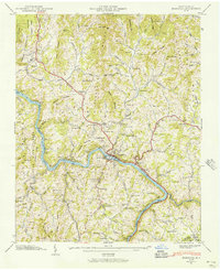 1945 Marshall1957 Print · USGSMadison County in the mid-1940s is defined by the vital transit corridor of the French Broad River and its accompanying rail lines. Genealogists and historians can trace family locations through numerous landmarks like Madison Seminary, Old Station Cem, and Little Pine Sch.6 unique versions available
 - 1946 Map of Marshall, 1947 Print
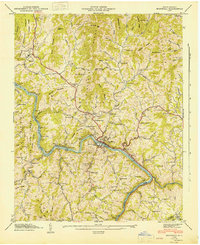 1946 Marshall1947 Print · USGSMadison County at the mid-century shows a landscape defined by the winding French Broad River and the industrial activity of the Southern Railway. Researchers can trace the roots of mountain communities through numerous family burial sites like Runnion Cem and local landmarks such as Madison Seminary.
End of results
Showing maps 1-2 of 2
Top cities near Rollins
- Asheville historical maps
- Canton historical maps
- Woodfin historical maps
- Weaverville historical maps
- Mars Hill historical maps
- Biltmore Forest historical maps
See more
Frequently asked questions
- What are the different types of historical maps available for Rollins?
- What is the oldest map of Rollins?
- Where can I purchase historical maps of Rollins for my home or office?
- Where can I download high-res historical maps of Rollins?
- Are there historical topographic maps available for Rollins?
- Is there historical aerial imagery available for Rollins?
- Where are historical maps of Rollins sourced from?