1960s Maps of Jacktown, North Carolina
Explore 3 historic maps of Jacktown from the 1960s. These maps offer a rare glimpse into what life looked like during the 1960s — showing old roads, neighborhoods, homes, and landmarks that have changed or disappeared over time.
Whether you're researching your family's past, planning a metal detecting trip, or studying how Jacktown's landscape evolved across the 1960s, these high-resolution maps are a powerful tool for exploring the history of this region.
- Focus on a specific era: All maps on this page are from the 1960s, giving you a focused view of this time period.
- See what’s changed: Compare century-old streets, trails, and buildings to today's modern landscape using overlays and satellite layers.
- Research with precision: Use these maps for genealogy, historical research, land use analysis, or educational projects.
- View, download, or print: Maps are fully viewable online in high resolution, and can be downloaded or printed for your own records.
Start exploring Jacktown's history through authentic maps from the 1960s. This is your window into the past.
Jacktown, NC maps
(3)- 1960 Map of Charlotte
 1960 Charlotte1960 Print · USGSMid-century North Carolina and South Carolina meet in this 1960 survey of the Piedmont's industrial and textile heartland. Trace the growth of Charlotte alongside historic landmarks like Kings Mountain National Military Park and the Charlotte Naval Ammunition Depot.2 unique versions available
 - 1962 Map of Charlotte
 1962 Charlotte1962 Print · USGSThe North Carolina Piedmont in the early sixties showcases a landscape transformed by massive reservoirs and industrial growth. Researchers can trace the development of Lake Norman, locate the Charlotte Naval Ammunition Depot, or find family landmarks like Wesley Chapel and Brown & Norcott Mills.
 - 1962 Map of Marion East, 1964 Print
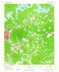 1962 Marion East1964 Print · USGSMcDowell County's foothills and river valleys are captured here in the early sixties, anchored by the industrial and rail hubs of Marion and East Marion. Genealogists can trace family roots through rural landmarks like Nebo Cem, Dysartsville Ch, and the small settlement of Jacktown.2 unique versions available
End of results
Showing maps 1-3 of 3
Top cities near Jacktown
- Morganton historical maps
- Marion historical maps
- Spruce Pine historical maps
- Nebo historical maps
- Glen Alpine historical maps
- Old Fort historical maps
Frequently asked questions
- What are the different types of historical maps available for Jacktown?
- What is the oldest map of Jacktown?
- Where can I purchase historical maps of Jacktown for my home or office?
- Where can I download high-res historical maps of Jacktown?
- Are there historical topographic maps available for Jacktown?
- Is there historical aerial imagery available for Jacktown?
- Where are historical maps of Jacktown sourced from?