1900s (20th Century) Maps of Spruce Pine, North Carolina
Explore 22 historic maps of Spruce Pine from the 1900s (20th Century). These maps offer a rare glimpse into what life looked like during the 1900s — showing old roads, neighborhoods, homes, and landmarks that have changed or disappeared over time.
Whether you're researching your family's past, planning a metal detecting trip, or studying how Spruce Pine's landscape evolved across the 1900s, these high-resolution maps are a powerful tool for exploring the history of this region.
- Focus on a specific era: All maps on this page are from the 1900s, giving you a focused view of this time period.
- See what’s changed: Compare century-old streets, trails, and buildings to today's modern landscape using overlays and satellite layers.
- Research with precision: Use these maps for genealogy, historical research, land use analysis, or educational projects.
- View, download, or print: Maps are fully viewable online in high resolution, and can be downloaded or printed for your own records.
Start exploring Spruce Pine's history through authentic maps from the 1900s. This is your window into the past.
Spruce Pine, NC maps
(22)- 1900 Map of Mount Mitchell, 1963 Print
 1900 Mount Mitchell1963 Print · USGSWestern North Carolina at the turn of the century shows a landscape of high peaks and isolated river settlements before the arrival of modern highways. Genealogists and mountain historians can trace early homesteads along the Cane River or follow the Southern RR through Old Fort and Black Mountain.3 unique versions available
 - 1902 Map of Mount Mitchell, 1937 Print
 1902 Mount Mitchell1937 Print · USGSThe high peaks of Western North Carolina are captured here at the start of the twentieth century, showing the rail and river corridors that shaped the region. Trace early settlements like Burnsville, Montreat, and the winding Southern Railway.3 unique versions available
 - 1905 Map of Morganton, 1941 Print
 1905 Morganton1941 Print · USGSThe foothills and high peaks of the Blue Ridge come alive in the early twentieth century, centered on the growing towns of Morganton and Lenoir. Genealogists and historians can trace the early rail corridor of the Southern Railway and locate vanished landmarks like Arneys Store and Rutherford College.2 unique versions available
 - 1934 Map of Spruce Pine
 1934 Spruce Pine1934 Print · USGSMitchell County industrial and mountain life are captured in the mid-1930s as the local mining economy thrived. Genealogists and historians can trace families near Spruce Pine, locate the Prison Camp, and identify remote sites like Wolfden Mine and Hunter Chapel.
 - 1934 Map of Linville Falls
 1934 Linville Falls1934 Print · USGSAvery County mountain life in the mid-thirties centered on the North Toe River and its rugged ridges. Genealogists can locate family landmarks like Walnut Grove Ch, Brushy Creek Sch, and the Hemphill Mine near the crossing at Heffner Gap.
 - 1953 Map of Charlotte, 1968 Print
 1953 Charlotte1968 Print · USGSThe North Carolina Piedmont and South Carolina borderlands are shown in detail during a period of significant growth and reservoir development. Trace the rail corridors of the Southern Railway or find family roots in towns like China Grove, Misenheimer, and Lincolnton.3 unique versions available
 - 1954 Map of Charlotte
 1954 Charlotte1954 Print · USGSThe North Carolina Piedmont in the mid-1950s shows a region of rapid growth and industrial expansion centered around Charlotte. Trace the era's infrastructure through the Southern railroad lines and locate significant landmarks like the Charlotte Naval Ammunition Depot and Lake Norman.2 unique versions available
 - 1955 Map of Knoxville
 1955 Knoxville1955 Print · USGSThe Southern Appalachians and the Smoky Mountains are shown here at a peak of mid-century development and conservation. Genealogists and historians can trace the early road networks connecting Gatlinburg, Waynesville, and the Cherokee Indian Reservation across the high ridges.
 - 1956 Map of Linville Falls, 1958 Print
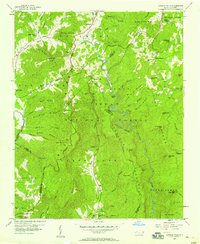 1956 Linville Falls1958 Print · USGSThe High Country of western North Carolina in the mid-fifties is captured here during the development of the Blue Ridge Parkway. Genealogists and hikers can locate Wise Cem, Walnut Grove Ch, and the subterranean depths of Linville Caverns.4 unique versions available
 - 1956 Map of Linville Falls, 1962 Print
 1956 Linville Falls1962 Print · USGSThe North Carolina high country is captured here during the mid-fifties, centered on the steep descent of the Linville River. Genealogists and hikers can trace old mountain communities and landmarks like the South Mtn Institute, Linville Caverns, and Wise Cem.2 unique versions available
 - 1957 Map of Knoxville, 1966 Print
 1957 Knoxville1966 Print · USGSThe Southern Appalachians of Tennessee and North Carolina are mapped here during the mid-twentieth century as new highways reached the high country. Genealogists and historians can trace the topography between Knoxville and Asheville, locating family landmarks near Fontana Lake or along the Blue Ridge Parkway.4 unique versions available
 - 1960 Map of Knoxville
 1960 Knoxville1960 Print · USGSThe Southern Appalachians come alive in the 1950s, showing the intersection of new national park tourism and deep-rooted mountain industry. Trace old rail lines like the Clinchfield RR and find high-altitude landmarks from Mt Le Conte to the Cherokee Indian Reservation.2 unique versions available
 - 1960 Map of Charlotte
 1960 Charlotte1960 Print · USGSMid-century North Carolina and South Carolina meet in this 1960 survey of the Piedmont's industrial and textile heartland. Trace the growth of Charlotte alongside historic landmarks like Kings Mountain National Military Park and the Charlotte Naval Ammunition Depot.2 unique versions available
 - 1960 Map of Spruce Pine, 1962 Print
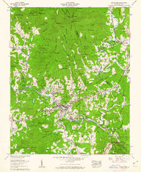 1960 Spruce Pine1962 Print · USGSSpruce Pine and the Toe River valley were bustling with mountain industry and rail transport in the early sixties. Genealogists and historians can trace family names and old landmarks across the Pisgah National Forest, including Altapass, the Clinchfield RR, and the Chestnut Flats Mine.5 unique versions available
 - 1960 Map of Little Switzerland, 1962 Print
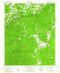 1960 Little Switzerland1962 Print · USGSThe Blue Ridge high country is captured here during the mid-century, defined by the winding parkway and the heavy engineering of the Clinchfield railroad. Local historians can trace a dozen mountain tunnels and visit remote landmarks like the Woods Mountain Lookout Tower and Collis Cem.5 unique versions available
 - 1962 Map of Charlotte
 1962 Charlotte1962 Print · USGSThe North Carolina Piedmont in the early sixties showcases a landscape transformed by massive reservoirs and industrial growth. Researchers can trace the development of Lake Norman, locate the Charlotte Naval Ammunition Depot, or find family landmarks like Wesley Chapel and Brown & Norcott Mills.
 - 1964 Map of Knoxville
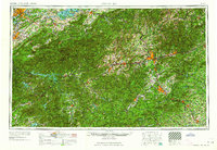 1964 Knoxville1964 Print · USGSThe Southern Appalachians and Great Smokies are captured here during the mid-sixties, showing the rugged borderlands of Tennessee and North Carolina. Researchers can trace historic mountain routes like U S 441, the expanse of Pisgah National Forest, and the growing footprints of Asheville and Knoxville.
 - 1985 Map of Asheville
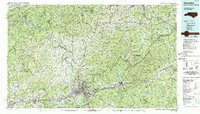 1985 Asheville1985 Print · USGSWestern North Carolina during the mid-eighties shows a region of deep mountain heritage and expanding highway networks. Genealogists and historians can trace the foundations of Asheville alongside older rail corridors like the Clinchfield Railroad and the high elevations of Mount Mitchell.2 unique versions available
 - 1986 Map of Hickory
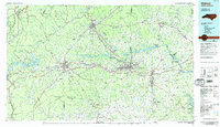 1986 Hickory1986 Print · USGSWestern North Carolina's foothills are seen here in the mid-eighties as textile and furniture towns flourished along the river. Trace the development of Hickory and Lenoir or locate local landmarks like Burke Chapel, Saw Mills, and Rhodhiss Lake.3 unique versions available
 - 1994 Map of Linville Falls, 1996 Print
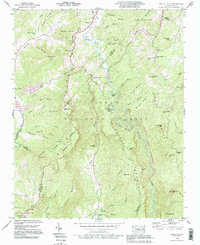 1994 Linville Falls1996 Print · USGSThe Blue Ridge high country of western North Carolina is documented here in the mid-nineties, centered on the dramatic descent of the Linville River. Researchers can locate family landmarks like Wise Cem and Pisgah Ch near the historic Linville Caverns.2 unique versions available
 - 1994 Map of Spruce Pine, 1998 Print
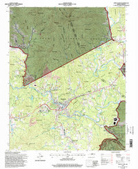 1994 Spruce Pine1998 Print · USGSSpruce Pine and the North Toe River valley are shown here in the mid-1990s as the local economy balanced mountain industry with preservation. Genealogists can trace family names at the Spruce Pine Memorial Cem or McKinney Cem, while collectors can locate old rail landmarks along the Clinchfield RR.
 - 1994 Map of Little Switzerland, 1998 Print
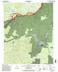 1994 Little Switzerland1998 Print · USGSLittle Switzerland and the high ridges of the Blue Ridge were undergoing updated federal survey in the mid-nineties. You can trace the intricate path of the Blue Ridge Parkway or locate family history at Chestnut Grove Ch, Hollyfield Cem, and the cluster of mountain tunnels near The Loop.
End of results
Showing maps 1-22 of 22
Top cities near Spruce Pine
- Marion historical maps
- Nebo historical maps
- Newland historical maps
- Green Mountain historical maps
- Bakersville historical maps
- Seven Devils historical maps
See more
Frequently asked questions
- What are the different types of historical maps available for Spruce Pine?
- What is the oldest map of Spruce Pine?
- Where can I purchase historical maps of Spruce Pine for my home or office?
- Where can I download high-res historical maps of Spruce Pine?
- Are there historical topographic maps available for Spruce Pine?
- Is there historical aerial imagery available for Spruce Pine?
- Where are historical maps of Spruce Pine sourced from?