Old Maps of Central Area, Eden for Metal Detecting
Plan your next treasure hunt with 41 historic maps of Central Area. Find old homesites, ghost towns, trails, and gathering spots that may be lost to time — perfect for identifying promising metal detecting locations.
- Locate forgotten sites: Uncover places like long-lost settlements, abandoned rail lines, or gathering spots.
- Plan better hunts: Use map overlays combined with LiDAR or satellite views to narrow in on historically rich areas.
- Made for detectorists: Thousands of hobbyists use these maps to discover relics, coins, and hidden history.
Use these historic maps to boost your research and find new opportunities beneath the surface of Central Area.
Central Area, Eden maps
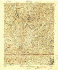
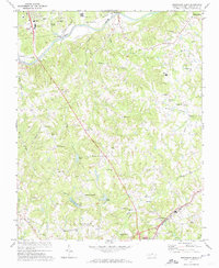
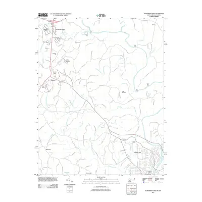
(41)- 1924 Map of Martinsville
 1924 Martinsville1924 Print · USGSHenry County is shown in the mid-twenties as a thriving industrial corridor along the Smith River. Genealogists can trace family roots through dozens of rural landmarks, from the Bough and Reilly Mill to the Mountain School and Rock Run Church.
 - 1924 Map of Draper
 1924 Draper1924 Print · USGSThe rural Piedmont of Southside Virginia is mapped here during the mid-twenties, showcasing a landscape of small tobacco farms and river-valley settlements. Researchers can trace family sites like Laceys Store, the Soapstone Quarry, and early depots at Leaksville Junction.
 - 1926 Map of Martinsville
 1926 Martinsville1926 Print · USGSHenry County and the Virginia-North Carolina border are captured in the mid-1920s, a period when the Smith River and twin rail lines drove local industry. Researchers can locate dozens of family-named landmarks and institutions like Rough and Ready Mill, Rangeleys Store, and Horse Pasture Church.2 unique versions available
 - 1926 Map of Draper
 1926 Draper1926 Print · USGSThe Virginia and North Carolina borderlands come alive in the mid-1920s, showing a landscape of small tobacco farms and rail-dependent hamlets. Genealogists can trace family roots through numerous local landmarks like Swansonville, Bachelors Hall Church, and the Danville and Western rail line.3 unique versions available
 - 1927 Map of Martinsville, 1942 Print
 1927 Martinsville1942 Print · USGSHenry County and the Virginia-North Carolina border are captured here during the mid-twenties, when the textile and rail economy was transforming the Piedmont. Researchers can trace family sites among dozens of landmarks like Rough and Ready Mill, Fieldale, and Rock Run Church.2 unique versions available
 - 1944 Map of Martinsville
 1944 Martinsville1944 Print · USGSHenry County is captured in the mid-1940s as a thriving center of industry and agriculture along the Smith River. Genealogists and historians can trace family locations near dozens of rural landmarks like Rough and Ready Mill, Cedar Chappell, and the County Farm.
 - 1944 Map of Draper
 1944 Draper1944 Print · USGSThe Virginia and North Carolina borderlands come alive in the 1940s, showing the industrial and rail corridor stretching from Spray to Draper. Researchers can trace the Danville and Western Ry route through old stops like Cascade Station and discover dozens of rural community hubs like Stony Mill and Anderson Chapel.
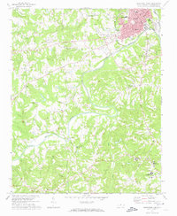
 - 1953 Map of Greensboro, 1981 Print
 1953 Greensboro1981 Print · USGSThe Piedmont borderlands of North Carolina and Virginia show a landscape defined by new reservoirs and old rail lines. Trace family roots and the changing river geography through Elon College, the John H Kerr Reservoir, and South Boston.
 - 1954 Map of Greensboro
 1954 Greensboro1954 Print · USGSThe Piedmont borderlands of North Carolina and Virginia come alive in this mid-fifties study of a region defined by its rivers and rails. Researchers can trace the growing Buggs Island Lake or follow the paths of the Southern Ry and Seaboard Air Line RR through towns like Oxford and Reidsville.
 - 1962 Map of Greensboro
 1962 Greensboro1962 Print · USGSThe Piedmont region along the Virginia and North Carolina border comes alive in the early 1960s, showing a landscape defined by industry and new reservoirs. Trace the path of the Virginian RR or explore the early development of Greensboro and Durham.
 - 1964 Map of Spray, 1966 Print
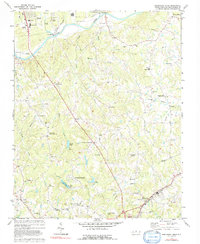
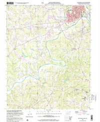
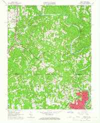 1964 Spray1966 Print · USGSThe Virginia and North Carolina border comes alive in the mid-sixties, centered on the industrial hub of the Smith River valley. Genealogists can trace family roots through numerous local landmarks like New Bethel Ch, Osborne Ch, and the streets of Leaksville.
 - 1965 Map of Draper, 1966 Print
 1965 Draper1966 Print · USGSNorth Carolina and Virginia meet along this industrial rail corridor during the mid-sixties, where the textile and transit hubs of the Piedmont were rapidly evolving. Researchers can trace family roots at Sunny Home Ch, locate the old Morgan Ford Bridge, or explore the rail sidings of Leaksville Junction.4 unique versions available
 - 1965 Map of Northwest Eden, 1978 Print
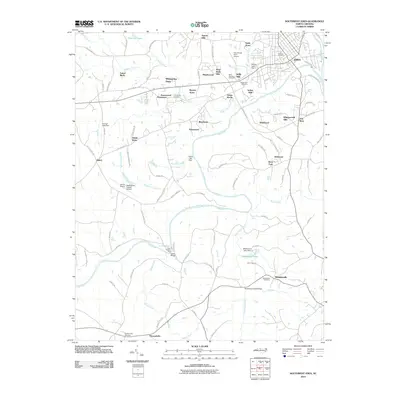
 1965 Northwest Eden1978 Print · USGSThe borderlands of Rockingham County and Henry County come alive in this mid-century survey of the Smith River valley. Genealogists and local historians can trace the foundations of Leaksville and Spray or locate rural landmarks like New Bethel Ch and the Norfolk and Western tracks.2 unique versions available
 - 1966 Map of Greensboro
 1966 Greensboro1966 Print · USGSThe North Carolina and Virginia Piedmont thrives during the mid-sixties, showcasing a landscape of textile hubs and expanding river reservoirs. Researchers can trace the rail corridors of the Southern Railway, find local landmarks like Elon College, or locate the extensive Camp Butner Military Reservation.
 - 1971 Map of Southeast Eden, 1974 Print
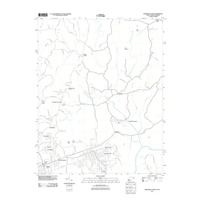
 1971 Southeast Eden1974 Print · USGSRockingham County in the early 1970s shows a landscape of rural crossroads and growing industry between the Dan River and REIDSVILLE. Genealogists can trace family landmarks like the Chinqua Penn Plantation, Slaydon Cem, and Oregon Hill.2 unique versions available
 - 1971 Map of Southwest Eden, 1974 Print
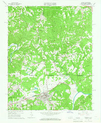
 1971 Southwest Eden1974 Print · USGSRockingham County in the early seventies shows a landscape where the industrial growth of Eden meets the quiet reaches of the Dan River. Researchers can trace local landmarks like Rockingham Community College, the Drive-in Theater, and historic rural sites such as Settles Bridge Ch.2 unique versions available
 - 1977 Map of Southeast Eden, 1992 Print
 1977 Southeast Eden1992 Print · USGSNorth Carolina's Piedmont region in the 1970s shows the growth of settlements like Eden and Reidsville alongside rural farmsteads. Genealogists can trace family landmarks and local institutions like Lincoln Sch, Harrisons Crossroads, and the Chinqua Penn Plantation.
 - 1984 Map of Danville
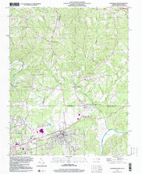
 1984 Danville1984 Print · USGSThe Virginia and North Carolina borderlands in the mid-1980s reveal a landscape of industrial river towns and rural Piedmont crossroads. Genealogists and historians can trace family sites near Highland Burial Park, find local landmarks like the Patrick Henry Monument, and locate old settlements like Callands or Milton.
 - 1984 Map of Greensboro
 1984 Greensboro1984 Print · USGSThe North Carolina Piedmont in the mid-eighties shows a region of growing urban centers and vital water resources. Local historians can trace the development of Greensboro, locate the Elon College campus, or explore the grounds of Guilford Courthouse National Military Park.
 - 1997 Map of Northeast Eden, 2000 Print
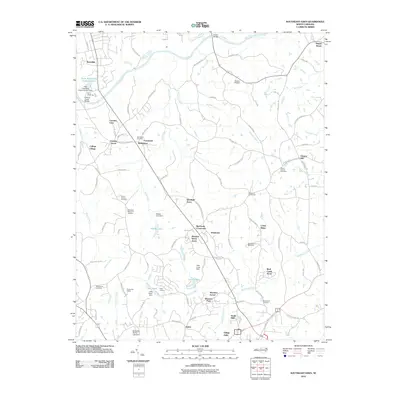
 1997 Northeast Eden2000 Print · USGSThe North Carolina-Virginia border comes alive in the late 1990s as the industrial hubs of Draper and Spray sit near the confluence of the Dan River. Genealogists and historians can trace rail lines like the Norfolk and Western or locate rural landmarks such as Irisburg Sch and St Johns Ch.
 - 2002 Map of Southwest Eden
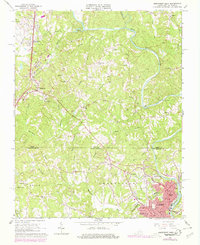
 2002 Southwest Eden2002 Print · USGSRockingham County in the early twenty-first century reveals a landscape defined by the winding Dan River and the expanding footprint of Eden. Genealogists and local historians can trace the sites of Rockingham Community College, the Shiloh Airport, and numerous rural sanctuaries like Settles Bridge Ch.
 - 2010 Map of Southeast Eden, 2010 Print
 2010 Southeast Eden2010 Print · USGSCovers Central Area, including Eden, Reidsville, and other nearby areas
 - 2010 Map of Southwest Eden, 2010 Print
 2010 Southwest Eden2010 Print · USGSCovers Central Area, including Eden, Wentworth, and other nearby areas
 - 2011 Map of Northeast Eden, 2011 Print
 2011 Northeast Eden2011 Print · USGSCovers Central Area, including Eden, Draper Village, and other nearby areas
 - 2011 Map of Northwest Eden, 2011 Print
 2011 Northwest Eden2011 Print · USGSCovers Central Area, including Eden, Ridgeway, and other nearby areas
Showing maps 1-25 of 41
Frequently asked questions
- What are the different types of historical maps available for Central Area?
- What is the oldest map of Central Area?
- Where can I purchase historical maps of Central Area for my home or office?
- Where can I download high-res historical maps of Central Area?
- Are there historical topographic maps available for Central Area?
- Is there historical aerial imagery available for Central Area?
- Where are historical maps of Central Area sourced from?