1970s Maps of Blue Acres, Laurinburg
Explore 2 historic maps of Blue Acres from the 1970s. These maps offer a rare glimpse into what life looked like during the 1970s — showing old roads, neighborhoods, homes, and landmarks that have changed or disappeared over time.
Whether you're researching your family's past, planning a metal detecting trip, or studying how Blue Acres's landscape evolved across the 1970s, these high-resolution maps are a powerful tool for exploring the history of this region.
- Focus on a specific era: All maps on this page are from the 1970s, giving you a focused view of this time period.
- See what’s changed: Compare century-old streets, trails, and buildings to today's modern landscape using overlays and satellite layers.
- Research with precision: Use these maps for genealogy, historical research, land use analysis, or educational projects.
- View, download, or print: Maps are fully viewable online in high resolution, and can be downloaded or printed for your own records.
Start exploring Blue Acres's history through authentic maps from the 1970s. This is your window into the past.
Blue Acres, Laurinburg maps
(2)- 1972 Map of Mc Coll, 1975 Print
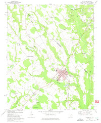 1972 Mc Coll1975 Print · USGSMarlboro County’s borderlands are shown here in the 1970s, centered on the railroad town of McColl and the agricultural hub of Tatum. Genealogists can trace family landmarks like Newton Cemetery, McLaurins Millpond, and Fletchers Chapel.2 unique versions available
 - 1976 Map of Mc Coll, 1978 Print
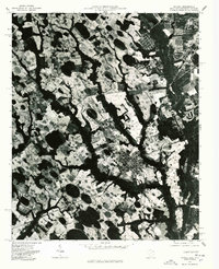 1976 Mc Coll1978 Print · USGSMarlboro County near the state line comes into sharp focus in the mid-1970s through this aerial-based survey. Researchers can trace land boundaries and farmsteads near Mc Coll and Tatum, or identify the rural junctions at Masons Crossroads.
End of results
Showing maps 1-2 of 2
Top cities near Blue Acres
- Laurinburg historical maps
- Bennettsville historical maps
- Rockingham historical maps
- Hamlet historical maps
- Maxton historical maps
- McColl historical maps
See more
Frequently asked questions
- What are the different types of historical maps available for Blue Acres?
- What is the oldest map of Blue Acres?
- Where can I purchase historical maps of Blue Acres for my home or office?
- Where can I download high-res historical maps of Blue Acres?
- Are there historical topographic maps available for Blue Acres?
- Is there historical aerial imagery available for Blue Acres?
- Where are historical maps of Blue Acres sourced from?