Old Maps of Windom, North Carolina
Explore 16 old maps of Windom, spanning from 1900 to today. These high-resolution historic maps reveal how streets, neighborhoods, landmarks, and natural features evolved over time — perfect for genealogy, metal detecting, research, and local history exploration.
What you can do with these maps:
- See how Windom changed over time: Compare historical maps to modern-day views to trace roads, homesites, rail lines & more.
- View detailed metadata: Each map includes creators, publishers, year, scale, and archive source.
- Overlay maps with satellite & LiDAR: Visualize the past alongside modern tools to explore terrain & human change.
- Trusted historical sources: Maps sourced from the USGS, Library of Congress, and other archives.
- Access maps your way: View online, download high-res files, or order prints for personal or research use.
Start exploring old maps of Windom to uncover forgotten places, hidden landmarks, and the deep history beneath your feet.
Windom, NC maps
(16)- 1900 Map of Mount Mitchell, 1963 Print
 1900 Mount Mitchell1963 Print · USGSWestern North Carolina at the turn of the century shows a landscape of high peaks and isolated river settlements before the arrival of modern highways. Genealogists and mountain historians can trace early homesteads along the Cane River or follow the Southern RR through Old Fort and Black Mountain.3 unique versions available
 - 1902 Map of Mount Mitchell, 1937 Print
 1902 Mount Mitchell1937 Print · USGSThe high peaks of Western North Carolina are captured here at the start of the twentieth century, showing the rail and river corridors that shaped the region. Trace early settlements like Burnsville, Montreat, and the winding Southern Railway.3 unique versions available
 - 1935 Map of Burnsville
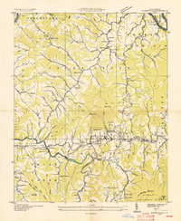 1935 Burnsville1935 Print · USGSThe Cane River valley and the Burnsville townsite are captured here in the mid-thirties as rural infrastructure expanded across Yancey County. Genealogists and historians can trace family locations through numerous landmarks like Clermont Cem, Mine Fork Sch, and the State Prison Camp.
 - 1939 Map of Burnsville, 1956 Print
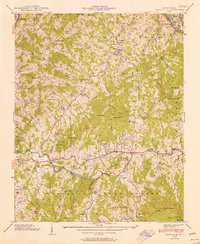 1939 Burnsville1956 Print · USGSBurnsville and the surrounding Yancey County ridges are captured here just before mid-century, showing a landscape defined by mountain gaps and river valleys. Genealogists can trace family names through numerous landmarks like Dellinger Cem, Banks Creek Ch, and the Day Book (P.O.).5 unique versions available
 - 1940 Map of Burnsville
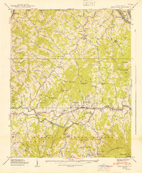 1940 Burnsville1940 Print · USGSYancey County in the late Depression era shows a landscape of tightly knit mountain communities and early state infrastructure. Researchers can locate family landmarks like the Clearmont Cem, the State Prison Camp, and the remote Day Book post office.2 unique versions available
 - 1955 Map of Knoxville
 1955 Knoxville1955 Print · USGSThe Southern Appalachians and the Smoky Mountains are shown here at a peak of mid-century development and conservation. Genealogists and historians can trace the early road networks connecting Gatlinburg, Waynesville, and the Cherokee Indian Reservation across the high ridges.
 - 1957 Map of Knoxville, 1966 Print
 1957 Knoxville1966 Print · USGSThe Southern Appalachians of Tennessee and North Carolina are mapped here during the mid-twentieth century as new highways reached the high country. Genealogists and historians can trace the topography between Knoxville and Asheville, locating family landmarks near Fontana Lake or along the Blue Ridge Parkway.4 unique versions available
 - 1960 Map of Knoxville
 1960 Knoxville1960 Print · USGSThe Southern Appalachians come alive in the 1950s, showing the intersection of new national park tourism and deep-rooted mountain industry. Trace old rail lines like the Clinchfield RR and find high-altitude landmarks from Mt Le Conte to the Cherokee Indian Reservation.2 unique versions available
 - 1964 Map of Knoxville
 1964 Knoxville1964 Print · USGSThe Southern Appalachians and Great Smokies are captured here during the mid-sixties, showing the rugged borderlands of Tennessee and North Carolina. Researchers can trace historic mountain routes like U S 441, the expanse of Pisgah National Forest, and the growing footprints of Asheville and Knoxville.
 - 1985 Map of Asheville
 1985 Asheville1985 Print · USGSWestern North Carolina during the mid-eighties shows a region of deep mountain heritage and expanding highway networks. Genealogists and historians can trace the foundations of Asheville alongside older rail corridors like the Clinchfield Railroad and the high elevations of Mount Mitchell.2 unique versions available
 - 1998 Map of Burnsville, 2001 Print
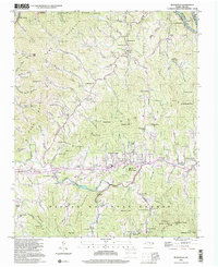 1998 Burnsville2001 Print · USGSYancey County's mountainous terrain is shown here during the late twentieth century, centered on the valley town of Burnsville. Genealogists and local historians can trace family roots through numerous landmarks, including Day Book, Clearmont Cem, and Harris Memorial Ch.
 - 2011 Map of Burnsville, 2011 Print
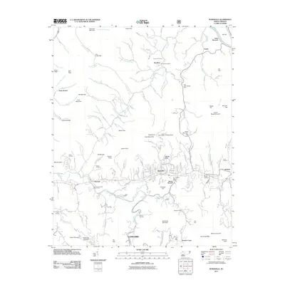 2011 Burnsville2011 Print · USGSCovers Windom, including Burnsville, Green Mountain, and other nearby areas
 - 2013 Map of Burnsville, 2013 Print
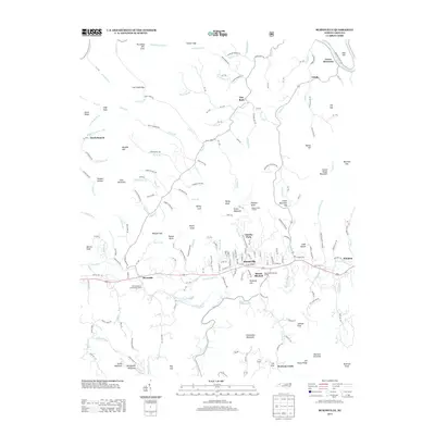 2013 Burnsville2013 Print · USGSCovers Windom, including Burnsville, Green Mountain, and other nearby areas
 - 2016 Map of Burnsville, 2016 Print
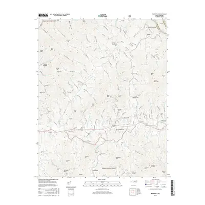 2016 Burnsville2016 Print · USGSCovers Windom, including Burnsville, Green Mountain, and other nearby areas
 - 2019 Map of Burnsville, 2019 Print
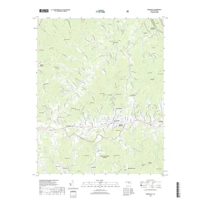 2019 Burnsville2019 Print · USGSCovers Windom, including Burnsville, Green Mountain, and other nearby areas
 - 2022 Map of Burnsville, 2022 Print
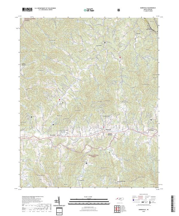 2022 Burnsville2022 Print · USGSBurnsville and the surrounding Yancey County highlands are captured here in the early 2020s, showing the intersection of mountain life and institutional growth. Researchers can locate numerous family burial sites like Edney Cem and landmarks such as the Yancey County Courthouse.
End of results
Showing maps 1-16 of 16
Top cities near Windom
- Erwin historical maps
- Marion historical maps
- Spruce Pine historical maps
- Burnsville historical maps
- Green Mountain historical maps
- Bakersville historical maps
Frequently asked questions
- What are the different types of historical maps available for Windom?
- What is the oldest map of Windom?
- Where can I purchase historical maps of Windom for my home or office?
- Where can I download high-res historical maps of Windom?
- Are there historical topographic maps available for Windom?
- Is there historical aerial imagery available for Windom?
- Where are historical maps of Windom sourced from?