Old Maps of Winchester, Ohio
Explore 11 old maps of Winchester, spanning from 1918 to today. These high-resolution historic maps reveal how streets, neighborhoods, landmarks, and natural features evolved over time — perfect for genealogy, metal detecting, research, and local history exploration.
What you can do with these maps:
- See how Winchester changed over time: Compare historical maps to modern-day views to trace roads, homesites, rail lines & more.
- View detailed metadata: Each map includes creators, publishers, year, scale, and archive source.
- Overlay maps with satellite & LiDAR: Visualize the past alongside modern tools to explore terrain & human change.
- Trusted historical sources: Maps sourced from the USGS, Library of Congress, and other archives.
- Access maps your way: View online, download high-res files, or order prints for personal or research use.
Start exploring old maps of Winchester to uncover forgotten places, hidden landmarks, and the deep history beneath your feet.
Winchester, OH maps
(11)- 1918 Map of Seaman, 1943 Print
 1918 Seaman1943 Print · USGSAdams and Brown counties appear in the years following the Great War, showing a landscape defined by small hamlets and the steam-era railroads. Researchers can trace family roots through dozens of rural landmarks like the County Infirmary, Eckmansville, and the Harper Ferry School.
 - 1957 Map of Huntington, 1966 Print
 1957 Huntington1966 Print · USGSThe industrial heart of the Ohio River valley is captured here in the mid-sixties, showing the growth of Huntington and Ashland. Researchers can trace the extensive rail networks of the Chesapeake and Ohio RR and locate sites like the Chief Cornstalk Hunting Ground.3 unique versions available
 - 1960 Map of Huntington
 1960 Huntington1960 Print · USGSThe tri-state river valley thrived in the late fifties as a hub of heavy industry and Appalachian rail transit. Genealogists and historians can trace the connection between river towns like Ashland and Portsmouth or locate family homesteads near Coleman Ridge.
 - 1961 Map of Winchester, 1962 Print
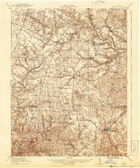
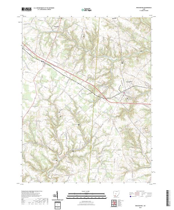
 1961 Winchester1962 Print · USGSThe rural landscape of Adams and Brown Counties comes into focus in the early sixties, centered on the railroad hub of Winchester. Researchers can trace old family lineages through Memorial Park Cemetery, Independence Cem, and the historic Mt Olivet Ch.3 unique versions available
 - 1986 Map of Maysville
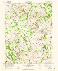
 1986 Maysville1986 Print · USGSThe Ohio River valley in the mid-eighties reveals a landscape of industrial river towns and sprawling public lands spanning the Kentucky and Ohio border. Researchers can trace the rail corridors of the Chesapeake and Ohio Railway or locate landmarks like Confidence Cemetery and the Fleming-Mason Airport.
 - 1991 Map of Maysville
 1991 Maysville1991 Print · USGSThe Ohio River valley at the turn of the nineties reveals a landscape of river-bend towns and dense forest preserves. Trace local history through landmark sites like Confidence Cemetery, the small-town streets of Ripley, and the river reaches of Manchester Island No 1.
 - 2010 Map of Winchester, 2010 Print
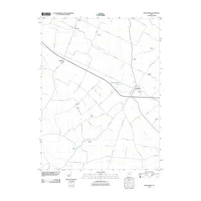 2010 Winchester2010 Print · USGSCovers Winchester, including Fincastle, Macon, and other nearby areas
 - 2013 Map of Winchester, 2013 Print
 2013 Winchester2013 Print · USGSCovers Winchester, including Fincastle, Macon, and other nearby areas
 - 2016 Map of Winchester, 2016 Print
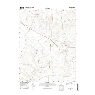
 2016 Winchester2016 Print · USGSCovers Winchester, including Fincastle, Macon, and other nearby areas
 - 2019 Map of Winchester, 2019 Print
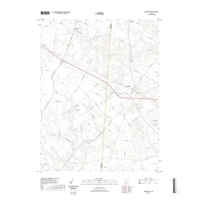 2019 Winchester2019 Print · USGSCovers Winchester, including Fincastle, Macon, and other nearby areas
 - 2023 Map of Winchester, 2023 Print
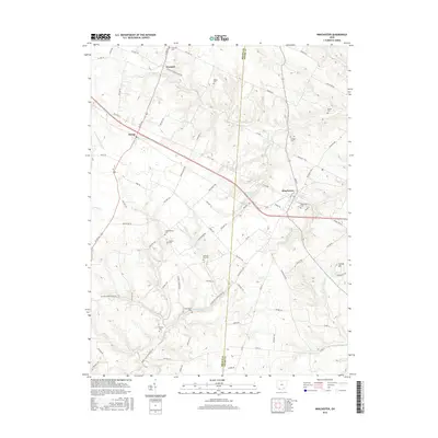
 2023 Winchester2023 Print · USGSSouthern Ohio at the junction of Adams and Brown Counties reveals a landscape of scattered family farms and quiet rural villages. Genealogists can trace decades of local history through sites like Wilson Cem, Horner Cem, and the settlement of Emerald.
End of results
Showing maps 1-11 of 11
Top cities near Winchester
- Georgetown historical maps
- West Union historical maps
- New Market historical maps
- Ripley historical maps
- Marshall historical maps
- Sardinia historical maps
See more
Frequently asked questions
- What are the different types of historical maps available for Winchester?
- What is the oldest map of Winchester?
- Where can I purchase historical maps of Winchester for my home or office?
- Where can I download high-res historical maps of Winchester?
- Are there historical topographic maps available for Winchester?
- Is there historical aerial imagery available for Winchester?
- Where are historical maps of Winchester sourced from?