Old Maps of Ohio
Explore 5,809 old maps of Ohio, spanning from 1892 to today. These high-resolution historic maps reveal how streets, neighborhoods, landmarks, and natural features evolved over time — perfect for genealogy, metal detecting, research, and local history exploration.
What you can do with these maps:
- See how Ohio changed over time: Compare historical maps to modern-day views to trace roads, homesites, rail lines & more.
- View detailed metadata: Each map includes creators, publishers, year, scale, and archive source.
- Overlay maps with satellite & LiDAR: Visualize the past alongside modern tools to explore terrain & human change.
- Trusted historical sources: Maps sourced from the USGS, Library of Congress, and other archives.
- Access maps your way: View online, download high-res files, or order prints for personal or research use.
Start exploring old maps of Ohio to uncover forgotten places, hidden landmarks, and the deep history beneath your feet.
Ohio maps
(5,809)- 1892 Map of Huntington, 1895 Print
 1892 Huntington1895 Print · USGSWest Virginia and Ohio meet along the river in the late nineteenth century, showing the rail-fueled growth of Huntington and Wayne. Local historians can trace the paths of the Chesapeake and Ohio Railroad past Barboursville and find early landmarks like Blue Sulphur Sp's and Davis Mill.
 - 1898 Map of Huntington
 1898 Huntington1898 Print · USGSNear the turn of the century, the Ohio River valley was transforming through the expansion of the Chesapeake and Ohio RR. Modern researchers can trace early nineteenth-century settlements from the bustling streets of Huntington to the inland hubs of Hamlin and Barboursville.3 unique versions available
 - 1898 Map of Ironton, 1955 Print
 1898 Ironton1955 Print · USGSSouthern Ohio's iron-producing region and the bustling riverfront at Ironton are documented here just before the turn of the century. Genealogists can trace family footprints near Vesuvius Furnace, Woodland Cemetery, and old post offices like Culbertson P.O.
 - 1898 Map of East Cincinnati, 1964 Print
 1898 East Cincinnati1964 Print · USGSGreater Cincinnati and Northern Kentucky emerge as a bustling riverfront and rail hub at the turn of the century. Genealogists and historians can trace the early footprints of Coney Island Resort, the Longview Asylum, and the Cincinnati Waterworks.
 - 1900 Map of Ironton, 1918 Print
 1900 Ironton1918 Print · USGSThe Ohio River valley and the iron-rich hills of Lawrence County are seen here at the turn of the century during a peak in industrial activity. Genealogists and historians can trace defunct post offices like Orr P.O. and explore the rail corridors of the Ironton R.R. and Cincinnati Hamilton & Dayton R.R.2 unique versions available
 - 1900 Map of Maumee Bay, 1921 Print
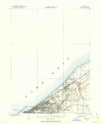
 1900 Maumee Bay1921 Print · USGSNorthwest Ohio and the Lake Erie shoreline are shown here just as the regions rail and energy sectors were maturing. Genealogists and historians can locate vanished post offices at Shepardsville Bono P. O. and trace early industrial sites like the Oil Wells and Coke Ovens near Curtice.2 unique versions available
 - 1900 Map of Toledo, 1932 Print
 1900 Toledo1932 Print · USGSToledo and the lower Maumee River valley are shown at the height of the railroad era, as the city expanded into an industrial powerhouse. Researchers can trace early infrastructure like the Michigan Division Canal and locate historic sites like the Toledo Insane Asylum or the Oil Wells near Lime City.
 - 1900 Map of Oak Harbor, 1943 Print
 1900 Oak Harbor1943 Print · USGSOttawa County shorelines and rail hubs are preserved here at the turn of the century, showing the region before modern development. Genealogists and historians can trace the early layouts of Oak Harbor, the military grounds at Camp Perry, and the path of the Toledo Div. railroad.2 unique versions available
 - 1901 Map of Oberlin, 1952 Print
 1901 Oberlin1952 Print · USGSLorain County at the turn of the century shows a bustling corridor of electric interurbans and industrial sandstone quarries. Researchers can trace early railroad junctions at Elyria and Grafton, or locate lakeside settlements like Beach Park and Lake Breeze.3 unique versions available
 - 1901 Map of Guyandot, 1953 Print
 1901 Guyandot1953 Print · USGSThe Ohio River valley at the start of the twentieth century shows a bustling corridor of industry and river commerce. Genealogists and historians can trace the early footprints of Huntington and Ceredo alongside early rail routes like the Baltimore and Ohio RR.
 - 1901 Map of Ceredo, 1953 Print
 1901 Ceredo1953 Print · USGSThe tri-state convergence of West Virginia, Ohio, and Kentucky comes alive in this early 20th-century survey of the Ohio River valley. Genealogists and rail historians can trace the vital transport networks of Kenova and Ceredo, alongside family-named landmarks like Walker Br and Rice Run.2 unique versions available
 - 1901 Map of Cadiz, 1954 Print
 1901 Cadiz1954 Print · USGSEastern Ohio at the dawn of the twentieth century was a landscape of ridge-top villages and bustling rail junctions. Trace the steam-era connections between Cadiz Junc and Jewett, or locate historic settlements like Bloomingdale and Amsterdam.2 unique versions available
 - 1901 Map of Dublin, 1955 Print
 1901 Dublin1955 Print · USGSCentral Ohio at the turn of the century reveals a landscape of independent agricultural villages and busy rail corridors long before the suburban expansion. Trace early property and settlement patterns in Dublin, Worthington, and Hilliard, and locate vanished rail stops along the Pennsylvania System and the Columbus Delaware and Marion Electric Ry.
 - 1901 Map of Massillon, 1955 Print
 1901 Massillon1955 Print · USGSMassillon and the Tuscarawas valley thrive at the turn of the century as centers of canal transit and heavy rail industry. Local historians can trace the paths of the Ohio and Erie Canal, the massive Insane Asylum, and coal operations like the Turkeyfoot Mine.2 unique versions available
 - 1901 Map of Canton, 1958 Print
 1901 Canton1958 Print · USGSStark County at the turn of the century is a landscape of growing industrial towns and busy rail corridors. Genealogists can trace family roots in New Berlin and Louisville or locate landmarks like Westlawn Cem and the Infirmary.
 - 1901 Map of Put-In-Bay, 1958 Print
 1901 Put-In-Bay1958 Print · USGSOttawa County's shoreline and the famous Lake Erie islands are captured at the start of the twentieth century, before modern development reshaped the coast. Genealogists and historians can trace the rail lines of the Lakeside and Sandusky Line and locate early settlements like Gypsum and St. George.
 - 1901 Map of Bellevue, 1958 Print
 1901 Bellevue1958 Print · USGSAcross the marshy lowlands and limestone springs of Erie and Sandusky counties at the turn of the century, a massive railroad network dominates the landscape. Genealogists can trace family footprints in Clyde and Bellevue or locate vanished rail stops at Thames and Parkertown.
 - 1901 Map of Fostoria, 1958 Print
 1901 Fostoria1958 Print · USGSNorthwest Ohio at the turn of the century is captured here as a thriving rail hub where three counties meet. Genealogists and rail historians can trace the early networks of Fostoria and locate long-standing settlements like New Riegel, Alvada, and Bascom.
 - 1901 Map of Bowling Green, 1958 Print
 1901 Bowling Green1958 Print · USGSWood County at the turn of the century is a hub of steam and rail traffic centered on the growing seat of Bowling Green. Researchers can trace old family sites and rural settlements like Hull Prairie, Tontogany, and Jerry City across a landscape of early railroad lines.
 - 1901 Map of Fremont, 1961 Print
 1901 Fremont1961 Print · USGSSandusky County at the dawn of the twentieth century is a bustling corridor of steam and electric rail lines. Trace the industrial footprint of Fremont and locate vanished rural junctions like Kingsway, Havens, and the Seneca Indian Reservation.
 - 1901 Map of Wooster, 1961 Print
 1901 Wooster1961 Print · USGSWayne County was a bustling corridor of rail and agriculture at the turn of the century, dominated by the growth of Wooster and Orrville. Researchers can trace historic institutions like Wooster University or locate the Mennonite Home and State Experiment Station.
 - 1901 Map of Elmore, 1961 Print
 1901 Elmore1961 Print · USGSNorthwest Ohio at the turn of the century was a landscape of thriving rail towns and fertile township acreage. You can trace the path of the Lake Shore Electric Railway through Woodville or locate early settlements like Pemberville and Rising Sun.
 - 1901 Map of Euclid, 1963 Print
 1901 Euclid1963 Print · USGSThe Lake Erie shoreline east of Cleveland was a bustling network of rail and recreation at the turn of the century. Trace early suburban development in Nottingham and Collamer, or locate landmarks like Euclid Beach Park and the Garfield Tomb.
 - 1902 Map of Parkersburg
 1902 Parkersburg1902 Print · USGSThe river-and-rail corridor between Ohio and West Virginia comes alive at the dawn of the twentieth century. Researchers can trace the early footprints of Parkersburg and Vienna, the sprawling Blennerhassett Island, and the old rail lines at Belpre.
 - 1902 Map of Wheeling
 1902 Wheeling1902 Print · USGSThe Ohio River valley at the start of the 1900s was a powerhouse of rail and river industry across West Virginia, Ohio, and Pennsylvania. Genealogists can trace family roots in early industrial hubs like Martins Ferry, locate historic landmarks like the S Bridge, or find riverfront settlements such as Beach Bottom and Yorkville.7 unique versions available
Showing maps 1-25 of 5,809
Top cities of Ohio
- Columbus historical maps
- Cleveland historical maps
- Cincinnati historical maps
- Toledo historical maps
- Akron historical maps
- Dayton historical maps
See more
Top counties of Ohio
- Cuyahoga County historical maps
- Franklin County historical maps
- Hamilton County historical maps
- Summit County historical maps
- Montgomery County historical maps
- Lucas County historical maps
See more
Frequently asked questions
- What are the different types of historical maps available for Ohio?
- What is the oldest map of Ohio?
- Where can I purchase historical maps of Ohio for my home or office?
- Where can I download high-res historical maps of Ohio?
- Are there historical topographic maps available for Ohio?
- Is there historical aerial imagery available for Ohio?
- Where are historical maps of Ohio sourced from?