1910s Maps of Ohio
Explore 128 historic maps of Ohio from the 1910s. These maps offer a rare glimpse into what life looked like during the 1910s — showing old roads, neighborhoods, homes, and landmarks that have changed or disappeared over time.
Whether you're researching your family's past, planning a metal detecting trip, or studying how Ohio's landscape evolved across the 1910s, these high-resolution maps are a powerful tool for exploring the history of this region.
- Focus on a specific era: All maps on this page are from the 1910s, giving you a focused view of this time period.
- See what’s changed: Compare century-old streets, trails, and buildings to today's modern landscape using overlays and satellite layers.
- Research with precision: Use these maps for genealogy, historical research, land use analysis, or educational projects.
- View, download, or print: Maps are fully viewable online in high resolution, and can be downloaded or printed for your own records.
Start exploring Ohio's history through authentic maps from the 1910s. This is your window into the past.
Ohio maps
(128)- 1910 Map of Frazeysburg, 1937 Print
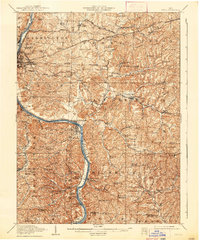
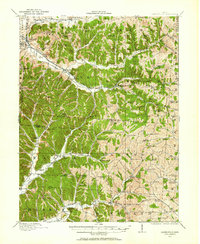
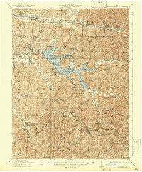
 1910 Frazeysburg1937 Print · USGSMuskingum and Licking Counties are captured here during a pivotal era of rail dominance and canal obsolescence. Researchers can locate vanished rural schoolhouses like Pisgah School or trace the early paths of the Ohio Canal near Dresden.2 unique versions available
 - 1910 Map of Philo, 1938 Print
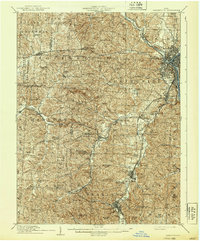
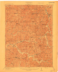
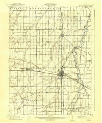
 1910 Philo1938 Print · USGSThe Muskingum River valley was a bustling corridor of rail and river commerce at the turn of the century. Genealogists can locate dozens of country schoolhouses like Toadtown School and Sleepy Hollow School, or trace family roots near Taylorsville and the National Road.2 unique versions available
 - 1910 Map of Zanesville, 1939 Print
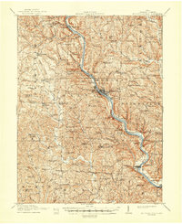
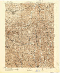
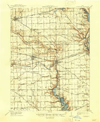
 1910 Zanesville1939 Print · USGSMuskingum and Perry counties are shown here in the early twentieth century as Zanesville emerged as a powerhouse of rail and river commerce. Researchers can trace historic transport routes like the National Road or locate local landmarks such as Moxahala Park and the Fultonham (Axline PO).2 unique versions available
 - 1910 Map of Granville, 1944 Print
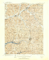
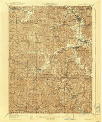
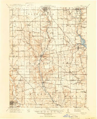
 1910 Granville1944 Print · USGSLicking County at the dawn of the automobile era shows a landscape of tightly-knit farming townships and busy rail corridors. Genealogists can locate family-named landmarks like Hazelton Corners, rural congregations at Wesley Chapel, and numerous local schools such as Wright School.
 - 1910 Map of Conesville, 1948 Print
 1910 Conesville1948 Print · USGSThe Muskingum River valley and the Ohio Canal are captured here in the decade before the Great War. Genealogists can trace family homesteads near dozens of rural landmarks like Young America School, Otsego, and Munroe Basin.
 - 1910 Map of Mc Connelsville, 1948 Print
 1910 Mc Connelsville1948 Print · USGSAlong the Muskingum River in the early 1900s, river navigation and rural commerce define the landscape. Genealogists can trace family roots through numerous country schools and churches like Mt Carmel Church and Rokeby Lock.
 - 1910 Map of Carrollton, 1957 Print
 1910 Carrollton1957 Print · USGSCarroll County and parts of Stark and Columbiana counties are documented here during an era of robust rail expansion and rural development. Genealogists can trace family footprints across dozens of local landmarks like Phalana Hall School, Macedonia Church, and the County Infirmary.
 - 1910 Map of Laurelville, 1962 Print
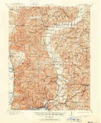
 1910 Laurelville1962 Print · USGSHocking and Vinton counties come alive in the decade before the First World War, showing a landscape of ridge-top farms and valley hamlets. Genealogists can locate family landmarks like Eagle Mills, the Indian Mound, and dozens of schools including Tuling School and Union School.
 - 1911 Map of Antrim
 1911 Antrim1911 Print · USGSGuernsey County and parts of Harrison and Tuscarawas Counties appear here just after the first decade of the century, when the rural landscape was dotted with family-named schools and crossroads. Genealogists can trace the exact locations of vanished local landmarks like Moccasin School, Wesley Church, and the dual-named Winterset P.O. Winchester.3 unique versions available
 - 1911 Map of Berne
 1911 Berne1911 Print · USGSThe Ohio-Indiana borderlands come to life in this pre-war survey of the rural landscape between the St. Marys and Wabash rivers. Genealogists can trace family footprints through numerous district sites like Duck Creek School No 4, St Anthony, and Zion Church.
 - 1911 Map of Loramie, 1936 Print
 1911 Loramie1936 Print · USGSWestern Ohio at the start of the twentieth century shows a landscape transitioning from the canal era to the age of electric rail. Researchers can trace the Miami and Erie Canal through Minster and New Bremen, or locate family sites near St Patricks Church and Schwaberow School.
 - 1911 Map of Uhrichsville, 1937 Print
 1911 Uhrichsville1937 Print · USGSTuscarawas County's industrial river valleys and canal routes are shown here at their height before the mid-century decline of rail. Researchers can trace the path of the Ohio and Erie Canal and locate family-named landmarks like Beidler P O, Wesley Church, and Gnadenhutten.
 - 1911 Map of New Lexington, 1939 Print
 1911 New Lexington1939 Print · USGSPerry County and its neighbors hummed with industrial activity when this survey was conducted. Local researchers can trace old rail lines and family-linked landmarks from St Aloysius Academy down to the mining hubs of Shawnee and New Straitsville.2 unique versions available
 - 1911 Map of Cumberland, 1939 Print
 1911 Cumberland1939 Print · USGSSoutheastern Ohio at the start of the twentieth century was a landscape of ridge-top schools and valley rail junctions. Genealogists can trace family footprints through dozens of rural landmarks like Goshen Church, Dogtown, and the Rough and Ready School.2 unique versions available
 - 1911 Map of Summerfield, 1942 Print
 1911 Summerfield1942 Print · USGSSoutheast Ohio’s rural landscape is captured here during a time of peak settlement, showing the region's dense network of family-named ridges and valley farms. Genealogists can trace local roots through numerous landmarks like Richland Church, Kings Mine, and the Science Hill School.
 - 1911 Map of Spencerville, 1942 Print
 1911 Spencerville1942 Print · USGSWestern Ohio in the early 1900s was a hub of canal and rail transport, anchored by the industrial and shipping activity in St Marys. Genealogists and historians can trace numerous rural schoolhouses like Hardscrabble School and the path of the Miami and Erie Canal.
 - 1911 Map of Delphos, 1942 Print
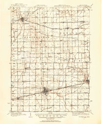
 1911 Delphos1942 Print · USGSNorthwest Ohio at the height of the steam and electric rail era shows a landscape deeply organized by section lines and turnpikes. Genealogists can trace rural family life through dozens of named sites like Eickholt School, Horeb Church, and the town of Landeck.
 - 1911 Map of Covington, 1946 Print
 1911 Covington1946 Print · USGSWestern Ohio’s agricultural heartland is mapped here as a web of turnpikes and railroads connects thriving towns. Trace old family sites near Bradford, Gettysburg, and uniquely named rural landmarks like Lickskillet School or Cassels Corners.
 - 1911 Map of Oxford, 1950 Print
 1911 Oxford1950 Print · USGSOxford and its surrounding townships thrived as centers of education and commerce in the early twentieth century. Genealogists can trace family footprints across dozens of local school districts, from Flora School to Cotton Run School, and locate rural landmarks like Halderman Mill or Maple Grove Church.
 - 1911 Map of Era, 1952 Print
 1911 Era1952 Print · USGSPickaway County at the start of the 1900s is a landscape of established farmsteads and creekside milling. Genealogists can trace family footprints through numerous rural school sites like Tick Ridge School or Locust Grove School and find early commerce hubs like Crownover Mill and Williamsport.
 - 1911 Map of Sciotoville, 1952 Print
 1911 Sciotoville1952 Print · USGSThe industrial riverfronts and rural hollows of southern Ohio are shown here in the early twentieth century before modern development. Genealogists and historians can trace numerous rural landmarks like Davis Sta George PO, Harrison Furnace School, and the brickyards near New Boston.2 unique versions available
 - 1911 Map of Wauseon, 1954 Print
 1911 Wauseon1954 Print · USGSFulton County and the Michigan-Ohio borderlands thrived as a major railroad hub in the early twentieth century. Researchers can trace numerous vanished district schools like Swamp Angel School and stop-points like Tedrow PO or Ottokee Sta.
 - 1911 Map of Swanton, 1956 Print
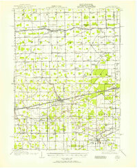 1911 Swanton1956 Print · USGSNorthwest Ohio and the Michigan border are captured here just before the era of major highway expansion. Genealogists can trace early twentieth-century property locations near Metamora, Raab Corners, and numerous rural schoolhouses like Frogpond School.
 - 1911 Map of Newcomerstown, 1959 Print
 1911 Newcomerstown1959 Print · USGSTuscarawas County in the early twentieth century is captured here as a corridor of heavy rail and old canal routes. Genealogists can locate family-named rural schools like Steitz School or May School and trace the original path of the Ohio Canal near Port Washington.
 - 1912 Map of Monroe
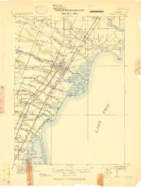 1912 Monroe1912 Print · USGSMonroe County before the First World War was a landscape defined by its strategic lakefront positioning and a massive concentration of competing railroads. Genealogists can trace the early footprints of Monroe, Brest P.O., and Erie while following local landmarks like Sandy Creek and Plum Creek.
Showing maps 1-25 of 128
Top cities of Ohio
- Columbus historical maps
- Cleveland historical maps
- Cincinnati historical maps
- Toledo historical maps
- Akron historical maps
- Dayton historical maps
See more
Top counties of Ohio
- Cuyahoga County historical maps
- Franklin County historical maps
- Hamilton County historical maps
- Summit County historical maps
- Montgomery County historical maps
- Lucas County historical maps
See more
Frequently asked questions
- What are the different types of historical maps available for Ohio?
- What is the oldest map of Ohio?
- Where can I purchase historical maps of Ohio for my home or office?
- Where can I download high-res historical maps of Ohio?
- Are there historical topographic maps available for Ohio?
- Is there historical aerial imagery available for Ohio?
- Where are historical maps of Ohio sourced from?