1980s Maps of Ohio
Explore 45 historic maps of Ohio from the 1980s. These maps offer a rare glimpse into what life looked like during the 1980s — showing old roads, neighborhoods, homes, and landmarks that have changed or disappeared over time.
Whether you're researching your family's past, planning a metal detecting trip, or studying how Ohio's landscape evolved across the 1980s, these high-resolution maps are a powerful tool for exploring the history of this region.
- Focus on a specific era: All maps on this page are from the 1980s, giving you a focused view of this time period.
- See what’s changed: Compare century-old streets, trails, and buildings to today's modern landscape using overlays and satellite layers.
- Research with precision: Use these maps for genealogy, historical research, land use analysis, or educational projects.
- View, download, or print: Maps are fully viewable online in high resolution, and can be downloaded or printed for your own records.
Start exploring Ohio's history through authentic maps from the 1980s. This is your window into the past.
Ohio maps
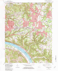
(45)- 1980 Map of Wellston, 1982 Print
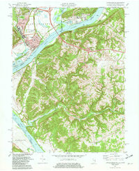
 1980 Wellston1982 Print · USGSThe hill country of south-central Ohio in the early eighties shows a landscape of expansive state forests and deep-rooted river towns. Genealogists and historians can trace rural heritage through sites like Buckeye Furnace State Memorial and Mount Zion Cemetery.
 - 1980 Map of Senecaville, 1983 Print
 1980 Senecaville1983 Print · USGSEastern Ohio at the start of the eighties reveals a complex landscape of coal extraction and river commerce. Genealogists and historians can trace rail lines like the Conrail and Baltimore and Ohio RR connecting towns like Byesville and Woodsfield.2 unique versions available
 - 1981 Map of Covington
 1981 Covington1981 Print · USGSNorthern Kentucky and Cincinnati meet along the river in the early eighties as suburban communities expand into the hills. Trace the development of Villa Hills and Fort Wright, or locate family sites at Highland Cemetery and Linden Grove Cem.2 unique versions available
 - 1981 Map of Hooven, 1982 Print
 1981 Hooven1982 Print · USGSThe Ohio-Indiana-Kentucky borderlands are captured here in the early eighties as industrial gravel operations and rail lines shaped the river valleys. Researchers can trace the Conrail lines through Valley Junction or locate old burial sites like Sugar Ridge Cem and Maple Grove Cem.2 unique versions available
 - 1981 Map of Laurel, 1982 Print
 1981 Laurel1982 Print · USGSClermont County's riverfront and rural interior are captured here in the early 1980s, documenting a landscape of small hamlets and family-named landmarks. Genealogists can trace sites like Monroe Cem, Franklin Chapel, and the historic river town of Point Pleasant.2 unique versions available
 - 1981 Map of Ironton, 1982 Print
 1981 Ironton1982 Print · USGSThe tri-state river valley at the start of the eighties shows a landscape shaped by heavy industry, atomic energy, and sprawling national forests. Researchers can trace the legacy of iron production at Harrison Furnace or follow the historic rail lines of the C & O RR and N & W RR.
 - 1981 Map of New Richmond, 1982 Print
 1981 New Richmond1982 Print · USGSThe Ohio River valley was a hub of river and rail transport in the early eighties, connecting riverside towns and rural uplands. Genealogists can trace family landmarks at Gubser Mill, Watkins Cem, and the historic Clermont Academy.2 unique versions available
 - 1981 Map of Lawrenceburg, 1982 Print
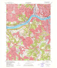
 1981 Lawrenceburg1982 Print · USGSThe tri-state junction of Indiana, Kentucky, and Ohio is captured here in the early eighties as the river economy matured. Researchers can trace family history through numerous burial sites like Greendale Cem and Petersburg Cem or locate the old Courthouse in Lawrenceburg.3 unique versions available
 - 1981 Map of Moscow, 1982 Print
 1981 Moscow1982 Print · USGSThe Ohio River valley near Moscow, Ohio, shows a landscape of heavy river infrastructure and ridge-top farming in the early eighties. Researchers can trace rural lineages through family-named landmarks like Fruit Ridge, McKendree Cem, and the old Flat Rock Ch.2 unique versions available
 - 1981 Map of Parkersburg, 1984 Print
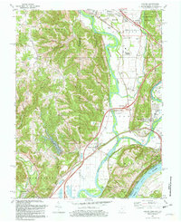
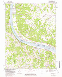
 1981 Parkersburg1984 Print · USGSThe Ohio River valley at the start of the 1980s reveals a landscape shaped by river commerce and the rail networks of the Baltimore and Ohio RR. Genealogists and historians can trace the development of riverfront communities like Parkersburg, Marietta, and Williamstown, alongside rural landmarks like Blennerhassett Island and Elizabeth.
 - 1982 Map of Addyston
 1982 Addyston1982 Print · USGSThe confluence of the Ohio and Great Miami Rivers defines this Hamilton County landscape in the early eighties. Researchers can trace the river-and-rail economy through the Chessie System line and find family sites at Miamitown Cem and Cleves.3 unique versions available
 - 1982 Map of Huntington, 1983 Print
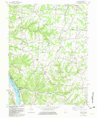
 1982 Huntington1983 Print · USGSThe tri-state region around Huntington and Ashland is shown in the early 1980s, documenting a landscape shaped by river commerce and coal-country railroads. Trace family roots and old routes through Barboursville, the Gas Field, and the Tug Fork valley.
 - 1983 Map of Burlington
 1983 Burlington1983 Print · USGSBoone County and the Cincinnati riverfront are captured here in the early eighties as aviation and suburban growth transformed the landscape. Researchers can find old family sites like the Col Abraham Depew Grave, the Anderson Ferry, and the Latonia Racetrack.4 unique versions available
 - 1983 Map of Withamsville, 1984 Print
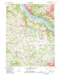
 1983 Withamsville1984 Print · USGSClermont and Hamilton counties are shown in the early eighties as suburban growth expands near the river. Researchers can trace family history at Asbury Cem, explore the old Newtown area, or follow the CHESAPEAKE AND OHIO line.4 unique versions available
 - 1983 Map of Newport, 1984 Print
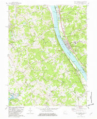
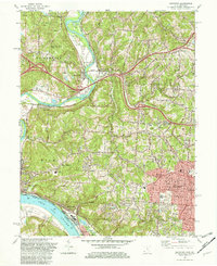
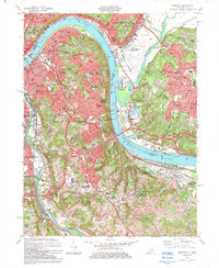 1983 Newport1984 Print · USGSGreater Cincinnati and Northern Kentucky come alive in this early 1980s survey of the riverfront and its surrounding hilltops. Genealogists and local historians can map out long-standing landmarks like Evergreen Cemetery, CINCINNATI MUNICIPAL AIRPORT (LUNKEN FIELD), and the St Ursula Convent and Academy.2 unique versions available
 - 1984 Map of Ripley
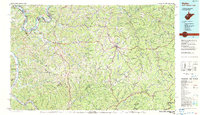 1984 Ripley1984 Print · USGSThe West Virginia riverfront and interior highlands are captured here in the mid-eighties as energy production reshaped the landscape. Researchers can trace the Ohio River industrial corridor through Ravenswood or locate smaller inland communities like Gandeeville and Reedy.
 - 1984 Map of Moundsville
 1984 Moundsville1984 Print · USGSThe Ohio River valley and the Appalachian interior meet in the mid-eighties as a hub of rail and river commerce. Genealogists and historians can trace the development of river towns like New Martinsville, inland hubs like Waynesburg, and the path of the B & O RR.
 - 1984 Map of Lancaster, 1985 Print
 1984 Lancaster1985 Print · USGSCentral Ohio and the Hocking Valley come into focus during the mid-eighties as suburban growth meets the wooded ridges of the southeast. Researchers can trace transportation networks through Buckeye Lake or locate landmarks like Flint Ridge State Memorial and Moxahala Park.
 - 1985 Map of Adrian
 1985 Adrian1985 Print · USGSThe tri-state borderlands of Michigan, Indiana, and Ohio were well-established by the mid-1980s, characterized by a dense network of glacial lakes and agricultural rail hubs. Genealogists and historians can trace rail lines like the Norfolk and Western Railway and locate landmarks such as the Old Indian Treaty Cem or Riverside Cem.
 - 1985 Map of Erie, 1986 Print
 1985 Erie1986 Print · USGSThe Pennsylvania lakefront and the city of Erie are documented here in the mid-eighties, highlighting the region's transition from industrial hub to regional center. Genealogists and researchers can trace the neighborhoods of Wesleyville and Lake City or locate landmarks like Waldameer Park and the Conrail lines.
 - 1985 Map of Cleveland North, 1986 Print
 1985 Cleveland North1986 Print · USGSThe Ohio shoreline of Lake Erie in the mid-1980s reveals a bustling landscape of industrial rail lines and expanding lakefront communities. Trace the infrastructure of the era through Burke Lakefront Airport, the sprawling CONRAIL lines, and parks like Headlands Beach State Park.
 - 1986 Map of Bellefontaine
 1986 Bellefontaine1986 Print · USGSWest Central Ohio in the mid-1980s reveals a landscape of growing metropolitan fringes and established rural centers. Researchers can trace historic cemeteries and civic institutions from Oak Grove Cem to the State Reformatory For Women and Cedar Bog State Nature Preserve.
 - 1986 Map of Pittsburgh West
 1986 Pittsburgh West1986 Print · USGSThe Tri-State region's coal and rail corridors are captured in the mid-eighties as industry and aviation expanded. Trace the legacy of extraction at Nelms Mine No 1, locate Short Creek PO, or follow the Chessie System tracks along the Ohio River.3 unique versions available
 - 1986 Map of Piqua
 1986 Piqua1986 Print · USGSThe western Ohio and eastern Indiana borderlands appear here in the mid-1980s, showcasing a landscape of river-valley industry and fertile plains. Researchers can trace historic rail lines like Conrail and Norfolk and Western through towns like Greenville and Winchester.3 unique versions available
 - 1986 Map of Mansfield
 1986 Mansfield1986 Print · USGSNorth-central Ohio in the mid-eighties shows a landscape of industrial towns and large-scale water management projects. Researchers can trace historic sites like the Mansfield Reformatory, Malabar Farm State Park, and the racing grounds at Mid-Ohio Race Course.
Showing maps 1-25 of 45
Top cities of Ohio
- Columbus historical maps
- Cleveland historical maps
- Cincinnati historical maps
- Toledo historical maps
- Akron historical maps
- Dayton historical maps
See more
Top counties of Ohio
- Cuyahoga County historical maps
- Franklin County historical maps
- Hamilton County historical maps
- Summit County historical maps
- Montgomery County historical maps
- Lucas County historical maps
See more
Frequently asked questions
- What are the different types of historical maps available for Ohio?
- What is the oldest map of Ohio?
- Where can I purchase historical maps of Ohio for my home or office?
- Where can I download high-res historical maps of Ohio?
- Are there historical topographic maps available for Ohio?
- Is there historical aerial imagery available for Ohio?
- Where are historical maps of Ohio sourced from?