2000-2009 Maps of Ohio
Explore 50 historic maps of Ohio from 2000-2009. These maps offer a rare glimpse into what life looked like during the 2000s — showing old roads, neighborhoods, homes, and landmarks that have changed or disappeared over time.
Whether you're researching your family's past, planning a metal detecting trip, or studying how Ohio's landscape evolved across the 2000s, these high-resolution maps are a powerful tool for exploring the history of this region.
- Focus on a specific era: All maps on this page are from the 2000s, giving you a focused view of this time period.
- See what’s changed: Compare century-old streets, trails, and buildings to today's modern landscape using overlays and satellite layers.
- Research with precision: Use these maps for genealogy, historical research, land use analysis, or educational projects.
- View, download, or print: Maps are fully viewable online in high resolution, and can be downloaded or printed for your own records.
Start exploring Ohio's history through authentic maps from the 2000s. This is your window into the past.
Ohio maps
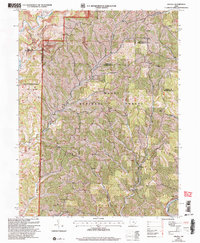
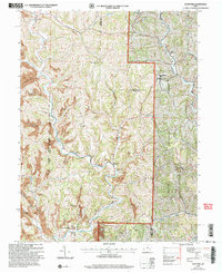
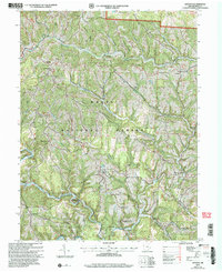
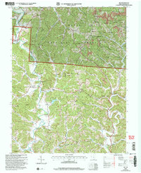
(50)- 2002 Map of Athens, 2005 Print
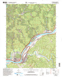
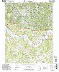
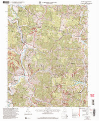
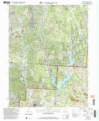
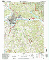 2002 Athens2005 Print · USGSAthens and its surrounding ridges come alive in this early 2000s survey, showing the city's evolution alongside the Hocking River. Genealogists and historians can trace family cemeteries like Bassett Cem and McCole Cem or explore the institutional footprints of Ohio University and the State Hospital.
 - 2002 Map of Pedro, 2006 Print
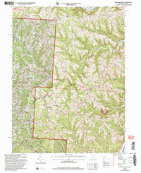
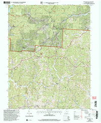
 2002 Pedro2006 Print · USGSLawrence County at the turn of the millennium shows a landscape shaped by natural resource extraction within the Wayne National Forest. Genealogists and historians can trace the foundations of local industry and community life through sites like the clay pits at Superior, the Pedro Sch, and Lawco Lake.
 - 2002 Map of New Matamoras, 2006 Print
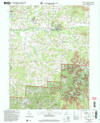
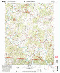
 2002 New Matamoras2006 Print · USGSThe Ohio River valley at the turn of the new millennium shows a landscape defined by riverside settlements and deep forest ridges. Genealogists and hikers can locate sites like Salem Hall, Zion Ch, and the high ridges of the Wayne National Forest.
 - 2002 Map of Rinard Mills, 2006 Print
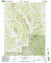
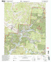
 2002 Rinard Mills2006 Print · USGSThe Little Muskingum River valley at the turn of the millennium remains a landscape of historic river crossings and ridge-top homesteads. Trace the location of Knowlton Covered Bridge, the Rinard Mills settlement, and rural churches like Mt Hope Ch.
 - 2002 Map of Raven Rock, 2006 Print
 2002 Raven Rock2006 Print · USGSThe riverfront communities of West Virginia and Ohio are captured here at the start of the 21st century. Genealogists can locate family-named landmarks such as Chapman Cem and Wade Cem, or trace the development around St Marys and Newport.
 - 2002 Map of Round Bottom, 2006 Print
 2002 Round Bottom2006 Print · USGSThe riverfront communities of Monroe County thrive along the Ohio River at the start of the twenty-first century. Genealogists and historians can trace numerous rural landmarks like Winklers Mill, Chapel Hill Ch, and the Emma Grove Cem.
 - 2002 Map of Junction City, 2006 Print
 2002 Junction City2006 Print · USGSPerry and Fairfield counties are shown at the turn of the millennium as industrial remnants meet national forest lands. Local historians can trace old family sites like Harvey Cem and church congregations at Friendship Ch or Turkey Creek Ch.
 - 2002 Map of Amesville, 2006 Print
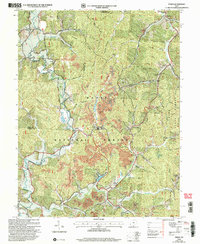
 2002 Amesville2006 Print · USGSThe Appalachian foothills of Athens and Morgan counties appear here at the turn of the millennium, showing a landscape defined by coal and timber. Researchers can trace family roots at Beasley Cem and explore old settlements like Sharpsburg or Lathrop.
 - 2002 Map of Stewart, 2006 Print
 2002 Stewart2006 Print · USGSAthens County at the start of the millennium shows a landscape defined by the winding Hocking River and the expansion of the Wayne National Forest. Genealogists can trace family names at Sand Rock Cemetery and locate community hubs like Asbury Church and Broadwell.
 - 2002 Map of Kitts Hill, 2006 Print
 2002 Kitts Hill2006 Print · USGSLawrence County, Ohio, at the start of the 2000s, shows a landscape of deep timbered hollows and ridge-top communities within the Wayne National Forest. Genealogists can trace family names through dozens of rural sites like Hackworth Cem, Oakland Chapel, and Rock Hill Sch.
 - 2002 Map of Rodney, 2006 Print
 2002 Rodney2006 Print · USGSGallia County at the turn of the millennium shows a landscape where public lands and industry meet along the bends of Raccoon Creek. Genealogists can locate family sites like the Hulbert Cem, Alexander Ch, and the old Green Sch.
 - 2002 Map of South Webster, 2006 Print
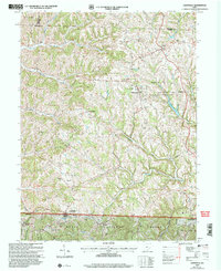
 2002 South Webster2006 Print · USGSSouth Webster and its surrounding mining hills are documented in this 2002 revision. Researchers can trace family history at Bloom Switch Cem or follow the B & O Railroad past old industrial sites like Jackson Furnace and Firebrick.
 - 2002 Map of Dalzell, 2006 Print
 2002 Dalzell2006 Print · USGSSoutheast Ohio’s rural landscape is captured here just after the turn of the millennium, showing a region defined by forest and small-scale industry. Genealogists and local historians can trace family ties at Zion Ch (Cem) or find the historic Hune Covered Bridge.
 - 2002 Map of Glenwood, 2006 Print
 2002 Glenwood2006 Print · USGSThe Ohio River valley and the ridges of Cabell and Mason counties are shown here as they appeared at the start of the century. Genealogists and local historians can trace rural family life through landmarks like Moores Chapel, Swan Creek Sch, and Dudley Gap.
 - 2002 Map of Apple Grove, 2006 Print
 2002 Apple Grove2006 Print · USGSLife along the Ohio River at the dawn of the 21st century centered on riverfront hamlets and the ridges of the Wayne National Forest. Researchers can trace local heritage through sites like Mercers Bottom, Sunnyside School, and several family-linked cemeteries like Kings Chapel.
 - 2002 Map of Woodsfield, 2006 Print
 2002 Woodsfield2006 Print · USGSMonroe County at the turn of the millennium shows a landscape shaped by ridge-top settlements and winding creek valleys. Trace family history at Hope Ridge Cem or Ashbury Chapel, and locate landmarks from Woodsfield to the Wayne National Forest.
 - 2002 Map of Waterloo, 2006 Print
 2002 Waterloo2006 Print · USGSThe rugged ridges of Lawrence and Gallia counties are seen here in the early 2000s within the Wayne National Forest. Genealogists can trace family names through Waterloo Cem and find early community hubs like Flag Spring Ch and Arabia.
 - 2002 Map of Stafford, 2006 Print
 2002 Stafford2006 Print · USGSSoutheast Ohio's ridge country at the turn of the millennium shows a landscape shaped by rural tradition and natural resource extraction. Genealogists can trace family landmarks like Mt Tabor Ch and Zion Cem or locate the old Township Sch near Harriettsville.
 - 2002 Map of Antioch, 2006 Print
 2002 Antioch2006 Print · USGSMonroe County’s rural ridges and creek valleys are documented here at the turn of the century within the National Forest. Genealogists can trace family landmarks like Fletchers Chapel, Moffets Ch, and the Covered Bridge near Antioch.
 - 2002 Map of Aid, 2006 Print
 2002 Aid2006 Print · USGSLawrence County at the start of the 21st century reveals a landscape where Wayne National Forest wilderness meets a long history of ridge-top farming and coal mining. Researchers can trace family sites near Aid Cem and Linnville, or locate early educational landmarks like Township Sch No 2 and the Symmes Valley High Sch.
 - 2002 Map of Corning, 2006 Print
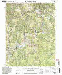
 2002 Corning2006 Print · USGSThe Hocking Valley region at the start of the 21st century reveals a landscape shaped by coal mining and modern conservation. Genealogists can locate family sites at Glouster Cem and Maplewood Cem, or trace the legacy of settlements like Millertown and McLeish.
 - 2002 Map of Athalia, 2006 Print
 2002 Athalia2006 Print · USGSThe Ohio River valley at the start of the 21st century reveals a landscape of riverside villages and upland forest reserves. Genealogists and historians can trace community roots through numerous country churches like Wilma Chapel and old schools including Fairland Sch No 3.
 - 2002 Map of Nelsonville, 2006 Print
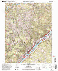
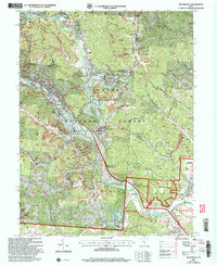 2002 Nelsonville2006 Print · USGSThe Hocking River valley at the start of the twenty-first century reveals a landscape of industrial history and forest conservation. Researchers can trace the legacy of coal mining and the Chesapeake and Ohio railroad near Buchtel and Strip Mine sites.
 - 2002 Map of Willow Island, 2006 Print
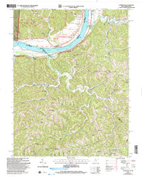
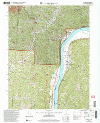
 2002 Willow Island2006 Print · USGSPleasants and Wood Counties come together along the Ohio River during the early 2000s, showcasing a landscape of heavy river locks and rural ridge-top homesteads. Genealogists and local historians can trace family-named sites like Pumpkin Knob Sch, Harness Ch, and the small settlement of Newlandsville.
 - 2002 Map of Lewisville, 2006 Print
 2002 Lewisville2006 Print · USGSSoutheastern Ohio's ridges and valleys are mapped here at the turn of the millennium, showing a landscape defined by small villages and protected woodlands. Genealogists can trace early settlers through the German Cem, Free Burial Ground, and numerous family-named hollows.
Showing maps 1-25 of 50
Top cities of Ohio
- Columbus historical maps
- Cleveland historical maps
- Cincinnati historical maps
- Toledo historical maps
- Akron historical maps
- Dayton historical maps
See more
Top counties of Ohio
- Cuyahoga County historical maps
- Franklin County historical maps
- Hamilton County historical maps
- Summit County historical maps
- Montgomery County historical maps
- Lucas County historical maps
See more
Frequently asked questions
- What are the different types of historical maps available for Ohio?
- What is the oldest map of Ohio?
- Where can I purchase historical maps of Ohio for my home or office?
- Where can I download high-res historical maps of Ohio?
- Are there historical topographic maps available for Ohio?
- Is there historical aerial imagery available for Ohio?
- Where are historical maps of Ohio sourced from?