Old Maps of Butler County, Ohio
Explore 115 old maps of Butler County, spanning from 1904 to today. These high-resolution historic maps reveal how streets, neighborhoods, landmarks, and natural features evolved over time — perfect for genealogy, metal detecting, research, and local history exploration.
What you can do with these maps:
- See how Butler County changed over time: Compare historical maps to modern-day views to trace roads, homesites, rail lines & more.
- View detailed metadata: Each map includes creators, publishers, year, scale, and archive source.
- Overlay maps with satellite & LiDAR: Visualize the past alongside modern tools to explore terrain & human change.
- Trusted historical sources: Maps sourced from the USGS, Library of Congress, and other archives.
- Access maps your way: View online, download high-res files, or order prints for personal or research use.
Start exploring old maps of Butler County to uncover forgotten places, hidden landmarks, and the deep history beneath your feet.
Butler County, OH maps
(115)- 1904 Map of Mason, 1958 Print
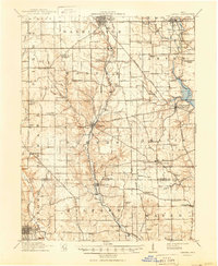
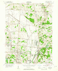
 1904 Mason1958 Print · USGSSouthwestern Ohio at the turn of the century is a landscape of thriving canal-era towns and expanding rail corridors. Genealogists and researchers can trace the early layouts of Union Village, Shaker Village, and the industrial riverside at Kings Mills.
 - 1906 Map of Mason, 1939 Print
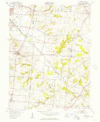
 1906 Mason1939 Print · USGSWarren and Butler counties are shown here in the first decade of the 1900s, when electric railways were transforming rural life. Genealogists can trace family roots through old hubs like Union Village, Kings Mills, and Amanda Excello P O.2 unique versions available
 - 1908 Map of Miamisburg, 1948 Print
 1908 Miamisburg1948 Print · USGSThe Miami Valley at the start of the twentieth century was a hub of electric traction lines and canal history. Genealogists and historians can trace the early layouts of Miamisburg and Franklin, or locate landmarks like Browns Chapel and the National Military Home.
 - 1911 Map of Oxford, 1950 Print
 1911 Oxford1950 Print · USGSOxford and its surrounding townships thrived as centers of education and commerce in the early twentieth century. Genealogists can trace family footprints across dozens of local school districts, from Flora School to Cotton Run School, and locate rural landmarks like Halderman Mill or Maple Grove Church.
 - 1915 Map of College Corner
 1915 College Corner1915 Print · USGSThe Indiana-Ohio borderlands at the start of the twentieth century are defined here by rail hubs and rural townships. Trace family roots and vanished landmarks near College Corner, Concord Church, and the winding Fourmile Creek.
 - 1915 Map of Harrison
 1915 Harrison1915 Print · USGSThe Indiana-Ohio borderlands come into focus during the mid-teens, showing a landscape of river-valley settlements and rural school districts. Genealogists can locate family landmarks like Vannatta School, Davis School, and the village of Okeana along the Dry Fork.
 - 1915 Map of Hamilton
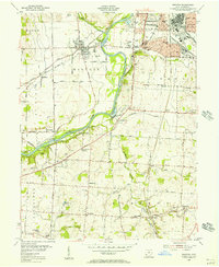
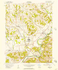
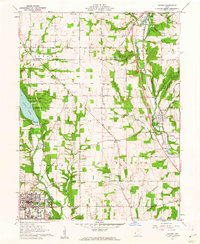
 1915 Hamilton1915 Print · USGSButler County was a bustling industrial and transit corridor in the years before the Great War, centered on the Miami River. Researchers can trace the path of the Miami and Erie Canal and locate historic sites like Shaker Village, Venice Ross P O, and the Biddinger School.2 unique versions available
 - 1917 Map of Hamilton, 1942 Print
 1917 Hamilton1942 Print · USGSButler County and the Miami River valley are captured here just before the era of major highway expansion, when industrial towns and electric railways defined the region. Researchers can locate the Shaker Village, trace the Miami and Erie Canal, or find family sites near Darrtown and Millville.
 - 1918 Map of College Corner
 1918 College Corner1918 Print · USGSThe Indiana-Ohio borderlands come into focus during the Great War era, showing the intersection of rail and road commerce. Genealogists and historians can trace the early layout of College Corner, the grounds of Tallawanda Springs, and rural landmarks like School No 3.4 unique versions available
 - 1951 Map of Franklin, 1953 Print
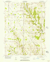
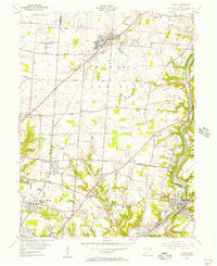
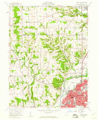
 1951 Franklin1953 Print · USGSThe industrial corridor of the Great Miami River valley thrives in the early 1950s as a major rail hub for the New York Central and Baltimore and Ohio. Genealogists can trace family landmarks like Swartzel Cem and Stettler Ch or locate the ancient Indian Mound overlooking the river.
 - 1953 Map of Cincinnati, 1965 Print
 1953 Cincinnati1965 Print · USGSThe Ohio River valley and the industrial heartland of Indiana and Ohio are captured here during the mid-century peak of rail and river commerce. Genealogists and historians can trace connections between Cincinnati and outlying military sites like Camp Atterbury and Bakalar AFB.3 unique versions available
 - 1955 Map of Monroe, 1956 Print
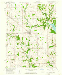
 1955 Monroe1956 Print · USGSIn the mid-1950s, the border of Butler and Warren Counties was a landscape of established institutions and quiet rail stops. Researchers can trace historic communal sites like the Otterbein Home, old cemeteries such as Mound Cemetery, and stops along the Pennsylvania RR at Beedles Station.
 - 1955 Map of Harrison, 1956 Print
 1955 Harrison1956 Print · USGSThe borderlands of Ohio and Indiana are captured here in the mid-fifties as the villages of Harrison and West Harrison thrive along the river. Researchers can trace family roots through numerous sites like Glen Haven Cem and the Township School.5 unique versions available
 - 1955 Map of Hamilton, 1956 Print
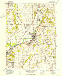
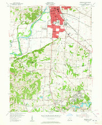
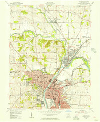 1955 Hamilton1956 Print · USGSHamilton and the Great Miami River valley are shown here in the mid-1950s during a period of robust industrial and rail activity. Researchers can trace the routes of the Pennsylvania Railroad or locate family sites like Stahlheber Ch and St Stephens Cem.
 - 1955 Map of Reily, 1956 Print
 1955 Reily1956 Print · USGSThe Indiana-Ohio borderlands come into focus in the mid-1950s, showing a landscape defined by the First Principal Meridian. Genealogists and historians can trace small settlements like Mixersville and Scipio, and locate old burial sites including Springdale Cemetery and Asbury Cemetery.3 unique versions available
 - 1955 Map of Glendale, 1956 Print
 1955 Glendale1956 Print · USGSGreater Cincinnati was rapidly evolving in the mid-fifties as industrial rail hubs and suburban growth met the traditional farming landscape. Genealogists can locate several family burial grounds like Smizer Cem and old stops including Mauds Sta and Rialto.
 - 1955 Map of Trenton, 1956 Print
 1955 Trenton1956 Print · USGSButler County in the mid-fifties shows the industrial and recreational pulse along the Miami River between Middletown and Hamilton. Genealogists and historians can trace family plots at Shafer Farm Cem, visit the Amusement Park, or locate the Amanda Sta railroad stop.
 - 1955 Map of Mason, 1956 Print
 1955 Mason1956 Print · USGSSouthwestern Ohio was entering a period of suburban expansion in the mid-fifties while maintaining its vital river and rail corridors. Trace the massive Voice of America transmitter site and local landmarks like Kings Mills and Gate of Heaven Cemetery.
 - 1955 Map of Millville, 1956 Print
 1955 Millville1956 Print · USGSButler County in the mid-fifties remains a landscape of rail-side hamlets and rural schoolhouses. Genealogists can trace family names through sites like Minton Cem and Bethel Cem or follow the old Baltimore and Ohio line through McGonigle.4 unique versions available
 - 1955 Map of Shandon, 1957 Print
 1955 Shandon1957 Print · USGSButler and Hamilton counties in the mid-1950s reveal a mix of quiet rural townships and emerging industrial sites. Genealogists can trace family footprints through several local cemeteries like Scott Cem and Butterfield Cem or the vanished stops of Shandon Sta.
 - 1955 Map of Greenhills, 1957 Print
 1955 Greenhills1957 Print · USGSButler and Hamilton counties in the mid-fifties reveal a mix of established river towns and new suburban growth. Genealogists and local historians can trace family sites like Huston Cem and Werner Cem, or locate the original grounds of the St Francis Seminary.2 unique versions available
 - 1957 Map of Cincinnati
 1957 Cincinnati1957 Print · USGSThe Ohio River valley and its surrounding highlands thrived during the mid-fifties industrial peak, centered on the bustling Cincinnati and Dayton metropolitan hubs. Researchers can trace the extensive rail networks and military sites like Wright-Patterson AFB and Camp Atterbury.
 - 1959 Map of Middletown, 1961 Print
 1959 Middletown1961 Print · USGSThe Miami Valley in the late fifties shows a region in transition between its river-and-rail origins and the modern industrial era. Genealogists can trace family names through the Elk Creek Cem, Astoria Cem, and local school locations like Madison High Sch.5 unique versions available
 - 1960 Map of College Corner, 1961 Print
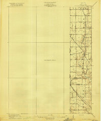
 1960 College Corner1961 Print · USGSCollege Corner sits at the crossroads of Indiana and Ohio at the start of the 1960s, a landscape defined by intersecting railroads and state lines. Genealogists can trace family roots through College Corner Cemetery, Hopewell Ch, and the rural settlement of Charlottesville.4 unique versions available
 - 1961 Map of Oxford, 1962 Print
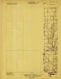
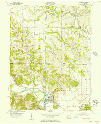
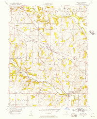
 1961 Oxford1962 Print · USGSButler and Preble counties come into focus during the early sixties, showing the expansion of Miami University alongside traditional farmsteads. Researchers can trace the Pennsylvania rail corridor or locate ancestral sites like Beechwood Cem and Morning Sun.4 unique versions available
Showing maps 1-25 of 115
Top cities of Butler County
- Hamilton historical maps
- Middletown historical maps
- Fairfield historical maps
- Lemon Township historical maps
- Trenton historical maps
- Ross Township historical maps
See more
Frequently asked questions
- What are the different types of historical maps available for Butler County?
- What is the oldest map of Butler County?
- Where can I purchase historical maps of Butler County for my home or office?
- Where can I download high-res historical maps of Butler County?
- Are there historical topographic maps available for Butler County?
- Is there historical aerial imagery available for Butler County?
- Where are historical maps of Butler County sourced from?