Old Maps of Reily Township, Ohio
Explore 19 old maps of Reily Township, spanning from 1915 to today. These high-resolution historic maps reveal how streets, neighborhoods, landmarks, and natural features evolved over time — perfect for genealogy, metal detecting, research, and local history exploration.
What you can do with these maps:
- See how Reily Township changed over time: Compare historical maps to modern-day views to trace roads, homesites, rail lines & more.
- View detailed metadata: Each map includes creators, publishers, year, scale, and archive source.
- Overlay maps with satellite & LiDAR: Visualize the past alongside modern tools to explore terrain & human change.
- Trusted historical sources: Maps sourced from the USGS, Library of Congress, and other archives.
- Access maps your way: View online, download high-res files, or order prints for personal or research use.
Start exploring old maps of Reily Township to uncover forgotten places, hidden landmarks, and the deep history beneath your feet.
Reily Township, OH maps
(19)- 1915 Map of Harrison
 1915 Harrison1915 Print · USGSThe Indiana-Ohio borderlands come into focus during the mid-teens, showing a landscape of river-valley settlements and rural school districts. Genealogists can locate family landmarks like Vannatta School, Davis School, and the village of Okeana along the Dry Fork.
 - 1915 Map of Hamilton
 1915 Hamilton1915 Print · USGSButler County was a bustling industrial and transit corridor in the years before the Great War, centered on the Miami River. Researchers can trace the path of the Miami and Erie Canal and locate historic sites like Shaker Village, Venice Ross P O, and the Biddinger School.2 unique versions available
 - 1917 Map of Hamilton, 1942 Print
 1917 Hamilton1942 Print · USGSButler County and the Miami River valley are captured here just before the era of major highway expansion, when industrial towns and electric railways defined the region. Researchers can locate the Shaker Village, trace the Miami and Erie Canal, or find family sites near Darrtown and Millville.
 - 1953 Map of Cincinnati, 1965 Print
 1953 Cincinnati1965 Print · USGSThe Ohio River valley and the industrial heartland of Indiana and Ohio are captured here during the mid-century peak of rail and river commerce. Genealogists and historians can trace connections between Cincinnati and outlying military sites like Camp Atterbury and Bakalar AFB.3 unique versions available
 - 1955 Map of Reily, 1956 Print
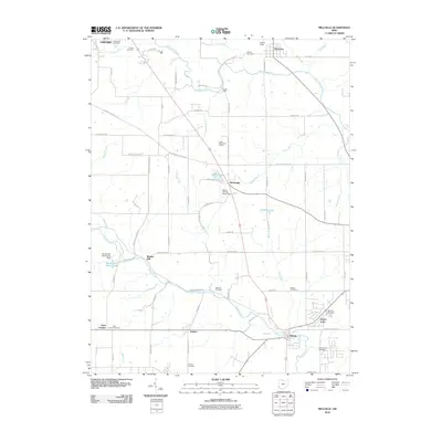
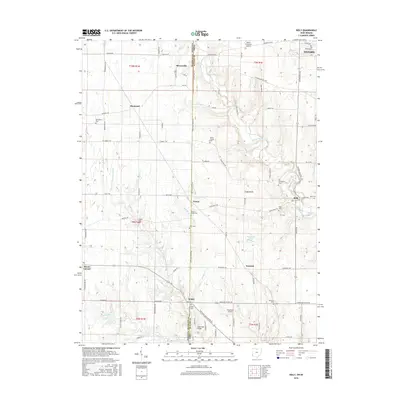
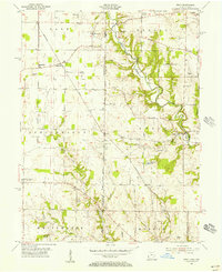 1955 Reily1956 Print · USGSThe Indiana-Ohio borderlands come into focus in the mid-1950s, showing a landscape defined by the First Principal Meridian. Genealogists and historians can trace small settlements like Mixersville and Scipio, and locate old burial sites including Springdale Cemetery and Asbury Cemetery.3 unique versions available
 - 1955 Map of Millville, 1956 Print
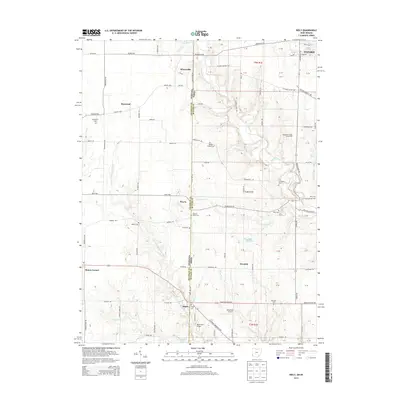
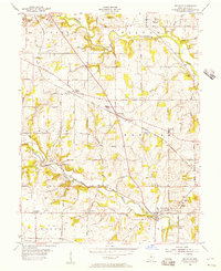 1955 Millville1956 Print · USGSButler County in the mid-fifties remains a landscape of rail-side hamlets and rural schoolhouses. Genealogists can trace family names through sites like Minton Cem and Bethel Cem or follow the old Baltimore and Ohio line through McGonigle.4 unique versions available
 - 1957 Map of Cincinnati
 1957 Cincinnati1957 Print · USGSThe Ohio River valley and its surrounding highlands thrived during the mid-fifties industrial peak, centered on the bustling Cincinnati and Dayton metropolitan hubs. Researchers can trace the extensive rail networks and military sites like Wright-Patterson AFB and Camp Atterbury.
 - 1986 Map of Cincinnati
 1986 Cincinnati1986 Print · USGSGreater Cincinnati and its tri-state surrounds are captured here in the mid-eighties as suburban growth reached into the neighboring hills and river valleys. Researchers can trace the development of transit hubs like Greater Cincinnati International Airport and historic sites such as Spring Grove Cemetery.3 unique versions available
 - 1992 Map of Reily, 1995 Print
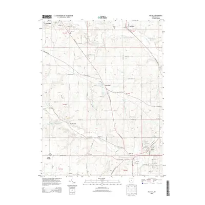
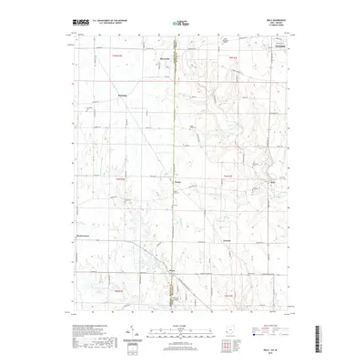
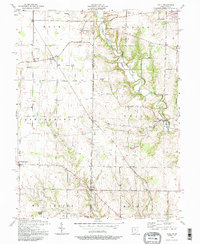 1992 Reily1995 Print · USGSThe Indiana-Ohio borderlands come into focus in the early nineties, showing a landscape defined by winding creeks and rural townships. Genealogists can trace family footprints through numerous local landmarks, including the Mathew-Smith Cem, Wesley Chapel, and the community of Mixersville.
 - 2010 Map of Reily, 2010 Print
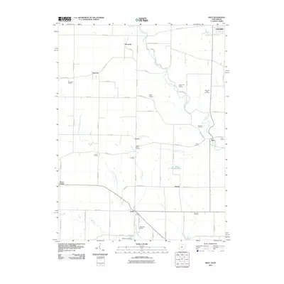 2010 Reily2010 Print · USGSCovers Reily Township, including Oxford, Mount Carmel, and other nearby areas
 - 2010 Map of Millville, 2010 Print
 2010 Millville2010 Print · USGSCovers Reily Township, including Hamilton, Oxford, and other nearby areas
 - 2013 Map of Millville, 2013 Print
 2013 Millville2013 Print · USGSCovers Reily Township, including Hamilton, Oxford, and other nearby areas
 - 2013 Map of Reily, 2013 Print
 2013 Reily2013 Print · USGSCovers Reily Township, including Oxford, Mount Carmel, and other nearby areas
 - 2016 Map of Millville, 2016 Print
 2016 Millville2016 Print · USGSCovers Reily Township, including Hamilton, Oxford, and other nearby areas
 - 2016 Map of Reily, 2016 Print
 2016 Reily2016 Print · USGSCovers Reily Township, including Oxford, Mount Carmel, and other nearby areas
 - 2019 Map of Reily, 2019 Print
 2019 Reily2019 Print · USGSCovers Reily Township, including Oxford, Mount Carmel, and other nearby areas
 - 2019 Map of Millville, 2019 Print
 2019 Millville2019 Print · USGSCovers Reily Township, including Hamilton, Oxford, and other nearby areas
 - 2023 Map of Millville, 2023 Print
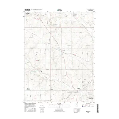
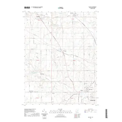
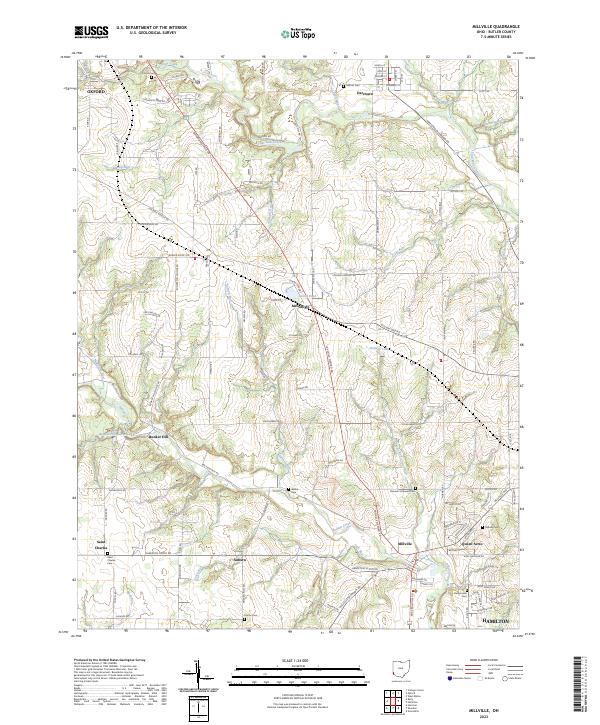 2023 Millville2023 Print · USGSButler County's rural townships and crossroads villages are documented here in the early 2020s. Researchers can trace local history through sites like Samuel's Lutheran Cem and Oxford Cem or explore the drainage of Four Mile Creek.
 - 2023 Map of Reily, 2023 Print
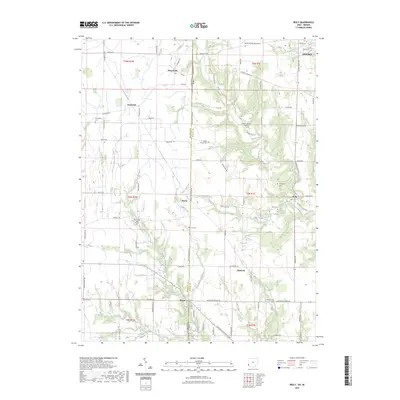 2023 Reily2023 Print · USGSThe rural borderlands of Butler and Franklin counties are meticulously mapped here in the early twenty-first century. Researchers can trace family history through numerous rural burial sites like Scipio Union Cem and Walker Chapel Cem or locate the historic centers of Peoria and Newkirk.
End of results
Showing maps 1-19 of 19
Top cities near Reily Township
- Cincinnati historical maps
- Hamilton historical maps
- Fairfield historical maps
- Oxford historical maps
- Forest Park historical maps
- Harrison historical maps
See more
Top neighborhoods of Reily Township
Frequently asked questions
- What are the different types of historical maps available for Reily Township?
- What is the oldest map of Reily Township?
- Where can I purchase historical maps of Reily Township for my home or office?
- Where can I download high-res historical maps of Reily Township?
- Are there historical topographic maps available for Reily Township?
- Is there historical aerial imagery available for Reily Township?
- Where are historical maps of Reily Township sourced from?