1950s Maps of Ohio
Explore 258 historic maps of Ohio from the 1950s. These maps offer a rare glimpse into what life looked like during the 1950s — showing old roads, neighborhoods, homes, and landmarks that have changed or disappeared over time.
Whether you're researching your family's past, planning a metal detecting trip, or studying how Ohio's landscape evolved across the 1950s, these high-resolution maps are a powerful tool for exploring the history of this region.
- Focus on a specific era: All maps on this page are from the 1950s, giving you a focused view of this time period.
- See what’s changed: Compare century-old streets, trails, and buildings to today's modern landscape using overlays and satellite layers.
- Research with precision: Use these maps for genealogy, historical research, land use analysis, or educational projects.
- View, download, or print: Maps are fully viewable online in high resolution, and can be downloaded or printed for your own records.
Start exploring Ohio's history through authentic maps from the 1950s. This is your window into the past.
Ohio maps
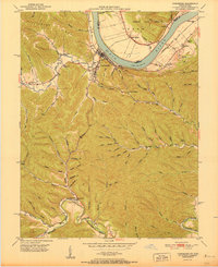
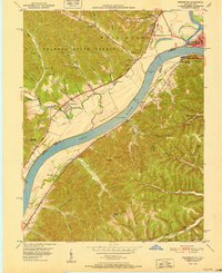
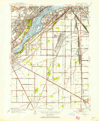
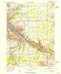
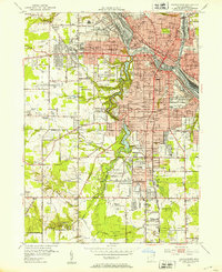
(258)- 1950 Map of Cleveland
 1950 Cleveland1950 Print · USGSCovers Ohio, including Cleveland, Akron, and other nearby areas
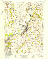
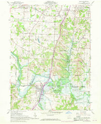
 - 1950 Map of Marion
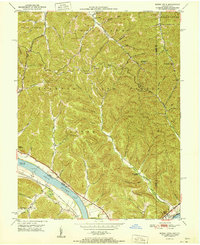
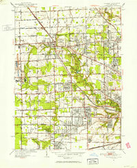
 1950 Marion1950 Print · USGSCentral Ohio was a powerhouse of rail and river industry at the mid-century point, serving as a vital corridor between the Great Lakes and the Ohio River valley. Genealogists and rail historians can trace the paths of the Erie RR and Nickel Plate Road through towns like Bucyrus, Galion, and Upper Sandusky.
 - 1950 Map of Erie, 1953 Print
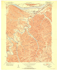
 1950 Erie1953 Print · USGSThe northern and southern shores of the Great Lakes meet in the mid-twentieth century, showcasing the vital shipping and rail corridors between Ontario and Pennsylvania. Trace the routes of the Michigan Central railroad or locate coastal landmarks like Presque Isle Light and the settlement of Iona Station.
 - 1950 Map of Covington, 1953 Print
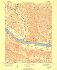
 1950 Covington1953 Print · USGSNorthern Kentucky's riverfront and southern suburbs are captured here at the mid-century mark as neighborhoods expanded along the Dixie Highway. Genealogists and historians can trace family plots in Highland Cem or locate community landmarks like the Villa Madonna and Dixie Heights High Sch.
 - 1951 Map of Vanceburg
 1951 Vanceburg1951 Print · USGSVanceburg and the surrounding Lewis County hills are captured here in the early fifties, showing the river-and-rail economy along the Ohio River. Researchers can trace old family sites and rural infrastructure, from the Lewis County Infirmary to local landmarks like Evans Chapel and the Rock Run Sch.
 - 1951 Map of Buena Vista
 1951 Buena Vista1951 Print · USGSThe Ohio River borderlands at the start of the 1950s show a landscape of deep timbered hollows and river navigation. Researchers can trace rural life through the locations of Dam No 32, the Twin Creek Mission, and the Rome (Stout PO) settlement.
 - 1951 Map of Garrison
 1951 Garrison1951 Print · USGSThe riverfront and rugged hollows of Lewis County are captured here just after the war, when the railroad still dominated the shoreline. Genealogists can locate family-named sites like Skidmore Cemetery and Tannery School along the winding Kinniconick Creek.
 - 1951 Map of Concord
 1951 Concord1951 Print · USGSThe riverfront communities of Lewis County and Adams County thrive along the Ohio during the early post-war era. Genealogists and local historians can trace family locations near Concord, identify the Stout Post Office, or find rural landmarks like Beasley Fork Chapel and the Carrs School.2 unique versions available
 - 1951 Map of Friendship
 1951 Friendship1951 Print · USGSThe Ohio River valley at the turn of the 1950s shows a landscape of river-dependent industry and hill-country settlements. Researchers can trace the legacy of family homesteads through features like Morris Hill Cem, Bethel Ch, and Upper Carey Run Sch.2 unique versions available
 - 1951 Map of Canton
 1951 Canton1951 Print · USGSThe industrial heartland of Ohio and Pennsylvania reached its mid-century peak during this era of heavy rail and river transit. Genealogists and historians can trace the development of steel towns like Aliquippa and Weirton alongside the Ohio River and major lines of the Pennsylvania RR.
 - 1951 Map of Pond Run
 1951 Pond Run1951 Print · USGSSouthern Ohio and northern Kentucky met along the river in the early fifties, where the forest landscape was dotted with family hollows and small rail stops. Genealogists and hikers can trace old landmarks like the Pond Run Lookout Tower, McDermitt Cem, and the tracks of The Chesapeake and Ohio.
 - 1951 Map of Berkey, 1952 Print
 1951 Berkey1952 Print · USGSThis Lucas County landscape in the early fifties shows a rural community defined by family farms and the Michigan-Ohio border. Genealogists can locate family landmarks like the Wolfinger Cemetery, Sharples Church, and schools like Mulberry School.3 unique versions available
 - 1951 Map of Maumee, 1952 Print
 1951 Maumee1952 Print · USGSIn the early 1950s, the Maumee River valley was a corridor of burgeoning industry and deep frontier history. Researchers can trace military sites like Fort Meigs and Fort Miami, alongside local landmarks such as Turkey Foot Rock and Springfield Chapel.2 unique versions available
 - 1951 Map of Sylvania, 1952 Print
 1951 Sylvania1952 Print · USGSSylvania and the northern edge of Lucas County appear here in the early fifties, caught between its rail-industrial roots and growing suburban leisure. Researchers can trace family sites from Toledo Memorial Park and Cemetery to vanished landmarks like the Drive-In Theater and Franklin Airport.2 unique versions available
 - 1951 Map of Whitehouse, 1952 Print
 1951 Whitehouse1952 Print · USGSLucas County during the early fifties reveals a landscape of organized agriculture and rail-side hamlets. Genealogists and local historians can trace family land near Whitehouse, locate the Whitehouse Cemetery, and see the early layout of Monclova and Crissey.
 - 1951 Map of Rossford, 1953 Print
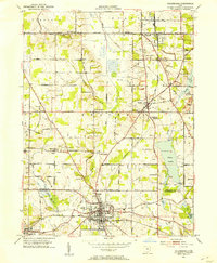
 1951 Rossford1953 Print · USGSWood County’s industrial and rail infrastructure dominates the Maumee River landscape during the early 1950s. Genealogists and local historians can trace the development of Lime City and Moline or locate landmarks like the Rossford Ordnance Depot and Sunshine Cem.
 - 1951 Map of Columbiana, 1953 Print
 1951 Columbiana1953 Print · USGSThe Mahoning and Columbiana county line in the early fifties shows a landscape of rail-connected towns and rural cemeteries. Genealogists can trace family names at Zion Hill Ch Cem or Easterly Cem while exploring the rail routes of the ERIE RAILROAD.
 - 1951 Map of Campbell, 1953 Print
 1951 Campbell1953 Print · USGSThe Mahoning River valley in the early fifties shows a dense industrial corridor of rails and riverside towns on the Ohio-Pennsylvania line. Genealogists can trace family landmarks like White Sch, St Johns Cem, and Holy Rosary Cem.
 - 1951 Map of Burlington, 1953 Print
 1951 Burlington1953 Print · USGSBoone County and the Ohio River shoreline appear here in the early fifties, showing the region as it transitioned into a major aviation hub. Genealogists can locate family burial sites like I O O F Cem and Watts Cem, or trace early roads near Hebron and Florence.
 - 1951 Map of Franklin, 1953 Print
 1951 Franklin1953 Print · USGSThe industrial corridor of the Great Miami River valley thrives in the early 1950s as a major rail hub for the New York Central and Baltimore and Ohio. Genealogists can trace family landmarks like Swartzel Cem and Stettler Ch or locate the ancient Indian Mound overlooking the river.
 - 1951 Map of New Middletown, 1953 Print
 1951 New Middletown1953 Print · USGSEastern Ohio at the dawn of the fifties shows a rural landscape adapting to new interstate travel. Researchers can trace ancestral locations at Bethel Cem, Springfield High Sch, and the emerging corridor of the Ohio Turnpike.
 - 1951 Map of Youngstown, 1953 Print
 1951 Youngstown1953 Print · USGSYoungstown at the peak of its mid-century industrial era reveals a city defined by its river-valley railroads and sprawling park systems. Researchers can trace neighborhood history through landmarks like Idora Park, Youngstown College, and the sprawling Mill Creek Park.
 - 1951 Map of Bolivar, 1968 Print
 1951 Bolivar1968 Print · USGSTuscarawas and Stark counties during the mid-century are shown here as a landscape of active resource extraction and watershed management. You can trace the path of the Ohio Canal and locate family markers at Fort Laurens Cem and the Siffert Cem.
 - 1952 Map of Maysville East, 1953 Print
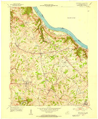
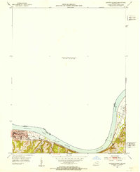 1952 Maysville East1953 Print · USGSThe Ohio River valley near the Mason County line is captured here in the early fifties, showing the vital river-and-rail corridor. Researchers can trace the riverfront development of Maysville or locate landmarks near Sand Hill and the Chesapeake and Ohio railroad.
 - 1952 Map of Genoa, 1953 Print
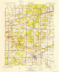
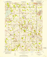
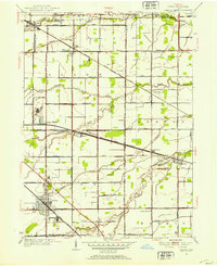 1952 Genoa1953 Print · USGSNorthwest Ohio at the start of the fifties shows a landscape of busy rail corridors and small crossroads communities. Genealogists can trace family footprints near Genoa or find burial sites at Williston Cem and Clay Cem.2 unique versions available
Showing maps 1-25 of 258
Top cities of Ohio
- Columbus historical maps
- Cleveland historical maps
- Cincinnati historical maps
- Toledo historical maps
- Akron historical maps
- Dayton historical maps
See more
Top counties of Ohio
- Cuyahoga County historical maps
- Franklin County historical maps
- Hamilton County historical maps
- Summit County historical maps
- Montgomery County historical maps
- Lucas County historical maps
See more
Frequently asked questions
- What are the different types of historical maps available for Ohio?
- What is the oldest map of Ohio?
- Where can I purchase historical maps of Ohio for my home or office?
- Where can I download high-res historical maps of Ohio?
- Are there historical topographic maps available for Ohio?
- Is there historical aerial imagery available for Ohio?
- Where are historical maps of Ohio sourced from?