1930s Maps of Ohio
Explore 32 historic maps of Ohio from the 1930s. These maps offer a rare glimpse into what life looked like during the 1930s — showing old roads, neighborhoods, homes, and landmarks that have changed or disappeared over time.
Whether you're researching your family's past, planning a metal detecting trip, or studying how Ohio's landscape evolved across the 1930s, these high-resolution maps are a powerful tool for exploring the history of this region.
- Focus on a specific era: All maps on this page are from the 1930s, giving you a focused view of this time period.
- See what’s changed: Compare century-old streets, trails, and buildings to today's modern landscape using overlays and satellite layers.
- Research with precision: Use these maps for genealogy, historical research, land use analysis, or educational projects.
- View, download, or print: Maps are fully viewable online in high resolution, and can be downloaded or printed for your own records.
Start exploring Ohio's history through authentic maps from the 1930s. This is your window into the past.
Ohio maps
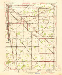
(32)- 1930 Map of Greenup
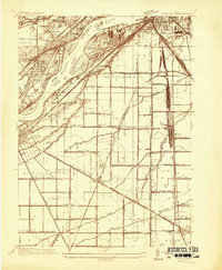
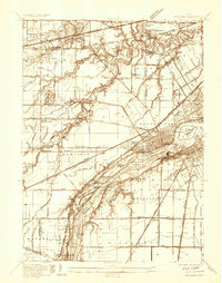
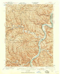
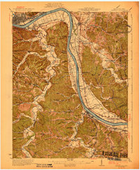 1930 Greenup1930 Print · USGSThe industrial corridor of the Ohio River valley is captured here in the early twentieth century, showing the borderlands of Greenup County and southern Ohio. Researchers can trace the legacy of iron production at Franklin Furnace or locate family roots near Tongs P O and Wurtland.3 unique versions available
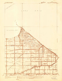
 - 1931 Map of Felicity
 1931 Felicity1931 Print · USGSClermont County's riverfront and rolling uplands are captured here in the early thirties as a network of small schoolhouses and rail lines defined rural life. Researchers can trace the path of the Cincinnati Georgetown and Portsmouth RR or locate family sites near Felicity, Utopia, and Lock 34.2 unique versions available
 - 1931 Map of Higginsport, 1948 Print
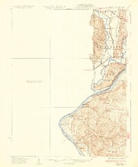
 1931 Higginsport1948 Print · USGSThe Ohio River corridor and Brown County hinterlands come alive in this early twentieth-century survey of the borderlands near Georgetown. Local historians can trace long-gone rural schoolhouses like McFadden School or locate the historic Brown County Infirmary and the Abandoned Columbus and Sardinia Road.
 - 1932 Map of Lawrenceburg
 1932 Lawrenceburg1932 Print · USGSThe tri-state confluence of Indiana, Ohio, and Kentucky comes alive in this early 1930s survey of the river valleys. Genealogists can trace family roots through rural landmarks like Eighteenmile House, Bullittsville Ch, and the Woolper Sch.3 unique versions available
 - 1934 Map of Reno Beach
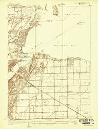
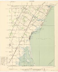
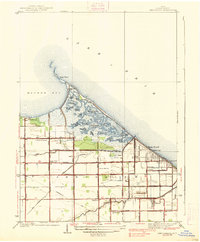
 1934 Reno Beach1934 Print · USGSThe Lucas County shoreline in the mid-1930s reveals a unique landscape of lakefront clubs and reclaimed marshland. Genealogists and local historians can trace the foundations of the Jerusalem community through landmarks like St Lukes Ch, Bono, and the Reno Sch.
 - 1934 Map of Point Place
 1934 Point Place1934 Print · USGSThe Lake Erie shoreline near Toledo comes to life in the mid-1930s, showing a landscape defined by maritime trade and residential growth. Genealogists and historians can trace family locations near Point Place, Momineetown, and landmarks like the Toledo Yacht Club.
 - 1934 Map of Rossford
 1934 Rossford1934 Print · USGSWood County was a hub of transit and industry in the 1930s, where the Maumee River met a complex web of rail yards and highways. Genealogists can locate family landmarks like Eagle Point Colony, Sunshine Cem, and the old schools at Lark Sch and Glenwood Sch.
 - 1935 Map of Walbridge
 1935 Walbridge1935 Print · USGSThe rail-and-road corridors of Northwest Ohio come alive in this mid-1930s survey of the Walbridge and Millbury area. Genealogists and researchers can pinpoint family landmarks like Hayes Place, the Black Swamp Ch, and early aviation at the Toledo Landing Field.
 - 1935 Map of Grand Rapids
 1935 Grand Rapids1935 Print · USGSLucas and Wood counties during the mid-1930s display a landscape defined by the winding Maumee River and its industrial history. Genealogists and historians can trace the foundations of local communities at St Patrick Cem, Nazareth Hall, and the Lucas Wood Co Canal.
 - 1935 Map of Whitehouse
 1935 Whitehouse1935 Print · USGSWestern Lucas County was a landscape of intricate drainage ditches and rail corridors in the mid-1930s. Researchers can trace the path of the Toledo and Indiana (Electric) line or locate family sites at Weckerly Cemetery and Roberts Chapel.
 - 1935 Map of Maumee
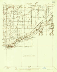
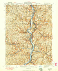
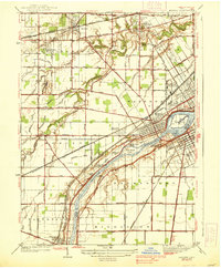
 1935 Maumee1935 Print · USGSThe Maumee River valley is shown in the mid-1930s, just as electric railways and state highways began to reshape the old river towns. Genealogists and researchers can locate Springfield Chapel, trace the Cincinnati and Lake Erie line, or find the Hulls Crossing Mill.
 - 1935 Map of Springdale
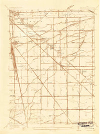
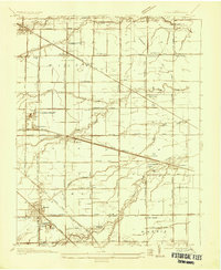
 1935 Springdale1935 Print · USGSThe Ohio River valley at the height of the mid-1930s reveals a landscape shaped by river commerce and the Chesapeake and Ohio railroad. Researchers can locate numerous vanished country schools like Hamilton School, the infrastructure of Dam 33, and rural centers such as Tollesboro.
 - 1935 Map of Genoa
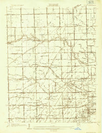
 1935 Genoa1935 Print · USGSOttawa and Lucas counties come alive in the mid-1930s, revealing a landscape of limestone quarries and rural crossroads. Genealogists and historians can locate family landmarks such as the Lutheran Cemetery, tracing the industrial footprint of the U S Gypsum Company and the New York Central line.
 - 1935 Map of Berkey
 1935 Berkey1935 Print · USGSLucas County farms and small crossroads settlements are captured here in the mid-1930s as the region transitioned from electric rail to highway travel. Researchers can trace family sites near Wolfinger Cem, the St Elizabeth Sch Richfield Center, and the industrial spur at Allen Junction.
 - 1935 Map of Cameron, 1957 Print
 1935 Cameron1957 Print · USGSMarshall County in the mid-thirties was a landscape of deep hollows and high ridges linked by the Baltimore and Ohio RR. Genealogists and historians can locate dozens of country institutions like Wood Hill Ch, Beeler's Station, and Adaline Sch during the era of one-room schoolhouses.2 unique versions available
 - 1935 Map of Clarington, 1957 Print
 1935 Clarington1957 Print · USGSThe Ohio River valley during the mid-1930s reveals a landscape of ridge-top schools and creek-side coal works. Genealogists can locate family landmarks like McLain Chapel, Centerville Demos P.O., and the Woodland Hill Sch.2 unique versions available
 - 1935 Map of Wheeling, 1957 Print
 1935 Wheeling1957 Print · USGSThe industrial Ohio River valley is captured here in the mid-thirties, showing the complex rail and river networks of the tri-state area. Genealogists can trace family footprints across dozens of rural schools like Wells Sch and local landmarks such as Oglebay Park or the Mt Union Ch.
 - 1935 Map of Steubenville, 1958 Print
 1935 Steubenville1958 Print · USGSThe industrial heart of the Ohio River valley comes to life in this mid-century survey of the Ohio, West Virginia, and Pennsylvania borders. Genealogists and historians can trace the early footprints of Weirton, Steubenville, and smaller stops like Zalia and Reeds Mills.
 - 1936 Map of Erie
 1936 Erie1936 Print · USGSCoastal Monroe County in the mid-1930s shows a landscape of lakeside resorts and busy rail corridors heading toward the Ohio line. Genealogists and local historians can locate early twentieth-century landmarks like San Freal Sch, Luna Pier, and the Roselawn Memorial Cem.
 - 1936 Map of Alexandria
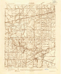
 1936 Alexandria1936 Print · USGSNorthern Kentucky and the Ohio River valley appear here in the mid-1930s, showing a landscape defined by sharp river bends and rural rail stops. Researchers can trace historic schools and parish centers like Sts Peter and Paul Sch, the winding Licking Valley Highway, and the riverside operations at Gubser Mill.2 unique versions available
 - 1937 Map of Sylvania
 1937 Sylvania1937 Print · USGSSylvania and the Ohio-Michigan borderlands are shown in the mid-1930s as limestone extraction and suburban neighborhoods began to reshape the landscape. Researchers can trace local industry at Medusa Quarry or locate vanished rural landmarks like Dorr St Sch and the Boy Scout Reservation.2 unique versions available
 - 1937 Map of Wellsville, 1960 Print
 1937 Wellsville1960 Print · USGSThe Ohio River valley thrives as a Tri-State industrial hub in the years before the Second World War. Researchers can trace the riverfront rail lines of the Pennsylvania RR and locate vanished local landmarks like Pughtown PO and Nessly Chapel.
 - 1938 Map of Walbridge
 1938 Walbridge1938 Print · USGSNorthwest Ohio at the height of its rail-and-road expansion shows a landscape defined by industrial hubs and developing neighborhoods. Genealogists and historians can trace family locations near Walbridge Yard, Millbury, and rural landmarks like the Allen Cem.2 unique versions available
 - 1938 Map of Maumee
 1938 Maumee1938 Print · USGSThe riverfront communities of Northwest Ohio thrive during the mid-1930s as rail and road networks begin to overtake the old canal system. Researchers can trace the legacy of the Miami and Erie Canal and explore historical sites like Fort Meigs and Fallen Timber State Park.2 unique versions available
 - 1938 Map of Reno Beach
 1938 Reno Beach1938 Print · USGSCoastal Lucas County comes alive in this pre-war survey of the Lake Erie marshes and beach communities. Researchers can trace the layout of Bono and Reno Beach or locate vanished local landmarks like Cement Block Sch and the Lakemont Golf Club.2 unique versions available
Showing maps 1-25 of 32
Top cities of Ohio
- Columbus historical maps
- Cleveland historical maps
- Cincinnati historical maps
- Toledo historical maps
- Akron historical maps
- Dayton historical maps
See more
Top counties of Ohio
- Cuyahoga County historical maps
- Franklin County historical maps
- Hamilton County historical maps
- Summit County historical maps
- Montgomery County historical maps
- Lucas County historical maps
See more
Frequently asked questions
- What are the different types of historical maps available for Ohio?
- What is the oldest map of Ohio?
- Where can I purchase historical maps of Ohio for my home or office?
- Where can I download high-res historical maps of Ohio?
- Are there historical topographic maps available for Ohio?
- Is there historical aerial imagery available for Ohio?
- Where are historical maps of Ohio sourced from?