Old Maps of Hamilton County, Ohio
Explore 134 old maps of Hamilton County, spanning from 1898 to today. These high-resolution historic maps reveal how streets, neighborhoods, landmarks, and natural features evolved over time — perfect for genealogy, metal detecting, research, and local history exploration.
What you can do with these maps:
- See how Hamilton County changed over time: Compare historical maps to modern-day views to trace roads, homesites, rail lines & more.
- View detailed metadata: Each map includes creators, publishers, year, scale, and archive source.
- Overlay maps with satellite & LiDAR: Visualize the past alongside modern tools to explore terrain & human change.
- Trusted historical sources: Maps sourced from the USGS, Library of Congress, and other archives.
- Access maps your way: View online, download high-res files, or order prints for personal or research use.
Start exploring old maps of Hamilton County to uncover forgotten places, hidden landmarks, and the deep history beneath your feet.
Hamilton County, OH maps
(134)- 1898 Map of East Cincinnati, 1964 Print
 1898 East Cincinnati1964 Print · USGSGreater Cincinnati and Northern Kentucky emerge as a bustling riverfront and rail hub at the turn of the century. Genealogists and historians can trace the early footprints of Coney Island Resort, the Longview Asylum, and the Cincinnati Waterworks.
 - 1904 Map of Mason, 1958 Print
 1904 Mason1958 Print · USGSSouthwestern Ohio at the turn of the century is a landscape of thriving canal-era towns and expanding rail corridors. Genealogists and researchers can trace the early layouts of Union Village, Shaker Village, and the industrial riverside at Kings Mills.
 - 1906 Map of Mason, 1939 Print
 1906 Mason1939 Print · USGSWarren and Butler counties are shown here in the first decade of the 1900s, when electric railways were transforming rural life. Genealogists can trace family roots through old hubs like Union Village, Kings Mills, and Amanda Excello P O.2 unique versions available
 - 1914 Map of East Cincinnati
 1914 East Cincinnati1914 Print · USGSThe eastern Cincinnati suburbs and Northern Kentucky riverfront come alive in this pre-war survey of industrial and residential growth. Genealogists can trace family footprints near the St Aloysius Orphan Asylum, Alpine Bell School, or the Covington Reservoirs.4 unique versions available
 - 1914 Map of West Cincinnati
 1914 West Cincinnati1914 Print · USGSCincinnati and the Ohio River valley appear here in a period of intense industrial growth and suburban expansion just before the First World War. Researchers can trace the dense rail networks of the Chesapeake and Ohio or locate early institutions like the Ohio Military Institute and Spring Grove Cemetery.4 unique versions available
 - 1915 Map of Lawrenceburg
 1915 Lawrenceburg1915 Print · USGSThe tri-state river junction between Indiana, Ohio, and Kentucky is captured just before the first World War during a peak era of rail expansion. Researchers can trace the legacy of local transit through Simmonson Station, the Suspension Bridge, and the tracks of the Electric line.
 - 1915 Map of Harrison
 1915 Harrison1915 Print · USGSThe Indiana-Ohio borderlands come into focus during the mid-teens, showing a landscape of river-valley settlements and rural school districts. Genealogists can locate family landmarks like Vannatta School, Davis School, and the village of Okeana along the Dry Fork.
 - 1915 Map of Hamilton
 1915 Hamilton1915 Print · USGSButler County was a bustling industrial and transit corridor in the years before the Great War, centered on the Miami River. Researchers can trace the path of the Miami and Erie Canal and locate historic sites like Shaker Village, Venice Ross P O, and the Biddinger School.2 unique versions available
 - 1917 Map of Hamilton, 1942 Print
 1917 Hamilton1942 Print · USGSButler County and the Miami River valley are captured here just before the era of major highway expansion, when industrial towns and electric railways defined the region. Researchers can locate the Shaker Village, trace the Miami and Erie Canal, or find family sites near Darrtown and Millville.
 - 1928 Map of Lawrenceburg, 1962 Print
 1928 Lawrenceburg1962 Print · USGSThe tri-state river valley at the end of the Roaring Twenties shows a landscape shaped by the Ohio River and bustling rail junctions. Researchers can trace historic ferries like the Lawrenceburg Ferry and find family-named landmarks like Commissary Corner or the Bullittsburg Ch.
 - 1932 Map of Lawrenceburg
 1932 Lawrenceburg1932 Print · USGSThe tri-state confluence of Indiana, Ohio, and Kentucky comes alive in this early 1930s survey of the river valleys. Genealogists can trace family roots through rural landmarks like Eighteenmile House, Bullittsville Ch, and the Woolper Sch.3 unique versions available
 - 1943 Map of Hooven
 1943 Hooven1943 Print · USGSThe Indiana-Ohio borderlands come into focus in the early 1940s, showing a landscape defined by the Whitewater R and the New York Central rail line. Researchers can locate early family sites near Sugar Ridge Cem, the Full Gospel Mission, and the State Line Monument.
 - 1943 Map of Lawrenceburg
 1943 Lawrenceburg1943 Print · USGSThe Indiana-Kentucky-Ohio tri-state border comes alive in this wartime-era survey of the Ohio River valley. Researchers can trace the rail-side growth of Lawrenceburg and Greendale or locate family plots in the Greendale Cem.
 - 1950 Map of Covington, 1953 Print
 1950 Covington1953 Print · USGSNorthern Kentucky's riverfront and southern suburbs are captured here at the mid-century mark as neighborhoods expanded along the Dixie Highway. Genealogists and historians can trace family plots in Highland Cem or locate community landmarks like the Villa Madonna and Dixie Heights High Sch.
 - 1951 Map of Burlington, 1953 Print
 1951 Burlington1953 Print · USGSBoone County and the Ohio River shoreline appear here in the early fifties, showing the region as it transitioned into a major aviation hub. Genealogists can locate family burial sites like I O O F Cem and Watts Cem, or trace early roads near Hebron and Florence.
 - 1952 Map of Newport, 1953 Print
 1952 Newport1953 Print · USGSNorthern Kentucky during the early fifties shows a bustling riverfront and established hillside neighborhoods at the junction of two major rivers. Genealogists and historians can locate family landmarks like Evergreen Cemetery, Kenton Co Infirmary, and numerous schools including Bellevue High Sch.
 - 1953 Map of Withamsville, 1955 Print
 1953 Withamsville1955 Print · USGSThe Ohio River valley in the early fifties shows a landscape of ridge-top settlements and active rail lines. Genealogists can trace family sites near Clough Chapel, Asbury Cem, and early schools like Township Sch.
 - 1953 Map of Madeira, 1955 Print
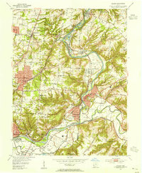 1953 Madeira1955 Print · USGSHamilton and Clermont counties meet along the Little Miami River during the mid-century suburban expansion of the Cincinnati area. Researchers can trace the grounds of the Sacred Heart Novitiate, the Pennsylvania Railroad corridor, and local landmarks like Lake Isabella.
 - 1953 Map of Cincinnati East, 1955 Print
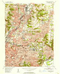 1953 Cincinnati East1955 Print · USGSCincinnati and its growing eastern suburbs are captured in the early fifties, showcasing a dense urban landscape of industry and education. Genealogists can locate family names at St Marys Cem or trace early school years at Withrow High Sch and St Xavier Sch.
 - 1953 Map of Cincinnati West, 1955 Print
 1953 Cincinnati West1955 Print · USGSThe western hills and industrial valleys of Cincinnati are captured here in the early fifties as neighborhoods expanded toward the county line. Researchers can locate specialized sites like the Clovernook Blind Home, trace rail lines through Ivorydale, or find family names at Wesleyan Cem.
 - 1953 Map of Cincinnati, 1965 Print
 1953 Cincinnati1965 Print · USGSThe Ohio River valley and the industrial heartland of Indiana and Ohio are captured here during the mid-century peak of rail and river commerce. Genealogists and historians can trace connections between Cincinnati and outlying military sites like Camp Atterbury and Bakalar AFB.3 unique versions available
 - 1954 Map of Hooven, 1955 Print
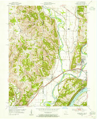 1954 Hooven1955 Print · USGSThe tri-state confluence of the Whitewater, Miami, and Ohio Rivers was a busy industrial and transit corridor in the 1950s. You can trace early family sites at Sugar Ridge Cem, follow the New York Central Railroad through Valley Junction, or locate the mid-century Gas Refinery.3 unique versions available
 - 1954 Map of Addyston, 1955 Print
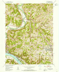 1954 Addyston1955 Print · USGSThe Ohio River valley and its industrial corridors are captured here in the mid-fifties as the Cincinnati suburbs began to crest the western hills. Genealogists and historians can trace the paths of the Baltimore and Ohio railroad through Addyston, North Bend, and landmarks like Bethel Cem.
 - 1955 Map of Burlington, 1956 Print
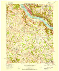 1955 Burlington1956 Print · USGSThe Ohio River valley in the mid-fifties reveals a bustling industrial riverfront alongside quiet Kentucky hillsides. Genealogists and historians can trace family cemeteries like Chambers Cem, locate the Anderson Ferry, and see the early Greater Cincinnati Airport.
 - 1955 Map of Harrison, 1956 Print
 1955 Harrison1956 Print · USGSThe borderlands of Ohio and Indiana are captured here in the mid-fifties as the villages of Harrison and West Harrison thrive along the river. Researchers can trace family roots through numerous sites like Glen Haven Cem and the Township School.5 unique versions available
Showing maps 1-25 of 134
Top cities of Hamilton County
- Cincinnati historical maps
- Norwood historical maps
- Forest Park historical maps
- Sharonville historical maps
- Blue Ash historical maps
- Springdale historical maps
See more
Frequently asked questions
- What are the different types of historical maps available for Hamilton County?
- What is the oldest map of Hamilton County?
- Where can I purchase historical maps of Hamilton County for my home or office?
- Where can I download high-res historical maps of Hamilton County?
- Are there historical topographic maps available for Hamilton County?
- Is there historical aerial imagery available for Hamilton County?
- Where are historical maps of Hamilton County sourced from?