1940s Maps of Ohio
Explore 72 historic maps of Ohio from the 1940s. These maps offer a rare glimpse into what life looked like during the 1940s — showing old roads, neighborhoods, homes, and landmarks that have changed or disappeared over time.
Whether you're researching your family's past, planning a metal detecting trip, or studying how Ohio's landscape evolved across the 1940s, these high-resolution maps are a powerful tool for exploring the history of this region.
- Focus on a specific era: All maps on this page are from the 1940s, giving you a focused view of this time period.
- See what’s changed: Compare century-old streets, trails, and buildings to today's modern landscape using overlays and satellite layers.
- Research with precision: Use these maps for genealogy, historical research, land use analysis, or educational projects.
- View, download, or print: Maps are fully viewable online in high resolution, and can be downloaded or printed for your own records.
Start exploring Ohio's history through authentic maps from the 1940s. This is your window into the past.
Ohio maps
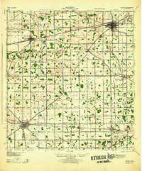
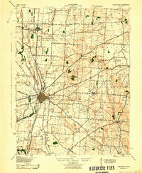
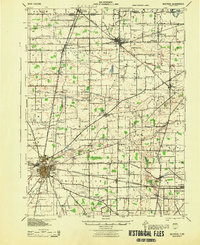
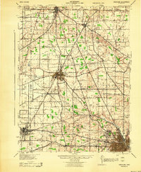
(72)- 1940 Map of Metz
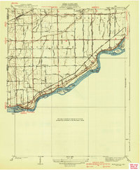
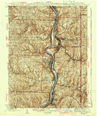
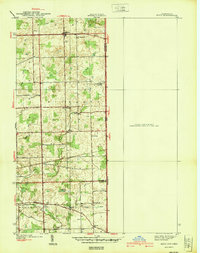 1940 Metz1940 Print · USGSThe Indiana-Ohio borderlands come into focus in the years before the war, showing a landscape of drainage ditches and family-named bridge crossings. Genealogists can trace rural life through landmarks like Metz Cem, Bethel Ch, and the small settlement of Alvarado.2 unique versions available
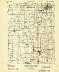
 - 1940 Map of Clarington
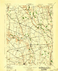
 1940 Clarington1940 Print · USGSThe Ohio River borderlands between Belmont, Monroe, and Marshall counties are captured here just before the mid-century industrial shift. Genealogists can trace family names and small-town roots at Armstrongs Mills, McLain Chapel, and many rural schoolhouses like Mt Hobart Sch.
 - 1940 Map of Whitehouse
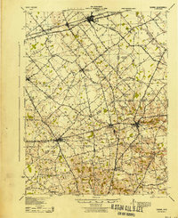
 1940 Whitehouse1940 Print · USGSLucas County and the village of Whitehouse are shown here in the mid-1930s as a vital railroad crossroads. Researchers can trace the layout of early schools and cemeteries like Bordner Sch and the Whitehouse Cem, or locate the historic Airway Beacon.2 unique versions available
 - 1940 Map of Clear Lake
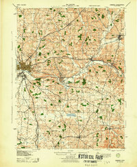
 1940 Clear Lake1940 Print · USGSThe tri-state border region of Indiana, Michigan, and Ohio is captured here just before the 1940s, centered on the activity surrounding Clear Lake. Researchers can trace early school sites and family landmarks like Powers Sch, Stallman Bridge, and the Teeters Cem.2 unique versions available
 - 1940 Map of Grand Rapids
 1940 Grand Rapids1940 Print · USGSThe riverfront and rail lines of Wood and Lucas Counties are captured here in the years before WWII. Genealogists and historians can trace the Napoleon Canal, locate Salem Ch, and follow the Twelvemile Reservation Boundary near Grand Rapids.2 unique versions available
 - 1942 Map of Cameron
 1942 Cameron1942 Print · USGSThe northern panhandle in the early 1940s reveals a landscape of riverfront industry and remote ridge-top schools. Genealogists can locate family landmarks like Beelers Station, Blairs Ridge Ch, and the curiously named Squirrel Alley Sch.2 unique versions available
 - 1942 Map of Estral Beach
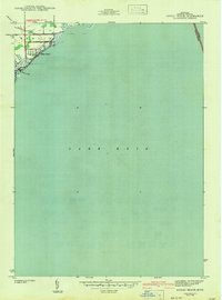 1942 Estral Beach1942 Print · USGSThe Monroe County shoreline comes into focus during the early 1940s, highlighting the coastal community at Estral Beach and its relationship with the lake. Genealogists and historians can trace local development in Berlin township along Langton Creek and Port Sunlight Rd.2 unique versions available
 - 1942 Map of Wheeling
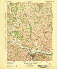
 1942 Wheeling1942 Print · USGSThe Northern Panhandle and Ohio Valley are shown at their industrial peak during the mid-forties, spanning three states. Researchers can trace the riverfront rail networks and rural school districts like Hammond Sch, plus regional landmarks such as Oglebay Park and the Teachers College at West Liberty.2 unique versions available
 - 1942 Map of Steubenville
 1942 Steubenville1942 Print · USGSThe industrial corridor of the upper Ohio River comes to life here during the early 1940s. Genealogists can trace family roots through the streets of Steubenville and Weirton, or locate rural landmarks like Jefferson Sch and New Alexandria Sta.2 unique versions available
 - 1943 Map of Shauck
 1943 Shauck1943 Print · USGSNorth Central Ohio is captured here in the mid-1940s, showing a landscape of small agricultural hamlets and a dense network of country schools. Genealogists and researchers can trace local landmarks like Johnsville Shauck P O, Chestnut Chapel, and the Erie RR corridor.
 - 1943 Map of Era
 1943 Era1943 Print · USGSPickaway and Ross Counties are shown in the early 1940s, a period when rural education and river-based land divisions still shaped the Ohio countryside. Genealogists can locate dozens of country schoolhouses like Frogeye Sch and trace the Pennsylvania rail line through Williamsport and Atlanta.
 - 1943 Map of Sabina
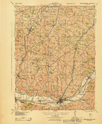
 1943 Sabina1943 Print · USGSMid-century Clinton and Highland counties are shown here as a landscape of rail-connected towns and crossroads hamlets. Genealogists can trace family footprints through numerous rural schools like Slickaway Sch, Powderlick Sch, and the Centerville Lees Creek P O.
 - 1943 Map of Gambier
 1943 Gambier1943 Print · USGSKnox County during the Second World War shows a landscape of institutional growth and deep-rooted rural communities. Genealogists can trace family footprints across dozens of local schoolhouses like Cherry Hall Sch and historic centers such as Democracy P O or Martinsburg.
 - 1943 Map of Bryan
 1943 Bryan1943 Print · USGSNorthwest Ohio during the mid-century is captured here as a landscape of grid-roads, small hamlets, and heavy rail traffic. Genealogists and local historians can trace family roots through numerous rural landmarks like Bethel Ch, Bratton Sch, and the hamlet of Farmer.
 - 1943 Map of Millersburg
 1943 Millersburg1943 Print · USGSHolmes County and southern Wayne County are shown in the 1940s as a landscape of small farms and rail-connected villages. Genealogists can locate numerous local institutions like Hazeldell Sch, follow the Pennsylvania RR through Millersburg, or find early Oil Wells.
 - 1943 Map of Coshocton
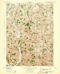
 1943 Coshocton1943 Print · USGSCoshocton and its surrounding river valleys are captured here during the early years of the war, showcasing a dense network of rural schools and rail-fed towns. Researchers can locate the COUNTY INFIRMARY, trace the old CANAL route near Canal Lewisville, or find family sites near Soggy Hill Sch and Helmick Sta.
 - 1943 Map of Hooven
 1943 Hooven1943 Print · USGSThe Indiana-Ohio borderlands come into focus in the early 1940s, showing a landscape defined by the Whitewater R and the New York Central rail line. Researchers can locate early family sites near Sugar Ridge Cem, the Full Gospel Mission, and the State Line Monument.
 - 1943 Map of Circleville
 1943 Circleville1943 Print · USGSMid-century Pickaway County is defined here by its intersection of rail power and ancient landmarks along the Scioto River. Genealogists and historians can trace dozens of rural schoolhouses like Bushwhack Sch, the county Infirmary, and the site of the Logan Elm.
 - 1943 Map of Erie
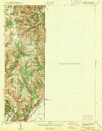
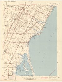 1943 Erie1943 Print · USGSThe Lake Erie shoreline in the early 1940s reveals a landscape of coastal marshes, growing beach communities, and vital rail corridors. Genealogists can locate family landmarks such as La Salle Cem and numerous country schools like San Freal Sch and Moran Sch.3 unique versions available
 - 1943 Map of Bucyrus
 1943 Bucyrus1943 Print · USGSCrawford County at the height of the Second World War reveals a landscape defined by busy rail junctions and rural school districts. Genealogists and historians can trace family roots through numerous numbered schoolhouses and settlements like Sulphur Springs, Tiro, and the County Infirmary.
 - 1943 Map of Newcomerstown
 1943 Newcomerstown1943 Print · USGSThe Tuscarawas River valley was a thriving industrial and rail corridor during the mid-forties. Genealogists can locate family homesteads near dozens of rural schools like Goose Leg Sch, and trace river crossings at Sells Ford and Browning Ford.
 - 1943 Map of Alger
 1943 Alger1943 Print · USGSDuring the early 1940s, this pocket of Ohio was a landscape of rail-fed villages and drainage ditches. Trace family roots across a grid of rural schools like Sugarfree Sch, follow the Erie RR through Alger, or explore the shores of Indian Lake.
 - 1943 Map of Crestline
 1943 Crestline1943 Print · USGSNorth-central Ohio is seen at a mid-century industrial peak, dominated by the massive rail corridors of the PENNSYLVANIA and ERIE lines. Genealogists and historians can trace the rural landscape through dozens of numbered schoolhouses and small settlements like Planktown, Ganges, and Toledo Jc.2 unique versions available
 - 1943 Map of Marengo
 1943 Marengo1943 Print · USGSCentral Ohio's agricultural heartland is documented here during the early war years, showing a landscape defined by small-town rail hubs and a dense network of rural schoolhouses. Researchers can trace family history through dozens of named sites like Chestnut Grove Sch, the County Infirmary, and settlements such as Westfield and Fulton.
 - 1943 Map of Mount Gilead
 1943 Mount Gilead1943 Print · USGSIn the early 1940s, this pocket of north-central Ohio remained a landscape of rail-connected towns and country school districts. Researchers can trace the rural heritage of Galion and Mount Gilead while locating landmarks like Miller Cem and the Guiding Star Sch.
Showing maps 1-25 of 72
Top cities of Ohio
- Columbus historical maps
- Cleveland historical maps
- Cincinnati historical maps
- Toledo historical maps
- Akron historical maps
- Dayton historical maps
See more
Top counties of Ohio
- Cuyahoga County historical maps
- Franklin County historical maps
- Hamilton County historical maps
- Summit County historical maps
- Montgomery County historical maps
- Lucas County historical maps
See more
Frequently asked questions
- What are the different types of historical maps available for Ohio?
- What is the oldest map of Ohio?
- Where can I purchase historical maps of Ohio for my home or office?
- Where can I download high-res historical maps of Ohio?
- Are there historical topographic maps available for Ohio?
- Is there historical aerial imagery available for Ohio?
- Where are historical maps of Ohio sourced from?