Old Maps of Oxford Township, Ohio
Explore 40 old maps of Oxford Township, spanning from 1909 to today. These high-resolution historic maps reveal how streets, neighborhoods, landmarks, and natural features evolved over time — perfect for genealogy, metal detecting, research, and local history exploration.
What you can do with these maps:
- See how Oxford Township changed over time: Compare historical maps to modern-day views to trace roads, homesites, rail lines & more.
- View detailed metadata: Each map includes creators, publishers, year, scale, and archive source.
- Overlay maps with satellite & LiDAR: Visualize the past alongside modern tools to explore terrain & human change.
- Trusted historical sources: Maps sourced from the USGS, Library of Congress, and other archives.
- Access maps your way: View online, download high-res files, or order prints for personal or research use.
Start exploring old maps of Oxford Township to uncover forgotten places, hidden landmarks, and the deep history beneath your feet.
Oxford Township, OH maps
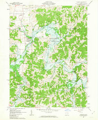
(40)- 1909 Map of Cambridge, 1963 Print
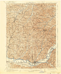
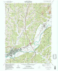
 1909 Cambridge1963 Print · USGSGuernsey County and the city of Cambridge are documented here in the early nineteen-hundreds, showing a region structured by river valleys and the historic National Road. Genealogists can trace early homesteads near Barnes Mill, the Galigher PO post office, and dozens of rural school sites.
 - 1911 Map of Newcomerstown, 1959 Print
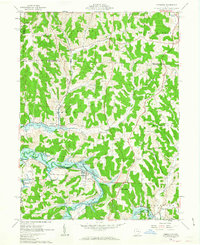
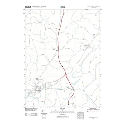
 1911 Newcomerstown1959 Print · USGSTuscarawas County in the early twentieth century is captured here as a corridor of heavy rail and old canal routes. Genealogists can locate family-named rural schools like Steitz School or May School and trace the original path of the Ohio Canal near Port Washington.
 - 1912 Map of Cambridge, 1946 Print
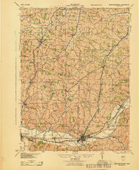
 1912 Cambridge1946 Print · USGSGuernsey County was a bustling hub of rail and river commerce at the start of the century. You can trace the path of the National Road and locate family landmarks like Barnes Mill, Zion Church, and dozens of district schools.2 unique versions available
 - 1913 Map of Newcomerstown, 1943 Print
 1913 Newcomerstown1943 Print · USGSTuscarawas County's industrial and educational roots are on display in the years before the Great War. Genealogists and historians can trace the Pennsylvania and Ohio Canal, locate the West Lafayette College, and find family schoolhouses like Putt School and Steitz School.
 - 1943 Map of Newcomerstown
 1943 Newcomerstown1943 Print · USGSThe Tuscarawas River valley was a thriving industrial and rail corridor during the mid-forties. Genealogists can locate family homesteads near dozens of rural schools like Goose Leg Sch, and trace river crossings at Sells Ford and Browning Ford.
 - 1951 Map of Canton
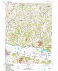
 1951 Canton1951 Print · USGSThe industrial heartland of Ohio and Pennsylvania reached its mid-century peak during this era of heavy rail and river transit. Genealogists and historians can trace the development of steel towns like Aliquippa and Weirton alongside the Ohio River and major lines of the Pennsylvania RR.
 - 1953 Map of Canton
 1953 Canton1953 Print · USGSThe industrial heartland of Ohio and Pennsylvania is captured at its mid-century peak in this detailed regional survey. Genealogists and historians can trace the vast rail networks of the Pennsylvania RR and find local landmarks like Nimisila Reservoir and Tappan Reservoir.
 - 1957 Map of Canton, 1971 Print
 1957 Canton1971 Print · USGSThe industrial heartland of eastern Ohio and western Pennsylvania comes alive in this mid-century survey of the Ohio River Valley. Trace the heritage of rail and river commerce through Pittsburgh, the massive steel towns along the Ohio River, and major junctions on the Pennsylvania RR.3 unique versions available
 - 1961 Map of Newcomerstown, 1963 Print
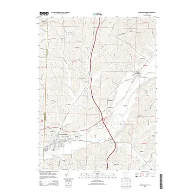
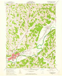 1961 Newcomerstown1963 Print · USGSThe Tuscarawas River valley in the early 1960s reveals a landscape shaped by coal extraction and old transit corridors. Researchers can trace the legacy of the Canal (Abandoned) and locate landmarks like the Cy Young Memorial Park and Stark Patent.2 unique versions available
 - 1961 Map of Fresno, 1963 Print
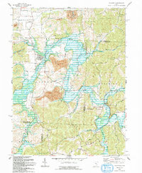
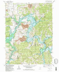
 1961 Fresno1963 Print · USGSIn the early sixties, the Tuscarawas River valley was a busy corridor for the Pennsylvania railroad and the expanding brick and mining industries. Genealogists can trace family names at Woods College Cem and Fairview Cem, or locate the Old Stone Fort near Orange.4 unique versions available
 - 1962 Map of Canton
 1962 Canton1962 Print · USGSThe industrial heartland of Eastern Ohio and Western Pennsylvania thrives in the early sixties as steel mills and rail lines dominate the river valleys. Genealogists and historians can trace local landmarks like McKinley National Memorial, Malone College, and industrial sites such as Republic Steel Corp.2 unique versions available
 - 1962 Map of Plainfield, 1963 Print
 1962 Plainfield1963 Print · USGSCoshocton and Guernsey counties are shown here in the early 1960s as the Wills Creek Reservoir reshaped the valley. Genealogists and local historians can trace small settlements like Linton Mills and Birds Run alongside numerous family cemeteries.4 unique versions available
 - 1962 Map of Kimbolton, 1963 Print
 1962 Kimbolton1963 Print · USGSGuernsey County's rolling hills and the Wills Creek valley are captured in the early sixties, showing the landscape before modern development. Genealogists can trace family names through rural landmarks like Kimbolton Cem, Wheeling Sch, and the remote settlement of Postboy.3 unique versions available
 - 1993 Map of Fresno
 1993 Fresno1993 Print · USGSCentral Ohio at the start of the 1990s reveals a landscape defined by the Tuscarawas River and winding ridges. Genealogists can trace numerous family-named burial sites including Waggoner Cem, Clappboard Cem, and Kimble Cem.
 - 1993 Map of Newcomerstown
 1993 Newcomerstown1993 Print · USGSThe Tuscarawas River valley in the early nineties shows a landscape deeply tied to its industrial and athletic heritage. Genealogists can trace family footprints across Stark Patent lands and find local landmarks like Cy Young Memorial Park and the Centenary Cem.
 - 1993 Map of Plainfield
 1993 Plainfield1993 Print · USGSThe eastern Ohio borderlands of Coshocton and Guernsey counties appear here in the early nineties, centered on the complex shoreline of Wills Creek Lake. Researchers can locate several burial grounds like Schweitzer Cem and trace the paths of the Old RR Gr through Birds Run.
 - 1994 Map of Kimbolton
 1994 Kimbolton1994 Print · USGSThe Guernsey County countryside at the close of the twentieth century shows a landscape transitioning between rural heritage and public recreation. Genealogists can trace family landmarks at Jones Cem, Kimbolton Cem, and the old Liberty Sch.2 unique versions available
 - 1994 Map of Fresno, 1998 Print
 1994 Fresno1998 Print · USGSCoshocton County in the mid-1990s reveals a landscape of industrial strip mining and deep-rooted rural settlements along the Tuscarawas River. Genealogists can trace family names at numerous burial sites like Kimble Cem, Fairview Cem, and Woods College Cem.
 - 1994 Map of Plainfield, 1998 Print
 1994 Plainfield1998 Print · USGSEastern Ohio's river valleys and coal-rich hills are shown here in the 1990s as Wills Creek winds through the meeting point of three counties. Researchers can trace rural lineages through numerous local sites including Linton Mills, Plainfield Cem, and Birds Run.
 - 1994 Map of Newcomerstown, 1998 Print
 1994 Newcomerstown1998 Print · USGSTuscarawas County in the 1990s shows a landscape where historic river-bottom settlements meet modern transit corridors. Genealogists and historians can trace family landmarks like Mt Zion Cem, the STARK PATENT boundaries, and the Cy Young Memorial Park.
 - 2010 Map of Fresno, 2010 Print
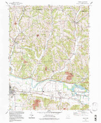
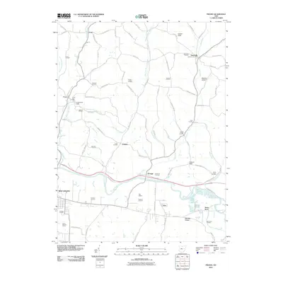 2010 Fresno2010 Print · USGSCovers Oxford Township, including West Lafayette, White Eyes Township, and other nearby areas
 - 2010 Map of Kimbolton, 2010 Print
 2010 Kimbolton2010 Print · USGSCovers Oxford Township, including Guernsey, Kimbolton, and other nearby areas
 - 2010 Map of Plainfield, 2010 Print
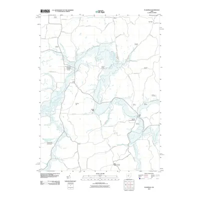 2010 Plainfield2010 Print · USGSCovers Oxford Township, including Plainfield, Flat Ridge, and other nearby areas
 - 2010 Map of Newcomerstown, 2010 Print
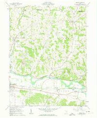
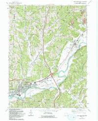
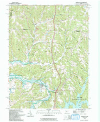
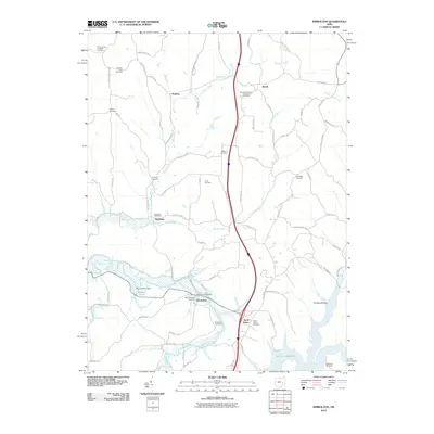
 2010 Newcomerstown2010 Print · USGSCovers Oxford Township, including Newcomerstown, Port Washington, and other nearby areas
 - 2013 Map of Newcomerstown, 2013 Print
 2013 Newcomerstown2013 Print · USGSCovers Oxford Township, including Newcomerstown, Port Washington, and other nearby areas
Showing maps 1-25 of 40
Top cities near Oxford Township
- New Philadelphia historical maps
- Coshocton historical maps
- Cambridge historical maps
- Newcomerstown historical maps
- West Lafayette historical maps
- Keene historical maps
See more
Top neighborhoods of Oxford Township
- Flat Iron Corner historical maps
- Isleta historical maps
- Orange historical maps
- Shady Bend historical maps
- Low Gap historical maps
Frequently asked questions
- What are the different types of historical maps available for Oxford Township?
- What is the oldest map of Oxford Township?
- Where can I purchase historical maps of Oxford Township for my home or office?
- Where can I download high-res historical maps of Oxford Township?
- Are there historical topographic maps available for Oxford Township?
- Is there historical aerial imagery available for Oxford Township?
- Where are historical maps of Oxford Township sourced from?