Old Maps of Madison County, Ohio
Explore 138 old maps of Madison County, spanning from 1901 to today. These high-resolution historic maps reveal how streets, neighborhoods, landmarks, and natural features evolved over time — perfect for genealogy, metal detecting, research, and local history exploration.
What you can do with these maps:
- See how Madison County changed over time: Compare historical maps to modern-day views to trace roads, homesites, rail lines & more.
- View detailed metadata: Each map includes creators, publishers, year, scale, and archive source.
- Overlay maps with satellite & LiDAR: Visualize the past alongside modern tools to explore terrain & human change.
- Trusted historical sources: Maps sourced from the USGS, Library of Congress, and other archives.
- Access maps your way: View online, download high-res files, or order prints for personal or research use.
Start exploring old maps of Madison County to uncover forgotten places, hidden landmarks, and the deep history beneath your feet.
Madison County, OH maps
(138)- 1901 Map of Dublin, 1955 Print
 1901 Dublin1955 Print · USGSCentral Ohio at the turn of the century reveals a landscape of independent agricultural villages and busy rail corridors long before the suburban expansion. Trace early property and settlement patterns in Dublin, Worthington, and Hilliard, and locate vanished rail stops along the Pennsylvania System and the Columbus Delaware and Marion Electric Ry.
 - 1903 Map of Dublin, 1939 Print
 1903 Dublin1939 Print · USGSCentral Ohio at the turn of the century is captured here as a landscape of river valleys and emerging railroad towns. Genealogists can trace early homesteads and routes between established centers like Worthington and smaller rural stops such as Amlin and Powell.2 unique versions available
 - 1906 Map of Mt Sterling, 1946 Print
 1906 Mt Sterling1946 Print · USGSCentral Ohio at the start of the twentieth century is a landscape of thriving rail hubs and rural townships. Trace the convergence of five railroads at Washington Courthouse and find family landmarks like the County Infirmary or Bloomingburg.
 - 1907 Map of London, 1940 Print
 1907 London1940 Print · USGSMadison County at the turn of the century shows a landscape transitioning through the height of the electric railway era. Genealogists can trace the rural schoolhouses like Dunn School and Glade School or locate family sites near Lilly Chapel and Lafayette.2 unique versions available
 - 1907 Map of South Charleston, 1943 Print
 1907 South Charleston1943 Print · USGSThe Clark County countryside at the turn of the century shows a landscape dominated by rail travel and local school districts. Genealogists can locate family-named landmarks such as Yeazel School, Pancake Chapel, and the settlement of Dolly Varden.2 unique versions available
 - 1911 Map of Era, 1952 Print
 1911 Era1952 Print · USGSPickaway County at the start of the 1900s is a landscape of established farmsteads and creekside milling. Genealogists can trace family footprints through numerous rural school sites like Tick Ridge School or Locust Grove School and find early commerce hubs like Crownover Mill and Williamsport.
 - 1913 Map of Era, 1936 Print
 1913 Era1936 Print · USGSPickaway County agricultural life and early transport networks are preserved here in the years before the Great War. Genealogists and local historians can locate dozens of country schoolhouses like Dublin Hill School and river crossings such as Becks Ford and Gulicks Ford.
 - 1914 Map of Mechanicsburg, 1954 Print
 1914 Mechanicsburg1954 Print · USGSChampaign County at the start of the Great War was a thriving landscape of rail-connected villages and one-room schoolhouses. Genealogists can trace family footprints at Pretty Prairie School, the ancient Indian Mound, or along the busy tracks of the Erie RR in North Lewisburg.
 - 1916 Map of Mechanicsburg, 1936 Print
 1916 Mechanicsburg1936 Print · USGSChampaign County at the height of the rail era shows a landscape where small villages and rural schoolhouses thrived alongside major transit corridors. Genealogists and historians can trace family locations near landmarks like Indian Mound, Catawba Station, and Five Points School.
 - 1916 Map of Octa, 1941 Print
 1916 Octa1941 Print · USGSFayette and Greene Counties are captured here at a peak of rural development, prior to the consolidation of its numerous neighborhood school districts. You can trace the rail-era infrastructure of Octa and Jeffersonville or locate early community sites like Dakin Chapel and the Selden PO.
 - 1916 Map of Milford Center, 1948 Print
 1916 Milford Center1948 Print · USGSThe rural expanse of central Ohio is captured here in the mid-nineteen-tens, centered on the rail junctions of Marysville and Milford Center. Genealogists and local historians can trace family roots through numerous country schools like Minoque School and the Industrial Home for Women.
 - 1923 Map of West Columbus, 1955 Print
 1923 West Columbus1955 Print · USGSFranklin County in the early twenties shows the growing western edge of Columbus and its surrounding rural townships. Genealogists and historians can trace the paths of the National Road and find landmarks like Camp Chase, Urbancrest, and Pisgah School.
 - 1925 Map of West Columbus, 1946 Print
 1925 West Columbus1946 Print · USGSFranklin and Pickaway counties are shown here in the mid-twenties, when the growing state capital met a landscape of electric railways and rural schoolhouses. Researchers can trace the National Road and locate sites like the Pisgah School, Mt Calvary Cemetery, and the State Hospital.
 - 1943 Map of Era
 1943 Era1943 Print · USGSPickaway and Ross Counties are shown in the early 1940s, a period when rural education and river-based land divisions still shaped the Ohio countryside. Genealogists can locate dozens of country schoolhouses like Frogeye Sch and trace the Pennsylvania rail line through Williamsport and Atlanta.
 - 1944 Map of Mechanicsburg
 1944 Mechanicsburg1944 Print · USGSChampaign County and its borders with Logan, Union, and Clark counties are shown here during the peak of the rail era in the 1940s. Genealogists and historians can locate numerous rural schools like Pretty Prairie Sch and landmarks such as the Indian Mound and White Cem.
 - 1944 Map of Milford Center
 1944 Milford Center1944 Print · USGSCentral Ohio during the war years shows a landscape of busy rail junctions and fertile creek valleys. Genealogists and local historians can locate old rural schoolhouses like Lombard Sch and trace the paths of the Pennsylvania railroad through Milford Center.
 - 1944 Map of Octa
 1944 Octa1944 Print · USGSSouthwestern Ohio at the end of the Second World War shows a landscape dense with rural schoolhouses and rail-connected villages. Genealogists can trace family roots through dozens of local landmarks like Sugar Grove Sch, Selden PO, and the junction at Octa.
 - 1947 Map of Columbus, 1948 Print
 1947 Columbus1948 Print · USGSCentral Ohio in the late 1940s is captured in this survey, showing the post-war transition of its rail hubs and military airfield expansions. Genealogists and historians can trace the paths of the Ohio Canal, the Pennsylvania RR lines, and the Camp Sherman Military Reservation.
 - 1950 Map of Marion
 1950 Marion1950 Print · USGSCentral Ohio was a powerhouse of rail and river industry at the mid-century point, serving as a vital corridor between the Great Lakes and the Ohio River valley. Genealogists and rail historians can trace the paths of the Erie RR and Nickel Plate Road through towns like Bucyrus, Galion, and Upper Sandusky.
 - 1954 Map of Hilliard, 1956 Print
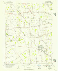 1954 Hilliard1956 Print · USGSCentral Ohio farm country and railway junctions are captured here in the mid-fifties, centered on the growing village of Hilliard. Genealogists can locate old rural landmarks like Mudsock, St John Ch, and the Hilliard Cemetery as they appeared before suburbanization.
 - 1955 Map of Harrisburg, 1956 Print
 1955 Harrisburg1956 Print · USGSThe rural borderlands of Franklin, Pickaway, and Madison counties come to life in the mid-fifties as the Baltimore and Ohio Railroad connects the towns of Orient and Derby. Researchers can trace the grounds of the Orient State Institute or locate family plots at Little Pennsylvania Cem and McKinley Cem.
 - 1955 Map of Galloway, 1956 Print
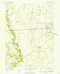 1955 Galloway1956 Print · USGSThe rural fringes of western Columbus during the mid-fifties reveal a landscape of creek-side camps and rail-stop villages. Genealogists can trace family names through sites like Oak Grove Cem and Gundy Cem, or locate the historic Alton Station along the Pennsylvania Railroad.
 - 1958 Map of Five Points, 1959 Print
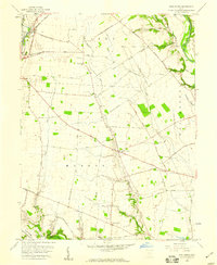 1958 Five Points1959 Print · USGSPickaway County farming life is captured in the late fifties as a network of rural roads connects local hubs like Five Points and Era. Genealogists and historians can trace family-named landmarks and routes like Whiteside-Lister Mill Road and Thomas Cem.4 unique versions available
 - 1961 Map of Columbus
 1961 Columbus1961 Print · USGSCentral and Southern Ohio are captured here in the early sixties, as the region's industrial rail hubs and military bases reached their peak. Genealogists and historians can trace the transition from urban Columbus to rural townships along the Scioto River, locating Lockbourne USAF and old junctions like Washington Court House.
 - 1961 Map of Vienna, 1962 Print
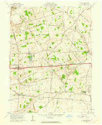 1961 Vienna1962 Print · USGSThe Clark and Madison County line reveals a productive Ohio landscape in the early sixties, centered on the historic National Road. Researchers can trace the New York Central Railroad corridor and locate landmarks like the State Fish Hatchery and Wilson Chapel.3 unique versions available
Showing maps 1-25 of 138
Top cities of Madison County
Frequently asked questions
- What are the different types of historical maps available for Madison County?
- What is the oldest map of Madison County?
- Where can I purchase historical maps of Madison County for my home or office?
- Where can I download high-res historical maps of Madison County?
- Are there historical topographic maps available for Madison County?
- Is there historical aerial imagery available for Madison County?
- Where are historical maps of Madison County sourced from?