Old Maps of Nelson, Oregon for Academic Research
Study the evolution of Nelson with 9 high-resolution historic maps. Whether you're teaching, researching, or modeling changes in land use, these maps provide essential visual documentation of urban, environmental, and geographic change.
- Analyze long-term change: Track patterns in development, transportation, and natural features.
- Ideal for environmental or urban studies: Support academic projects with primary historical map data.
- Use in the classroom or lab: Educators and researchers rely on these maps to bring historical context to life.
These maps are a powerful tool for teaching, research, and visualizing how Nelson has changed over the decades.
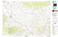
Nelson, OR maps
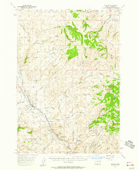
(9)- 1915 Map of Pine
 1915 Pine1915 Print · USGSEastern Oregon was a hub of gold mining and river commerce in the early twentieth century. Researchers can trace the legacy of pioneer families and industry at the Sanger Mine, follow the old Oregon-Washington Railroad, or locate the Mineral P O along the river.3 unique versions available
 - 1955 Map of Baker, 1964 Print
 1955 Baker1964 Print · USGSThe Oregon-Idaho borderlands are captured here in the mid-fifties as the Snake River underwent massive changes from dam construction. Trace the Oregon Trail Memorial Monument near Baker, find early mines like Virtue Mine, and follow the Union Pacific Railroad through Huntington.4 unique versions available
 - 1957 Map of Durkee, 1959 Print
 1957 Durkee1959 Print · USGSThe Burnt River Valley in the late fifties is captured here as a critical corridor for both pioneer history and modern transport. You can trace the historic Oregon Trail alongside the Union Pacific Railroad, locating Plano School, Gold Ridge Mine, and the settlement of Durkee.2 unique versions available
 - 1959 Map of Baker
 1959 Baker1959 Print · USGSThe Oregon and Idaho borderlands come alive in the late fifties, showing the rugged corridor along the Snake River and the high peaks of the Wallowa Mountains. Researchers can trace the legacy of the Union Pacific railroad or locate historic mining sites like the Flagstaff Mine and Virtue Mine.2 unique versions available
 - 1981 Map of Baker
 1981 Baker1981 Print · USGSEastern Oregon in the early eighties shows a landscape of deep canyons and high mountain mining districts. Genealogists and researchers can trace the Union Pacific corridor through Baker or locate remote operations like the Young American Mine and Rachel Mine.2 unique versions available
 - 1988 Map of Durkee
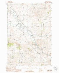 1988 Durkee1988 Print · USGSThe Burnt River Valley in the late 1980s reveals a landscape of enduring pioneer trails and active rail infrastructure. Researchers can trace the Oregon Trail, locate the Clay Pit Graves, and explore mining sites like Gold Ridge Mine.
 - 2014 Map of Durkee, 2014 Print
 2014 Durkee2014 Print · USGSCovers Nelson, including Durkee, Baker County, and other nearby areas
 - 2020 Map of Durkee, 2020 Print
 2020 Durkee2020 Print · USGSCovers Nelson, including Durkee, Baker County, and other nearby areas
 - 2023 Map of Durkee, 2023 Print
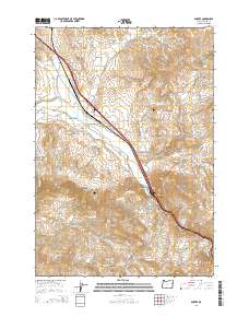
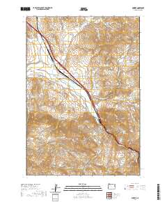
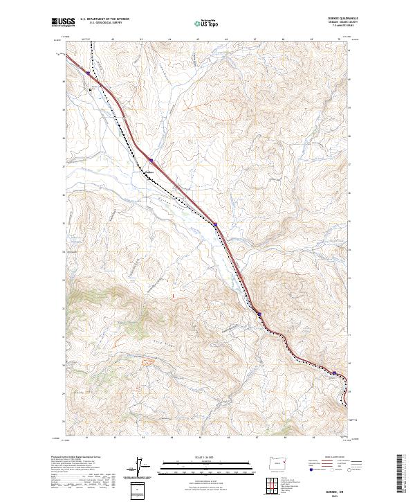 2023 Durkee2023 Print · USGSDurkee and the surrounding high-desert valley are captured here in the 2020s, showing the intersection of ranching life and rugged Oregon topography. Researchers can trace the path of Banks Ditch and locate landmarks like the Durkee Cem and Powell Cr Reservoir.
End of results
Showing maps 1-9 of 9
Top cities near Nelson
Frequently asked questions
- What are the different types of historical maps available for Nelson?
- What is the oldest map of Nelson?
- Where can I purchase historical maps of Nelson for my home or office?
- Where can I download high-res historical maps of Nelson?
- Are there historical topographic maps available for Nelson?
- Is there historical aerial imagery available for Nelson?
- Where are historical maps of Nelson sourced from?