Old Maps of Sixes, Oregon for Academic Research
Study the evolution of Sixes with 13 high-resolution historic maps. Whether you're teaching, researching, or modeling changes in land use, these maps provide essential visual documentation of urban, environmental, and geographic change.
- Analyze long-term change: Track patterns in development, transportation, and natural features.
- Ideal for environmental or urban studies: Support academic projects with primary historical map data.
- Use in the classroom or lab: Educators and researchers rely on these maps to bring historical context to life.
These maps are a powerful tool for teaching, research, and visualizing how Sixes has changed over the decades.
Sixes, OR maps
(13)- 1899 Map of Port Orford
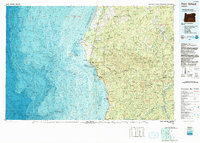
 1899 Port Orford1899 Print · USGSThe Oregon coast at the end of the nineteenth century was a frontier of maritime trade and rugged interior river settlements. Trace early coastal geography from Cape Blanco to Port Orford, and find isolated communities like Agness and Denmark.
 - 1903 Map of Port Orford
 1903 Port Orford1903 Print · USGSCoastal Curry County at the start of the twentieth century was a landscape of remote mountain outposts and rugged river valleys. Genealogists and historians can trace early settlements like Illahe, Agness, and Frankport, or locate landmarks such as Mountain Well and Floras Lake.7 unique versions available
 - 1954 Map of Coos Bay
 1954 Coos Bay1954 Print · USGSCoastal Oregon at mid-century shows a landscape of timber and tides, from the river ports to the edge of the Pacific. Researchers can trace family roots through coastal schools like Beachview School or follow the Southern Pacific RR through Reedsport and Coos Bay.
 - 1954 Map of Langlois, 1956 Print
 1954 Langlois1956 Print · USGSCoastal Curry County in the mid-fifties is a landscape of cranberry agriculture and rugged timberlands. Researchers can trace the early highway settlements of Denmark and Langlois or locate coastal landmarks like Floras Lake and the Cranberry Bogs.3 unique versions available
 - 1958 Map of Coos Bay, 1974 Print
 1958 Coos Bay1974 Print · USGSThe Southern Oregon coastline at mid-century reveals a bustling maritime and timber economy centered on Coos Bay and North Bend. Researchers can trace the legacy of coastal settlements from Bandon to Brookings, including rail lines of the Southern Pacific RR and the rugged reaches of the Siuslaw National Forest.
 - 1962 Map of Coos Bay
 1962 Coos Bay1962 Print · USGSThe Oregon coast at the end of the fifties reveals a landscape of timber ports and fishing villages connected by U.S. Highway 101. Researchers can trace the rail infrastructure of the Southern Pacific RR and locate early settlements from Florence down to Brookings.2 unique versions available
 - 1986 Map of Sixes
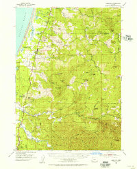
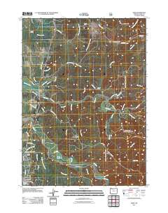
 1986 Sixes1986 Print · USGSCoastal Curry County is documented here in the mid-eighties, where the Sixes River meets the Pacific near rural timberlands. Researchers can locate the Pacific High Sch, the sprawling Cranberry Bogs, and the Port Orford Cedar Forest State Wayside.
 - 1992 Map of Port Orford, 1993 Print
 1992 Port Orford1993 Print · USGSThe southern Oregon coast and the coastal ranges of the early nineties are captured here in both topographic and bathymetric detail. Researchers can trace landforms from the reefs of Oregon Islands to inland landmarks like Bingham Mountain and Albert H Powers Memorial State Park.
 - 1996 Map of Sixes, 1999 Print
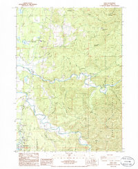
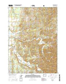
 1996 Sixes1999 Print · USGSThe coastal river valleys of Curry County are shown in the late 1990s as the landscape transitions from the small town of Sixes into deep timber country. Researchers can trace the Sixes River to the Grassy Knob Wilderness and locate the Pacific High School or the Port Orford Cedar Forest State Wayside.
 - 2011 Map of Sixes, 2011 Print
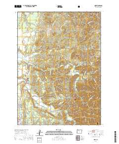
 2011 Sixes2011 Print · USGSCovers Sixes, including Port Orford, Curry County, and other nearby areas
 - 2014 Map of Sixes, 2014 Print
 2014 Sixes2014 Print · USGSCovers Sixes, including Port Orford, Curry County, and other nearby areas
 - 2020 Map of Sixes, 2020 Print
 2020 Sixes2020 Print · USGSCovers Sixes, including Port Orford, Curry County, and other nearby areas
 - 2023 Map of Sixes, 2023 Print
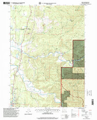
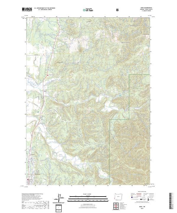 2023 Sixes2023 Print · USGSThe Oregon coast and its timbered interior are captured here in a time of modern forest management and conservation. Researchers can trace the drainages of the Sixes River and Elk River, locating landmarks like the Marsh Log-Pond and the Grassy Knob Wilderness.
End of results
Showing maps 1-13 of 13
Top cities near Sixes
Frequently asked questions
- What are the different types of historical maps available for Sixes?
- What is the oldest map of Sixes?
- Where can I purchase historical maps of Sixes for my home or office?
- Where can I download high-res historical maps of Sixes?
- Are there historical topographic maps available for Sixes?
- Is there historical aerial imagery available for Sixes?
- Where are historical maps of Sixes sourced from?