Old Maps of Ruch, Oregon
Explore 13 old maps of Ruch, spanning from 1908 to today. These high-resolution historic maps reveal how streets, neighborhoods, landmarks, and natural features evolved over time — perfect for genealogy, metal detecting, research, and local history exploration.
What you can do with these maps:
- See how Ruch changed over time: Compare historical maps to modern-day views to trace roads, homesites, rail lines & more.
- View detailed metadata: Each map includes creators, publishers, year, scale, and archive source.
- Overlay maps with satellite & LiDAR: Visualize the past alongside modern tools to explore terrain & human change.
- Trusted historical sources: Maps sourced from the USGS, Library of Congress, and other archives.
- Access maps your way: View online, download high-res files, or order prints for personal or research use.
Start exploring old maps of Ruch to uncover forgotten places, hidden landmarks, and the deep history beneath your feet.
Ruch, OR maps
(13)- 1908 Map of Grants Pass
 1908 Grants Pass1908 Print · USGSThe Rogue River valley and Siskiyou Mountains are shown here during a peak era of mineral extraction and rail expansion. Researchers can trace historic claims like the Granite Hill Mine or find early settlements such as Woodville and Wilderville before modern development altered the landscape.5 unique versions available
 - 1954 Map of Ruch, 1956 Print
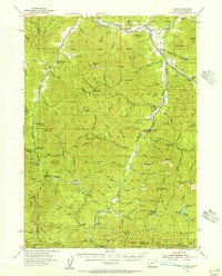 1954 Ruch1956 Print · USGSThe foothills of the Siskiyous in the 1950s show a landscape of active mining and forest management. Researchers can trace historic mineral claims like the Layton Mine or find early recreational and administrative sites like McKee Bridge Camp and Star Ranger Station.3 unique versions available
 - 1955 Map of Medford, 1964 Print
 1955 Medford1964 Print · USGSSouthern Oregon's valley towns and high peaks are captured here in the mid-1950s, showing the region before the completion of the modern interstate system. Genealogists and historians can trace the development of timber and mining outposts from Wolf Creek to Butte Falls and the early roads to Crater Lake.3 unique versions available
 - 1957 Map of Medford
 1957 Medford1957 Print · USGSSouthern Oregon during the mid-fifties is captured here as a region of growing valley cities and vast timberlands. Genealogists and historians can trace the rail-and-road corridors connecting Medford, Jacksonville, and Grants Pass to more remote locales like Wolf Creek or Butte Falls.
 - 1958 Map of Medford
 1958 Medford1958 Print · USGSSouthern Oregon's Rogue River valley thrived in the 1950s as a crossroads of rail and road. Researchers can trace the legacy of timber and tourism through Southern Pacific RR lines and landmarks like Crater Lake and Oregon Caves National Monument.
 - 1983 Map of Ruch
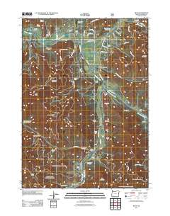
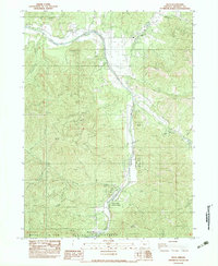 1983 Ruch1983 Print · USGSThe northern Applegate Valley comes into focus in the early 1980s, centered on the community of Ruch and its rugged surrounding peaks. Researchers can locate recreation landmarks like Cantrall-Buckley Park and trace mountain topography from Negro Ben Mtn to Squaw Peak.
 - 1989 Map of Grants Pass, 1990 Print
 1989 Grants Pass1990 Print · USGSSouthern Oregon's river valleys and mountain ranges are captured here in the late eighties, just as the region’s recreation and transit networks were maturing. Local historians can trace old settlements like Waldo and Holland or follow the Southern Pacific line through Grants Pass.
 - 1996 Map of Ruch, 1998 Print
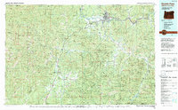
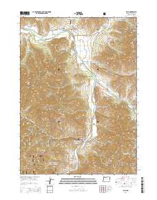
 1996 Ruch1998 Print · USGSThe Applegate Valley in the mid-1990s is shown here as a landscape of timbered peaks and riverside settlements. Genealogists and hikers can locate family-named landmarks like Offenbacher Point and historical crossings like McKee Bridge.
 - 2011 Map of Ruch, 2011 Print
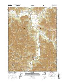
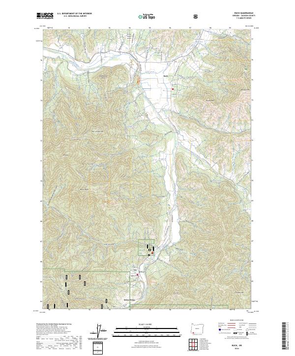
 2011 Ruch2011 Print · USGSCovers Ruch, including McKee Bridge, Jackson County, and other nearby areas
 - 2014 Map of Ruch, 2014 Print
 2014 Ruch2014 Print · USGSCovers Ruch, including McKee Bridge, Jackson County, and other nearby areas
 - 2017 Map of Ruch, 2017 Print
 2017 Ruch2017 Print · USGSCovers Ruch, including McKee Bridge, Jackson County, and other nearby areas
 - 2020 Map of Ruch, 2020 Print
 2020 Ruch2020 Print · USGSCovers Ruch, including McKee Bridge, Jackson County, and other nearby areas
 - 2024 Map of Ruch, 2024 Print
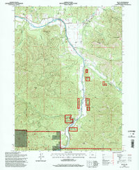
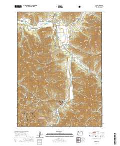
 2024 Ruch2024 Print · USGSThe Applegate River valley south of Medford comes into focus in this contemporary survey of its mountain-ringed settlements and historic water systems. Local researchers can trace the course of the China Ditch and Swayne Ditch or locate family-named landmarks like Offenbacher Point.
End of results
Showing maps 1-13 of 13
Top cities near Ruch
- Medford historical maps
- Central Point historical maps
- Eagle Point historical maps
- White City historical maps
- Phoenix historical maps
- Jacksonville historical maps
See more
Frequently asked questions
- What are the different types of historical maps available for Ruch?
- What is the oldest map of Ruch?
- Where can I purchase historical maps of Ruch for my home or office?
- Where can I download high-res historical maps of Ruch?
- Are there historical topographic maps available for Ruch?
- Is there historical aerial imagery available for Ruch?
- Where are historical maps of Ruch sourced from?