Old Maps of Jackson County, Oregon
Explore 365 old maps of Jackson County, spanning from 1891 to today. These high-resolution historic maps reveal how streets, neighborhoods, landmarks, and natural features evolved over time — perfect for genealogy, metal detecting, research, and local history exploration.
What you can do with these maps:
- See how Jackson County changed over time: Compare historical maps to modern-day views to trace roads, homesites, rail lines & more.
- View detailed metadata: Each map includes creators, publishers, year, scale, and archive source.
- Overlay maps with satellite & LiDAR: Visualize the past alongside modern tools to explore terrain & human change.
- Trusted historical sources: Maps sourced from the USGS, Library of Congress, and other archives.
- Access maps your way: View online, download high-res files, or order prints for personal or research use.
Start exploring old maps of Jackson County to uncover forgotten places, hidden landmarks, and the deep history beneath your feet.
Jackson County, OR maps
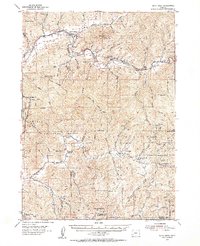
(365)- 1891 Map of Ashland
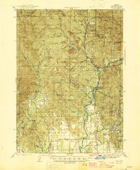
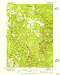
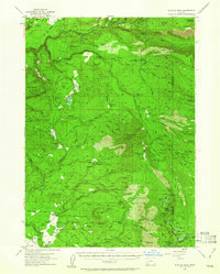
 1891 Ashland1891 Print · USGSSouthern Oregon's Rogue River Valley was undergoing rapid transformation in the late nineteenth century as rail lines connected its emerging towns. Genealogists and historians can trace early property and settlement patterns near Jacksonville, Medford, and the pristine Crater Lake basin.
 - 1893 Map of Ashland
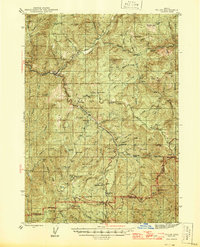
 1893 Ashland1893 Print · USGSSouthern Oregon in the late nineteenth century was a region of rapid change as the Oregon and California R. R. linked the valley floor. Researchers can trace the early footprints of Jacksonville, Medford, and Ashland, or locate landmarks like Crater Lake and Mt Pitt.6 unique versions available
 - 1897 Map of Ashland, 1937 Print
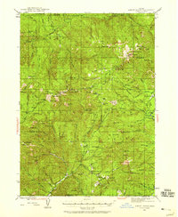
 1897 Ashland1937 Print · USGSSouthern Oregon's Rogue River Valley is captured here in the late nineteenth century as the railroad began to transform local commerce. Trace the early footprints of Jacksonville and Medford, or locate remote landmarks like Wizard Island and the high peaks of the Rogue River National Forest.
 - 1904 Map of Riddle
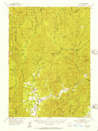
 1904 Riddle1904 Print · USGSSouthern Oregon's mining and railroad corridor is captured here at the start of the twentieth century. Genealogists can trace family footprints through early settlements like Riddles and Galesville or locate specific claims like the Placer Star Mine.5 unique versions available
 - 1908 Map of Grants Pass
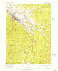
 1908 Grants Pass1908 Print · USGSThe Rogue River valley and Siskiyou Mountains are shown here during a peak era of mineral extraction and rail expansion. Researchers can trace historic claims like the Granite Hill Mine or find early settlements such as Woodville and Wilderville before modern development altered the landscape.5 unique versions available
 - 1938 Map of Medford
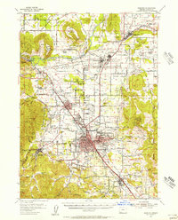
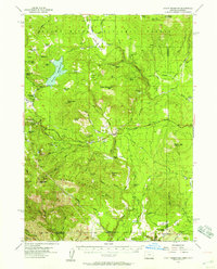
 1938 Medford1938 Print · USGSIn the 1930s, the Rogue River Valley served as a thriving hub for southern Oregon mining and transit. Genealogists and historians can trace old homesteads and landmarks like the Willow Springs Cem, the Millionaire Mine, and the Bybee Bridge.3 unique versions available
 - 1943 Map of Trail, 1945 Print
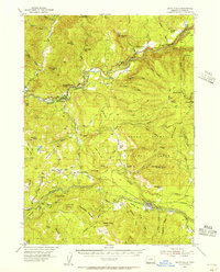
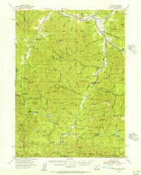
 1943 Trail1945 Print · USGSJackson County during the mid-forties reveals a landscape transitioning from remote ranching to significant military and forestry use. Genealogists and historians can locate early family sites like Younkers Ranch, trace the Mountain King Mine, or find the Reese Creek Sch near the Rogue River.4 unique versions available
 - 1944 Map of Tiller, 1946 Print
 1944 Tiller1946 Print · USGSDouglas County and Jackson County meet along high ridges during the mid-1940s, where remote ranching and timber mills defined the South Umpqua valley. Researchers can trace family homesteads like Lucas Ranch or search for old industrial sites such as the Banfield Mine and Old Johnson Mill.5 unique versions available
 - 1944 Map of Abbott Butte, 1958 Print
 1944 Abbott Butte1958 Print · USGSSouthern Oregon's high timber country is documented here in the mid-1940s, showing the intersection of the Rogue River and Umpqua National Forests. Genealogists and historians can trace isolated mountain life through Ash Homestead, the Al Sarena (Buzzard) Mine, and several historic ranger stations.3 unique versions available
 - 1947 Map of Abbott Butte
 1947 Abbott Butte1947 Print · USGSThe Oregon Cascades during the 1940s reveal a high-country landscape of ranger stations, mining claims, and early homesteads. Researchers can locate remote sites like the Al Sarena (Buzzard) Mine and the Ash Homestead or trace the Rogue River Trail.2 unique versions available
 - 1954 Map of Medford, 1956 Print
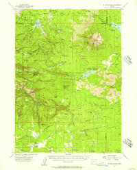
 1954 Medford1956 Print · USGSMedford and the Rogue River Valley are captured here in the mid-fifties, showing a landscape defined by volcanic peaks and growing orchards. Genealogists and historians can trace family ties at Pankey Park Cemetery, locate the Table Rock School, or map the early footprints of White City and Jacksonville.3 unique versions available
 - 1954 Map of Days Creek, 1956 Print
 1954 Days Creek1956 Print · USGSThe South Fork Umpqua River valley is shown in the mid-1950s as a landscape of remote mountain lookouts and small riverside communities. Local historians can locate early landmarks like Lavadoure Community Hall, the Mallery Mine, and the Galesville School.3 unique versions available
 - 1954 Map of Butte Falls, 1956 Print
 1954 Butte Falls1956 Print · USGSJackson County timber and ranching life are detailed here in the mid-fifties, centered on the logging hub of Butte Falls. You can trace the Aqueduct Logging Railroad, locate family properties like Frendenburg Ranch, and find the McLeod Covered Bridge.3 unique versions available
 - 1954 Map of Gold Hill, 1956 Print
 1954 Gold Hill1956 Print · USGSSouthern Oregon's river valleys and mining districts are captured here in the mid-1950s, showing the intersection of transit and timber. Genealogists and historians can trace the foundations of Rogue River and Gold Hill, finding landmarks like Log Town Cem and the Oregon Belle Mine.4 unique versions available
 - 1954 Map of Wimer, 1956 Print
 1954 Wimer1956 Print · USGSSouthern Oregon's timber and mountain country comes to life in the mid-fifties as the forest service network expands. Local historians can trace early rural life at Wimer, the Evans Valley Sch, and remote outposts like Salt Creek Guard Sta.3 unique versions available
 - 1954 Map of Lakecreek, 1956 Print
 1954 Lakecreek1956 Print · USGSJackson County, Oregon, is documented here in the mid-fifties as the ranching and timber landscape around the Little Butte Creek forks remained largely rural. Local historians can trace the foundations of Shale City, identify family-named landmarks like Bybee Pk, and locate the high-elevation Lost Lake.3 unique versions available
 - 1954 Map of Talent, 1956 Print
 1954 Talent1956 Print · USGSSiskiyou and Rogue River national forests meet here in the mid-fifties, where the Rogue River Valley's agricultural reach hits the high mountains. Genealogists and researchers can locate the Steam Cem, the settlement of Buncom, and old high-country sites like Freezeout Cabin.3 unique versions available
 - 1954 Map of Ashland, 1956 Print
 1954 Ashland1956 Print · USGSThe Rogue River Valley is captured here in the mid-fifties, centered on the growth of Ashland and its mountain passes. Genealogists and historians can trace the Southern Pacific RR through settlements like Colestin, Mistletoe, and Stienman.3 unique versions available
 - 1954 Map of Ruch, 1956 Print
 1954 Ruch1956 Print · USGSThe foothills of the Siskiyous in the 1950s show a landscape of active mining and forest management. Researchers can trace historic mineral claims like the Layton Mine or find early recreational and administrative sites like McKee Bridge Camp and Star Ranger Station.3 unique versions available
 - 1955 Map of Rustler Peak, 1957 Print
 1955 Rustler Peak1957 Print · USGSEastern Jackson County is shown here in the mid-fifties, dominated by timber operations and family ranching during a period of transition. Researchers can locate specific family lands like Thomson Ranch and landmarks including the Copco Powerhouse and Mt Pitt Sch (Aban'd).3 unique versions available
 - 1955 Map of Hyatt Reservoir, 1957 Print
 1955 Hyatt Reservoir1957 Print · USGSSouthern Oregon and the California borderlands are mapped here in the mid-fifties, capturing a landscape of high-altitude ranching and forest management. Researchers can trace historic homesteads like Schoolhouse Ranch or the small settlement of Lincoln near its mountain millpond.3 unique versions available
 - 1955 Map of Mt. Mc Loughlin, 1957 Print
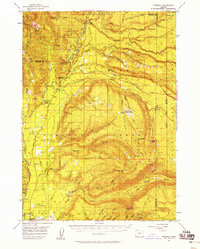
 1955 Mt. Mc Loughlin1957 Print · USGSThe Southern Cascades near the Jackson and Klamath county line are shown here in the mid-fifties, dominated by the peak of Mt McLoughlin. Researchers can trace old timber and water infrastructure at Deadwood, Swede Cabin, and the Big Elk Guard Station.3 unique versions available
 - 1955 Map of Medford, 1964 Print
 1955 Medford1964 Print · USGSSouthern Oregon's valley towns and high peaks are captured here in the mid-1950s, showing the region before the completion of the modern interstate system. Genealogists and historians can trace the development of timber and mining outposts from Wolf Creek to Butte Falls and the early roads to Crater Lake.3 unique versions available
 - 1956 Map of Prospect, 1958 Print
 1956 Prospect1958 Print · USGSThe high timber country of the Cascades is captured here during the mid-1950s, showing the intersection of national forest management and early tourism. Genealogists and historians can locate remote outposts like Skeeters Camp, the Huckleberry Guard Station, and Union Creek.3 unique versions available
 - 1957 Map of Medford
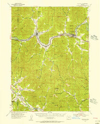
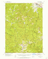
 1957 Medford1957 Print · USGSSouthern Oregon during the mid-fifties is captured here as a region of growing valley cities and vast timberlands. Genealogists and historians can trace the rail-and-road corridors connecting Medford, Jacksonville, and Grants Pass to more remote locales like Wolf Creek or Butte Falls.
Showing maps 1-25 of 365
Top cities of Jackson County
- Medford historical maps
- Ashland historical maps
- Central Point historical maps
- Eagle Point historical maps
- White City historical maps
- Talent historical maps
See more
Frequently asked questions
- What are the different types of historical maps available for Jackson County?
- What is the oldest map of Jackson County?
- Where can I purchase historical maps of Jackson County for my home or office?
- Where can I download high-res historical maps of Jackson County?
- Are there historical topographic maps available for Jackson County?
- Is there historical aerial imagery available for Jackson County?
- Where are historical maps of Jackson County sourced from?