1980s Maps of Jackson County, Oregon
Explore 63 historic maps of Jackson County from the 1980s. These maps offer a rare glimpse into what life looked like during the 1980s — showing old roads, neighborhoods, homes, and landmarks that have changed or disappeared over time.
Whether you're researching your family's past, planning a metal detecting trip, or studying how Jackson County's landscape evolved across the 1980s, these high-resolution maps are a powerful tool for exploring the history of this region.
- Focus on a specific era: All maps on this page are from the 1980s, giving you a focused view of this time period.
- See what’s changed: Compare century-old streets, trails, and buildings to today's modern landscape using overlays and satellite layers.
- Research with precision: Use these maps for genealogy, historical research, land use analysis, or educational projects.
- View, download, or print: Maps are fully viewable online in high resolution, and can be downloaded or printed for your own records.
Start exploring Jackson County's history through authentic maps from the 1980s. This is your window into the past.
Jackson County, OR maps
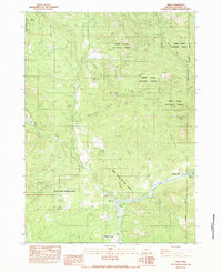
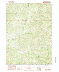
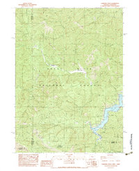
(63)- 1983 Map of Mt. Isabelle
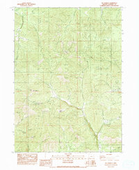 1983 Mt. Isabelle1983 Print · USGSJackson County's rugged mining and timber country is captured here during the early 1980s. Local historians and prospectors can trace the legacy of resource extraction at the Oregon Belle Mine and identify early land use through features like Placer Tailings and Deadhorse Spring.
 - 1983 Map of Siskiyou Peak
 1983 Siskiyou Peak1983 Print · USGSThe Oregon and California borderlands in the early eighties are documented through this detailed study of the Siskiyou Mountains and national forest lands. Researchers can locate remote landmarks like the Camp 22 site and Wrangle Campground, or trace the high-elevation path of the Pacific Crest National Scenic Trail.
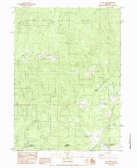
 - 1983 Map of Boswell Mtn
 1983 Boswell Mtn1983 Print · USGSJackson County's mining history and vanished settlements are preserved here in the early 1980s, before modern development further altered the landscape. Researchers can locate former townsites like Spikenard and Beagle, or trace old mining claims at War Eagle Mine and Mountain King Mine.
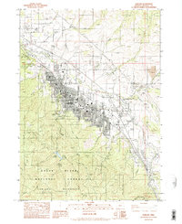
 - 1983 Map of Talent
 1983 Talent1983 Print · USGSSouthern Oregon in the early eighties shows the community of Talent amidst a complex network of irrigation and industry. Genealogists and historians can trace the Southern Pacific rail line, locate the Cem, and explore the high country of the Ashland Mine.
 - 1983 Map of Cleveland Ridge
 1983 Cleveland Ridge1983 Print · USGSJackson County's timbered high country is captured here in the early 1980s, revealing a landscape of forest management and creek-bed topography. Local historians can trace the paths near Railroad Gap or locate named landmarks like Round Top and Buck Flat.
 - 1983 Map of Shady Cove
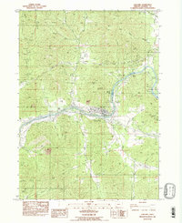
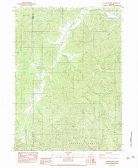
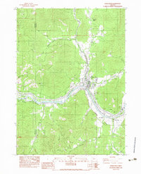
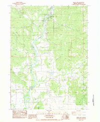 1983 Shady Cove1983 Print · USGSShady Cove and the Rogue River valley were centers of rural development in Jackson County during the early eighties. Researchers can trace the path of the Old RR Grade and locate old landmarks like Dodge Bridge and the community of Etna.
 - 1983 Map of Wimer
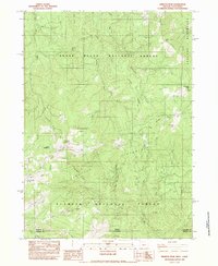
 1983 Wimer1983 Print · USGSThe rural Jackson County community of Wimer is documented here in the early eighties as a network of creek-side settlements and irrigation works. Researchers can trace land use through features like the Spring Brook Airport, Vroman Ditch, and the Pleasant Creek Forest Station.
 - 1983 Map of Sams Valley
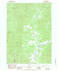
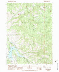
 1983 Sams Valley1983 Print · USGSJackson County's Rogue River valley is captured here in the early eighties, showing a landscape of volcanic plateaus and river industry. Researchers can locate the Fort Lane (Site), the Millionaire Mine, and the rail corridor of the K D S G M R.2 unique versions available
 - 1983 Map of Squaw Lakes
 1983 Squaw Lakes1983 Print · USGSThe Oregon and California borderlands in the early eighties show a landscape shifting from its mining roots toward large-scale water management. Researchers can trace historic extraction sites like the Daffodil Mine and Placer Tailings alongside the newer Applegate Lake.
 - 1983 Map of Trail
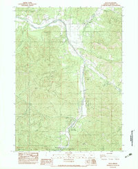
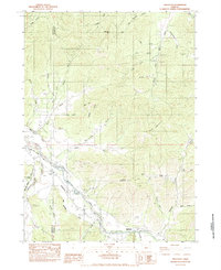
 1983 Trail1983 Print · USGSSouthern Oregon's river country is captured here in the early eighties, showing the transition from forest highlands to riverside settlements. Researchers can trace the path of the Trail through the mountains or locate specific fishing spots like Cable Hole and Bent Hole near Shady Cove.
 - 1983 Map of Mt. Ashland
 1983 Mt. Ashland1983 Print · USGSThe high Siskiyou borderlands come into focus in the early 1980s, showing the intersection of recreational development and industrial transport. Researchers can trace the Southern Pacific rail line through Cole or locate the Mt Ashland Ski Area and Mill Creek Plantation.2 unique versions available
 - 1983 Map of Gold Hill
 1983 Gold Hill1983 Print · USGSGold Hill and the Rogue River valley are shown here in the early 1980s, revealing a landscape defined by mining history and river industry. Trace old mineral claims like the Sylvanite Mine and Molly Mine, or locate family landmarks at Rock Point and the Cem.
 - 1983 Map of Emigrant Lake
 1983 Emigrant Lake1983 Print · USGSJackson County's high country and water systems are documented here in the early 1980s as recreation and ranching shaped the landscape. Researchers can trace historic family holdings at Cove Ranch and Henry Ranch or locate old industrial markers like the Barron Mine Water Tank.2 unique versions available
 - 1983 Map of Sterling Creek
 1983 Sterling Creek1983 Print · USGSSouthern Oregon in the early eighties shows a landscape of deep canyons and forest preserves defined by the Little Applegate River. Researchers can trace the layout of the Buncom settlement or locate family-named landmarks like Barr Ranch and Nelson Mountain.
 - 1983 Map of Tallowbox Mtn
 1983 Tallowbox Mtn1983 Print · USGSThe high ridges of the Siskiyous come to life in the early 1980s as mining claims and forest boundaries overlap. Trace old workings at the Bone of Contention Mine and Maid of the Mist Mine or locate high-country landmarks like Jim Mee Peak.
 - 1983 Map of Ruch
 1983 Ruch1983 Print · USGSThe northern Applegate Valley comes into focus in the early 1980s, centered on the community of Ruch and its rugged surrounding peaks. Researchers can locate recreation landmarks like Cantrall-Buckley Park and trace mountain topography from Negro Ben Mtn to Squaw Peak.
 - 1983 Map of Eagle Point
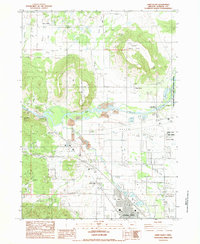
 1983 Eagle Point1983 Print · USGSJackson County's landscape in the early 1980s shows the growth of settlements and water infrastructure around the Agate Desert. Researchers can trace local landmarks like the Veterans Administration Domiciliary, Agate Reservoir, and the Shot Tower.2 unique versions available
 - 1983 Map of Carberry Creek
 1983 Carberry Creek1983 Print · USGSThe Siskiyou mountain country along the Oregon and California border is documented here in the early 1980s, showcasing a landscape of high ridges and deep mining history. Genealogists and researchers can locate old sites like Steamboat (Site), the Steamboat Mine, and the waters of Applegate Lake.
 - 1983 Map of Ashland
 1983 Ashland1983 Print · USGSAshland and the Bear Creek Valley are captured here in the early 1980s as the town expanded around its collegiate and transportation roots. Researchers can trace the grounds of Southern Oregon State College, the Southern Pacific rail line, and family landmarks like the Miller Ranch.
 - 1983 Map of Medford West
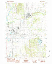
 1983 Medford West1983 Print · USGSJackson County is shown in the early eighties as the urban centers of Medford and Central Point expand toward the surrounding hills. Researchers can trace historic property boundaries in the Jacksonville Historic District or locate early mining activity near Rich Gulch and Johns Peak.
 - 1983 Map of Skeleton Mtn
 1983 Skeleton Mtn1983 Print · USGSThe northern reaches of Jackson County in the early 1980s reveal a landscape of forestry and mineral extraction. Researchers can locate prospects and mine tailings near landmarks like Skeleton Mountain and the Elderberry Flat Recreation Site.
 - 1983 Map of Applegate
 1983 Applegate1983 Print · USGSThe Applegate River valley at the Jackson and Josephine county line reveals a landscape of hydraulic mining and riverside agriculture. Trace the routes of the Laurel Hill Ditch and locate historical sites like the Mountain Lion Mine or Slagle Cem.
 - 1983 Map of King Mountain
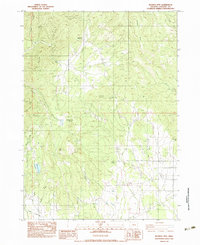
 1983 King Mountain1983 Print · USGSThe peaks and drainages of Southern Oregon are recorded here during the early 1980s. Researchers can trace the intersections of three counties while locating features like Onion Spring, Waggoner Gap, and the high point of King Mountain.
 - 1983 Map of Rogue River
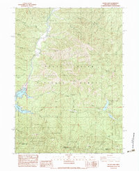
 1983 Rogue River1983 Print · USGSThe Rogue River valley in the early eighties shows a landscape shaped by mining and irrigation. Genealogists and historians can trace the river's bend past Fort Birdseye, locate the Shasta Mine, and follow the path of the South Highline Canal.
 - 1983 Map of Mc Conville Peak
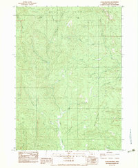
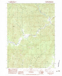 1983 Mc Conville Peak1983 Print · USGSJackson County's rugged backcountry comes into focus during the early eighties, showing a landscape defined by timbered peaks and vital water systems. Researchers can locate the Williams and Whalen Ditch and trace old family sites near McConville Gulch and Homestead Gulch.
Showing maps 1-25 of 63
Top cities of Jackson County
- Medford historical maps
- Ashland historical maps
- Central Point historical maps
- Eagle Point historical maps
- White City historical maps
- Talent historical maps
See more
Frequently asked questions
- What are the different types of historical maps available for Jackson County?
- What is the oldest map of Jackson County?
- Where can I purchase historical maps of Jackson County for my home or office?
- Where can I download high-res historical maps of Jackson County?
- Are there historical topographic maps available for Jackson County?
- Is there historical aerial imagery available for Jackson County?
- Where are historical maps of Jackson County sourced from?