Old Maps of Sodaville, Oregon
Explore 21 old maps of Sodaville, spanning from 1911 to today. These high-resolution historic maps reveal how streets, neighborhoods, landmarks, and natural features evolved over time — perfect for genealogy, metal detecting, research, and local history exploration.
What you can do with these maps:
- See how Sodaville changed over time: Compare historical maps to modern-day views to trace roads, homesites, rail lines & more.
- View detailed metadata: Each map includes creators, publishers, year, scale, and archive source.
- Overlay maps with satellite & LiDAR: Visualize the past alongside modern tools to explore terrain & human change.
- Trusted historical sources: Maps sourced from the USGS, Library of Congress, and other archives.
- Access maps your way: View online, download high-res files, or order prints for personal or research use.
Start exploring old maps of Sodaville to uncover forgotten places, hidden landmarks, and the deep history beneath your feet.
Sodaville, OR maps
(21)- 1911 Map of Brownsville
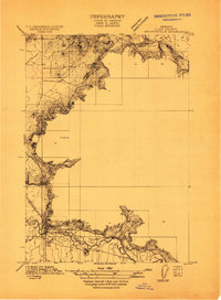 1911 Brownsville1911 Print · USGSBrownsville and the surrounding Linn County valley floor appear here during the early twentieth century. Genealogists and local historians can trace the early rail corridor of the Southern Pacific and locate rural landmarks like Rock Hill School and Warren School.
 - 1921 Map of Brownsville
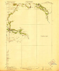 1921 Brownsville1921 Print · USGSLinn County agriculture and early rail travel define this landscape in the years following the Great War. Genealogists can trace the rural communities surrounding Brownsville through the locations of the Union Point School, Diamond Hill School, and the Southern Pacific line.4 unique versions available
 - 1950 Map of Brownsville, 1960 Print
 1950 Brownsville1960 Print · USGSLinn County agriculture and timber meet in the mid-1950s along the Calapooya River and South Santiam River. Genealogists and historians can trace the Oregon Electric line and locate sites like Union Point, Liberty Cem, and the Covered Bridge.3 unique versions available
 - 1952 Map of Brownsville
 1952 Brownsville1952 Print · USGSLinn County agriculture and timber industry are at a peak in the early fifties as the river valleys transition into the Cascade foothills. Researchers can trace family sites at Klum Cemetery, rural school districts like Fairview School, and the path of the Oregon Electric rail line.
 - 1953 Map of Salem
 1953 Salem1953 Print · USGSMid-century Oregon comes to life through this detailed survey of the Willamette Valley and the adjacent Pacific coastline. Researchers can trace the rail lines of the Southern Pacific RR, visit rural hubs like Fairview School, or locate coastal landmarks like the Yaquina Head Lighthouse.
 - 1954 Map of Salem
 1954 Salem1954 Print · USGSMid-century Western Oregon is centered on the productive Willamette River valley as its cities and infrastructure expand toward the mountains. Genealogists and historians can trace the rail lines of the Southern Pacific RR and Oregon Electric Ry through towns like Dallas, Independence, and Brownsville.
 - 1960 Map of Salem, 1968 Print
 1960 Salem1968 Print · USGSThe Willamette Valley and the surrounding mountain ranges are shown here in the 1960s during a period of significant reservoir construction. Genealogists and historians can trace rail lines like the Oregon Electric and find communities from Lincoln City on the coast to Sweet Home and Mill City in the foothills.2 unique versions available
 - 1962 Map of Salem
 1962 Salem1962 Print · USGSThe Willamette Valley and the surrounding Oregon ranges are captured here in the early sixties, showing the vital growth of the state's primary agricultural and academic corridor. Researchers can trace the mid-century footprints of Oregon State University and the University of Oregon, alongside rural landmarks like Camp Adair and Black Butte Mine.
 - 1963 Map of Salem
 1963 Salem1963 Print · USGSMid-century Oregon comes into focus as the Willamette Valley’s timber and agricultural industries meet the growing campuses of Oregon State University and the University of Oregon. Researchers can trace old rail lines like the Oregon Electric Railway and locate family plots at Siletz Cem or Dallas Cem.
 - 1983 Map of Mc Kenzie River, 1984 Print
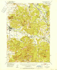
 1983 Mc Kenzie River1984 Print · USGSLinn and Lane Counties are shown in the early 1980s as a hub of hydroelectric power and timber production. Researchers can trace the development of river-valley towns like Sweet Home and Marcola or locate recreation sites at Foster Lake and Cougar Reservoir.
 - 1988 Map of Waterloo
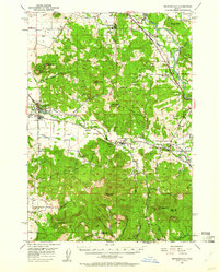
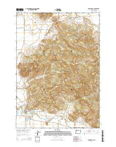
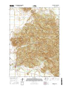
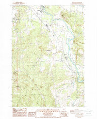 1988 Waterloo1988 Print · USGSLinn County’s river valley and surrounding foothills are documented in the late eighties as timber and agricultural patterns shifted. Genealogists can trace small-town development in Sodaville and Waterloo or locate family sites near Mountain Home.
 - 1988 Map of Brownsville
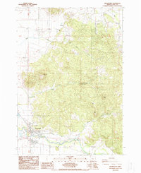 1988 Brownsville1988 Print · USGSBrownsville and the Calapooia River valley are captured in the late eighties as the region balanced its historic riverfront identity with modern infrastructure. Researchers can trace the corporate boundaries of Brownsville, locate local landmarks like the Brownsville Dam, and identify family-named summits such as Washburn Butte and Robe Hill.
 - 2011 Map of Waterloo, 2011 Print
 2011 Waterloo2011 Print · USGSCovers Sodaville, including Sweet Home, Waterloo, and other nearby areas
 - 2014 Map of Waterloo, 2014 Print
 2014 Waterloo2014 Print · USGSCovers Sodaville, including Sweet Home, Waterloo, and other nearby areas
 - 2014 Map of Brownsville, 2014 Print
 2014 Brownsville2014 Print · USGSCovers Sodaville, including Brownsville, Linn County, and other nearby areas
 - 2017 Map of Waterloo, 2017 Print
 2017 Waterloo2017 Print · USGSCovers Sodaville, including Sweet Home, Waterloo, and other nearby areas
 - 2017 Map of Brownsville, 2017 Print
 2017 Brownsville2017 Print · USGSCovers Sodaville, including Brownsville, Linn County, and other nearby areas
 - 2020 Map of Waterloo, 2020 Print
 2020 Waterloo2020 Print · USGSCovers Sodaville, including Sweet Home, Waterloo, and other nearby areas
 - 2020 Map of Brownsville, 2020 Print
 2020 Brownsville2020 Print · USGSCovers Sodaville, including Brownsville, Linn County, and other nearby areas
 - 2023 Map of Waterloo, 2023 Print
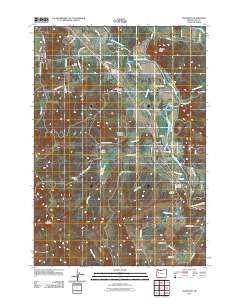
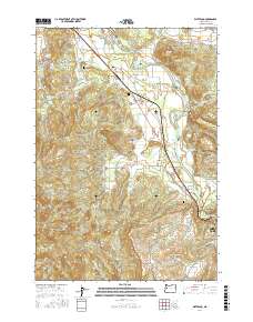
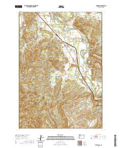
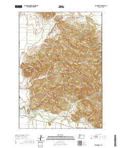
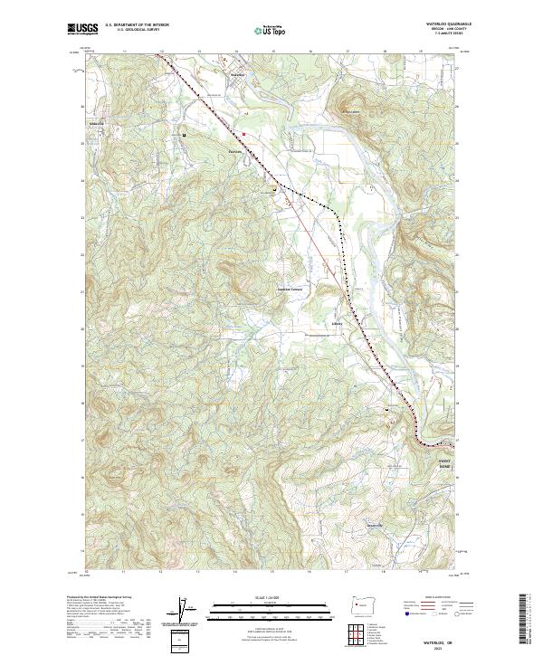 2023 Waterloo2023 Print · USGSLinn County's river-bottom settlements and rising foothills appear in high detail during the early 2020s. Genealogists can trace local roots at Linn Memorial Cem or explore the geography of Sodaville and the South Santiam River.
 - 2023 Map of Brownsville, 2023 Print
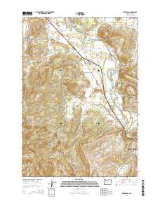
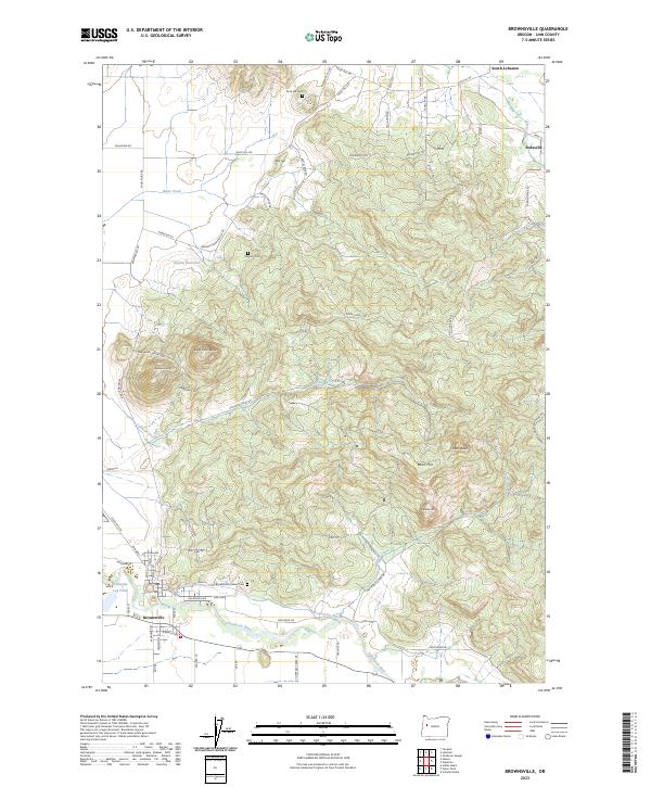 2023 Brownsville2023 Print · USGSTracing the southern Willamette Valley in the 2020s, this map captures the rural heritage of Linn County. Researchers can locate family landmarks like Claypool Cem and Rock Hill Cem or follow the path of the Calapooia River.
End of results
Showing maps 1-21 of 21
Top cities near Sodaville
- Albany historical maps
- Lebanon historical maps
- Sweet Home historical maps
- Jefferson historical maps
- Brownsville historical maps
- Tangent historical maps
See more
Frequently asked questions
- What are the different types of historical maps available for Sodaville?
- What is the oldest map of Sodaville?
- Where can I purchase historical maps of Sodaville for my home or office?
- Where can I download high-res historical maps of Sodaville?
- Are there historical topographic maps available for Sodaville?
- Is there historical aerial imagery available for Sodaville?
- Where are historical maps of Sodaville sourced from?