Old Maps of Rome, Oregon for Academic Research
Study the evolution of Rome with 6 high-resolution historic maps. Whether you're teaching, researching, or modeling changes in land use, these maps provide essential visual documentation of urban, environmental, and geographic change.
- Analyze long-term change: Track patterns in development, transportation, and natural features.
- Ideal for environmental or urban studies: Support academic projects with primary historical map data.
- Use in the classroom or lab: Educators and researchers rely on these maps to bring historical context to life.
These maps are a powerful tool for teaching, research, and visualizing how Rome has changed over the decades.
Rome, OR maps
(6)- 1955 Map of Jordan Valley, 1963 Print
 1955 Jordan Valley1963 Print · USGSThe high desert of Malheur County comes alive in the mid-1950s, showing the isolated ranching outposts and deep canyons along the Idaho border. Researchers can trace the remote reaches of the Owyhee River, the cattle town of Jordan Valley, and mining landmarks like War Eagle Mountain.3 unique versions available
 - 1957 Map of Jordan Valley
 1957 Jordan Valley1957 Print · USGSThe high-desert borderlands of Oregon and Idaho appear in the mid-fifties as a world of remote cattle ranches and mining claims. Researchers can trace historic family-named locations like Bowden Ranch and Riddle alongside the South Mountain Mining Company.
 - 1958 Map of Jordan Valley
 1958 Jordan Valley1958 Print · USGSSoutheast Oregon and Southwest Idaho are documented here during the mid-fifties, showing a landscape of remote cattle ranches and volcanic badlands. Genealogists and historians can trace family operations like the Bowden Ranch or locate the Pleasant Valley School and the South Mountain Mining Company.2 unique versions available
 - 1972 Map of Rome, 1975 Print
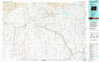
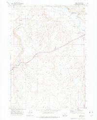 1972 Rome1975 Print · USGSIn the high desert of southeastern Oregon during the early 1970s, the small settlement of Rome serves as a vital outpost near the Owyhee River. Researchers can trace the ranching and irrigation history of the region through landmarks like the Crooked Creek Ranch, Happy Valley Ditch, and the Crooked Creek State Wayside.
 - 1994 Map of Jordan Valley
 1994 Jordan Valley1994 Print · USGSThe high desert of Malheur County meets the Idaho border in the mid-1990s, where ranching life centers on the Owyhee River drainage. Genealogists and local historians can trace the foundations of isolated settlements like Arock and Danner or the critical water works of Antelope Reservoir.2 unique versions available
 - 2023 Map of Rome, 2023 Print
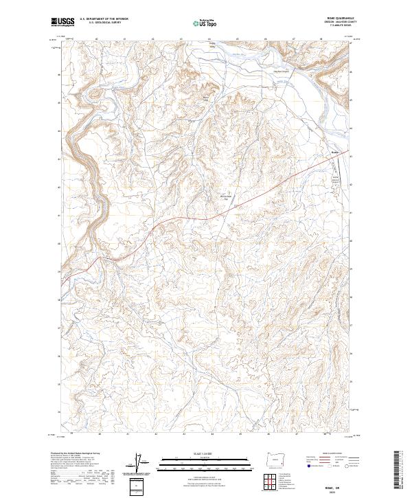 2023 Rome2023 Print · USGSSoutheastern Oregon’s high desert meets the Owyhee River in this recent survey of Malheur County. Researchers can trace the modern layout of the Rome settlement and Rome Service Airport, alongside natural landmarks like the Rome Cliffs and Owyhee Canyon.
End of results
Showing maps 1-6 of 6
Frequently asked questions
- What are the different types of historical maps available for Rome?
- What is the oldest map of Rome?
- Where can I purchase historical maps of Rome for my home or office?
- Where can I download high-res historical maps of Rome?
- Are there historical topographic maps available for Rome?
- Is there historical aerial imagery available for Rome?
- Where are historical maps of Rome sourced from?