Old Maps of Sheaville, Oregon
Explore 10 old maps of Sheaville, spanning from 1955 to today. These high-resolution historic maps reveal how streets, neighborhoods, landmarks, and natural features evolved over time — perfect for genealogy, metal detecting, research, and local history exploration.
What you can do with these maps:
- See how Sheaville changed over time: Compare historical maps to modern-day views to trace roads, homesites, rail lines & more.
- View detailed metadata: Each map includes creators, publishers, year, scale, and archive source.
- Overlay maps with satellite & LiDAR: Visualize the past alongside modern tools to explore terrain & human change.
- Trusted historical sources: Maps sourced from the USGS, Library of Congress, and other archives.
- Access maps your way: View online, download high-res files, or order prints for personal or research use.
Start exploring old maps of Sheaville to uncover forgotten places, hidden landmarks, and the deep history beneath your feet.
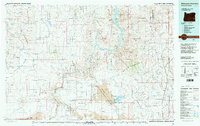
Sheaville, OR maps
(10)- 1955 Map of Boise, 1977 Print
 1955 Boise1977 Print · USGSThe Treasure Valley and Owyhee uplands are shown in detail during the mid-fifties, capturing the region's transition into a major agricultural and urban hub. Researchers can trace the Union Pacific line through Nampa, explore the volcanic Jordan Craters, or locate the historic mining district of Silver City.
 - 1958 Map of Boise
 1958 Boise1958 Print · USGSThe Treasure Valley and Snake River Plain come alive in the mid-fifties as the rail-and-river economy transitions into a modern agricultural hub. Trace the Union Pacific lines through Nampa or locate remote landmarks like Initial Point and the Rockville settlement.2 unique versions available
 - 1962 Map of Boise
 1962 Boise1962 Print · USGSThe Treasure Valley at the start of the sixties reveals a landscape of expanding towns and complex irrigation networks along the Snake River. Genealogists and historians can trace the foundations of modern Idaho through markers like Initial Point, the mining history of Silver City, and the early infrastructure of Lucky Peak Dam.
 - 1969 Map of Sheaville, 1973 Print
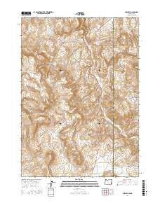
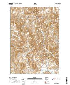
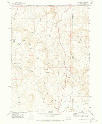 1969 Sheaville1973 Print · USGSThe Oregon-Idaho borderlands are captured in the late sixties, showing a landscape shaped by ranching and high-desert water sources. Researchers can find historical locations like Camp Lyons (Site), the settlement at Sheaville, and the Coal Mine in the Coal Mine Basin.2 unique versions available
 - 1981 Map of Mahogany Mountain, 1997 Print
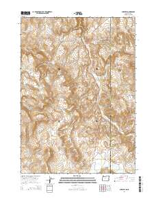
 1981 Mahogany Mountain1997 Print · USGSThe Oregon-Idaho borderlands in the early 1980s are characterized by the winding Owyhee River and isolated settlements. Researchers can trace remote locales like Crowley and Sheaville, and find landmarks such as Skull Spring and Upper Cow Lake.
 - 2011 Map of Sheaville, 2011 Print
 2011 Sheaville2011 Print · USGSCovers Sheaville, including Malheur County, Owyhee County, and other nearby areas
 - 2014 Map of Sheaville, 2014 Print
 2014 Sheaville2014 Print · USGSCovers Sheaville, including Malheur County, Owyhee County, and other nearby areas
 - 2017 Map of Sheaville, 2017 Print
 2017 Sheaville2017 Print · USGSCovers Sheaville, including Malheur County, Owyhee County, and other nearby areas
 - 2020 Map of Sheaville, 2020 Print
 2020 Sheaville2020 Print · USGSCovers Sheaville, including Malheur County, Owyhee County, and other nearby areas
 - 2023 Map of Sheaville, 2023 Print
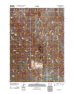
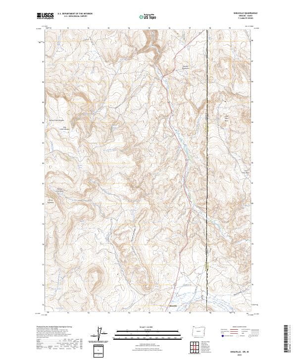 2023 Sheaville2023 Print · USGSThe Oregon-Idaho state line comes alive in this 2023 study of the high desert, centered on the settlement of Sheaville. Trace cattle-country history through Spring Creek Meadow, Coal Mine Basin, and uniquely named water sources like Sticky Joe Spring.
End of results
Showing maps 1-10 of 10
Top cities near Sheaville
Frequently asked questions
- What are the different types of historical maps available for Sheaville?
- What is the oldest map of Sheaville?
- Where can I purchase historical maps of Sheaville for my home or office?
- Where can I download high-res historical maps of Sheaville?
- Are there historical topographic maps available for Sheaville?
- Is there historical aerial imagery available for Sheaville?
- Where are historical maps of Sheaville sourced from?