Old Maps of Monmouth, Oregon
Explore 21 old maps of Monmouth, spanning from 1914 to today. These high-resolution historic maps reveal how streets, neighborhoods, landmarks, and natural features evolved over time — perfect for genealogy, metal detecting, research, and local history exploration.
What you can do with these maps:
- See how Monmouth changed over time: Compare historical maps to modern-day views to trace roads, homesites, rail lines & more.
- View detailed metadata: Each map includes creators, publishers, year, scale, and archive source.
- Overlay maps with satellite & LiDAR: Visualize the past alongside modern tools to explore terrain & human change.
- Trusted historical sources: Maps sourced from the USGS, Library of Congress, and other archives.
- Access maps your way: View online, download high-res files, or order prints for personal or research use.
Start exploring old maps of Monmouth to uncover forgotten places, hidden landmarks, and the deep history beneath your feet.
Monmouth, OR maps
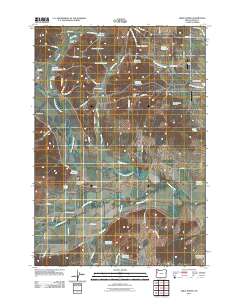
(21)- 1914 Map of Independence
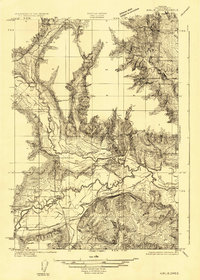
 1914 Independence1914 Print · USGSIn the early twentieth century, the Willamette Valley was a bustling network of river landings and short-line railroads. Trace the routes of the Valley and Siletz RR or locate family sites like Highland School and Buena Vista along the river.
 - 1917 Map of Salem
 1917 Salem1917 Print · USGSThe Willamette Valley at the peak of its rail-and-river era shows a landscape of growing towns and specialized state institutions. Researchers can trace early family-named junctions and rural educational sites like Grabenhorst Corners, Keizer School, and Wigrich Landing.3 unique versions available
 - 1922 Map of Airlie
 1922 Airlie1922 Print · USGSPolk County at the conclusion of the First World War shows a landscape defined by the river valleys and emerging rail lines. Genealogists can trace family locations near Lewisville or identify local heritage at Antioch School and Simpson Siding.3 unique versions available
 - 1940 Map of Salem
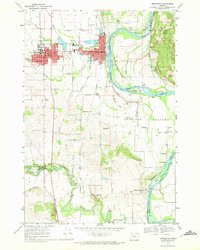
 1940 Salem1940 Print · USGSThe Willamette Valley thrives in the early days of the war, as Salem expands around its rail hubs and state institutions. Researchers can trace the legacy of the Southern Pacific line and find vanished local landmarks like the Poor Farm School for the Deaf or Oak Grove Church.
 - 1942 Map of Dallas
 1942 Dallas1942 Print · USGSPolk County at the start of the 1940s reveals a landscape of timber-dependent towns and rural school districts. Genealogists can trace family roots through numerous local landmarks like Pioneer Sch, Falls City, and the Southern Pacific rail lines.
 - 1953 Map of Salem
 1953 Salem1953 Print · USGSMid-century Oregon comes to life through this detailed survey of the Willamette Valley and the adjacent Pacific coastline. Researchers can trace the rail lines of the Southern Pacific RR, visit rural hubs like Fairview School, or locate coastal landmarks like the Yaquina Head Lighthouse.
 - 1954 Map of Salem
 1954 Salem1954 Print · USGSMid-century Western Oregon is centered on the productive Willamette River valley as its cities and infrastructure expand toward the mountains. Genealogists and historians can trace the rail lines of the Southern Pacific RR and Oregon Electric Ry through towns like Dallas, Independence, and Brownsville.
 - 1957 Map of Dallas, 1958 Print
 1957 Dallas1958 Print · USGSMid-century Polk County is captured here as a landscape of timber-clad ridges and valley farms during a period of steady growth. Genealogists and historians can trace family locations through numerous rural schools like Guthrie Sch, the Salt Creek Cem, and small rail stops such as Polk Station.3 unique versions available
 - 1957 Map of Salem, 1959 Print
 1957 Salem1959 Print · USGSThe Willamette Valley thrives during the mid-fifties as the state capital expands across the river into West Salem. Genealogists can trace family names and landmarks through Eola Cem, Pioneer Cemetery, and the riverside rail stops of the Oregon Electric line.2 unique versions available
 - 1960 Map of Salem, 1968 Print
 1960 Salem1968 Print · USGSThe Willamette Valley and the surrounding mountain ranges are shown here in the 1960s during a period of significant reservoir construction. Genealogists and historians can trace rail lines like the Oregon Electric and find communities from Lincoln City on the coast to Sweet Home and Mill City in the foothills.2 unique versions available
 - 1962 Map of Salem
 1962 Salem1962 Print · USGSThe Willamette Valley and the surrounding Oregon ranges are captured here in the early sixties, showing the vital growth of the state's primary agricultural and academic corridor. Researchers can trace the mid-century footprints of Oregon State University and the University of Oregon, alongside rural landmarks like Camp Adair and Black Butte Mine.
 - 1963 Map of Salem
 1963 Salem1963 Print · USGSMid-century Oregon comes into focus as the Willamette Valley’s timber and agricultural industries meet the growing campuses of Oregon State University and the University of Oregon. Researchers can trace old rail lines like the Oregon Electric Railway and locate family plots at Siletz Cem or Dallas Cem.
 - 1970 Map of Monmouth, 1972 Print
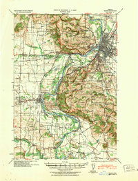
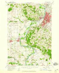
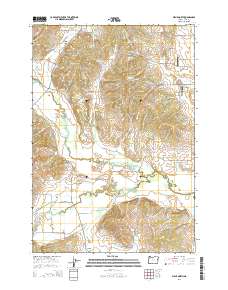
 1970 Monmouth1972 Print · USGSThe Willamette Valley comes alive in the early seventies, showing the established campus of Oregon College of Education and the riverfront at Independence. Genealogists and historians can trace the Southern Pacific tracks, local schools like Talmadge Jr High Sch, and riverside points including Wigrich Landing.2 unique versions available
 - 1974 Map of Airlie North, 1977 Print
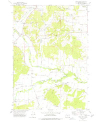 1974 Airlie North1977 Print · USGSPolk County agriculture and river-valley transport are captured here in the mid-1970s. Researchers can trace the Valley and Siletz rail line and locate pioneer-era sites like the Hart-Riggs Cem and the settlement of Lewisville.
 - 1980 Map of Corvallis, 1981 Print
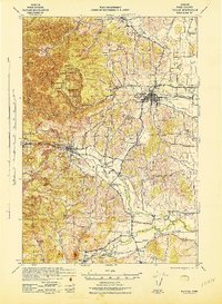
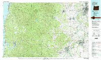 1980 Corvallis1981 Print · USGSThe Oregon Coast Range meets the fertile Willamette Valley in the early eighties, documenting a landscape of timber, agriculture, and growing college towns. Genealogists and historians can trace old rail lines like the Southern Pacific or locate landmarks like Marys Peak and the College of Education.
 - 2011 Map of Airlie North, 2011 Print
 2011 Airlie North2011 Print · USGSCovers Monmouth, including Airlie, Lewisville, and other nearby areas
 - 2014 Map of Airlie North, 2014 Print
 2014 Airlie North2014 Print · USGSCovers Monmouth, including Airlie, Lewisville, and other nearby areas
 - 2017 Map of Monmouth, 2017 Print
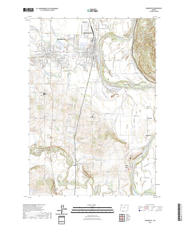
 2017 Monmouth2017 Print · USGSCovers Monmouth, including Independence, Hopville, and other nearby areas
 - 2020 Map of Monmouth, 2020 Print
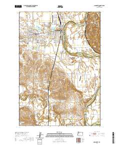 2020 Monmouth2020 Print · USGSCovers Monmouth, including Independence, Hopville, and other nearby areas
 - 2023 Map of Airlie North, 2023 Print
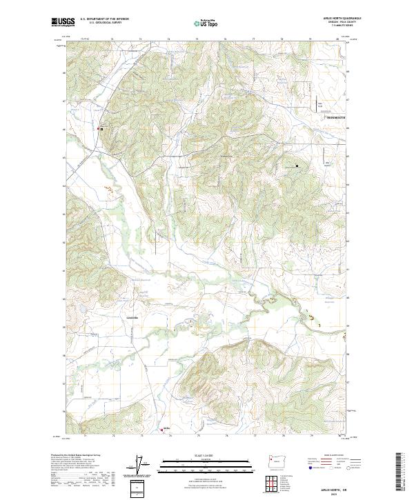 2023 Airlie North2023 Print · USGSAgricultural life in Polk County centers on the fertile valleys of the Luckiamute River and its tributaries. Researchers can trace local heritage through sites like the Hart Riggs Cemetery and the rural settlements of Lewisville and Airlie.
 - 2024 Map of Monmouth, 2024 Print
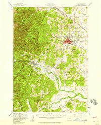
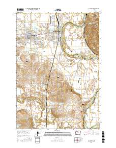
 2024 Monmouth2024 Print · USGSThe Willamette Valley towns of Monmouth and Independence are captured here alongside the winding Willamette River. Genealogists and researchers can trace family landmarks like Halls Ferry Cem, Western Oregon University, and the riverside settlement of Buena Vista.
End of results
Showing maps 1-21 of 21
Top cities near Monmouth
- Salem historical maps
- Albany historical maps
- Keizer historical maps
- Dallas historical maps
- Independence historical maps
- Jefferson historical maps
See more
Top neighborhoods of Monmouth
Frequently asked questions
- What are the different types of historical maps available for Monmouth?
- What is the oldest map of Monmouth?
- Where can I purchase historical maps of Monmouth for my home or office?
- Where can I download high-res historical maps of Monmouth?
- Are there historical topographic maps available for Monmouth?
- Is there historical aerial imagery available for Monmouth?
- Where are historical maps of Monmouth sourced from?