Old Maps of Imnaha, Oregon
Explore 7 old maps of Imnaha, spanning from 1954 to today. These high-resolution historic maps reveal how streets, neighborhoods, landmarks, and natural features evolved over time — perfect for genealogy, metal detecting, research, and local history exploration.
What you can do with these maps:
- See how Imnaha changed over time: Compare historical maps to modern-day views to trace roads, homesites, rail lines & more.
- View detailed metadata: Each map includes creators, publishers, year, scale, and archive source.
- Overlay maps with satellite & LiDAR: Visualize the past alongside modern tools to explore terrain & human change.
- Trusted historical sources: Maps sourced from the USGS, Library of Congress, and other archives.
- Access maps your way: View online, download high-res files, or order prints for personal or research use.
Start exploring old maps of Imnaha to uncover forgotten places, hidden landmarks, and the deep history beneath your feet.
Imnaha, OR maps
(7)- 1954 Map of Imnaha, 1958 Print
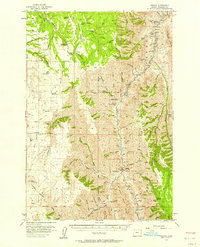 1954 Imnaha1958 Print · USGSNortheast Oregon ranching and canyon country are captured here during the mid-1950s, showing the intersection of private homesteads and national forest land. Researchers can find old landmarks like Zumwalt, the Imnaha School, and the Chesnimnus Cow Camp among the deep draws.2 unique versions available
 - 1955 Map of Grangeville, 1964 Print
 1955 Grangeville1964 Print · USGSThe high country of the Idaho-Oregon border comes alive in the mid-1950s, showing the deep river canyons and mountain peaks. Trace the Union Pacific RR through the valleys or locate settlements like Grangeville, Joseph, and the shoreline of Wallowa Lake.4 unique versions available
 - 1959 Map of Grangeville
 1959 Grangeville1959 Print · USGSThe high alpine peaks and deep river canyons of the Idaho-Oregon borderlands are captured in the late fifties. Researchers can trace the Union Pacific RR through the valleys to settlements like Enterprise, Union, and Grangeville.2 unique versions available
 - 1980 Map of Grangeville
 1980 Grangeville1980 Print · USGSGrangeville and the surrounding Camas Prairie are captured in the late twentieth century as the region balanced agriculture with its deep mining roots. Discover the locations of the Dewey Mine, the remote settlement of Florence, and the winding path of the Salmon River.
 - 1990 Map of Imnaha
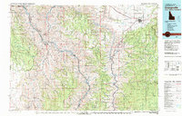
 1990 Imnaha1990 Print · USGSImnaha and the surrounding canyonlands appear in the late 1980s as a remote outpost of river-valley settlement and public forest land. Researchers can trace local landmarks like the Cem, the Gaging Station, and the winding route of Hat Point Road.
 - 2020 Map of Imnaha, 2020 Print
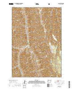 2020 Imnaha2020 Print · USGSCovers Imnaha, including Wallowa County, United States, and other nearby areas
 - 2023 Map of Imnaha, 2023 Print
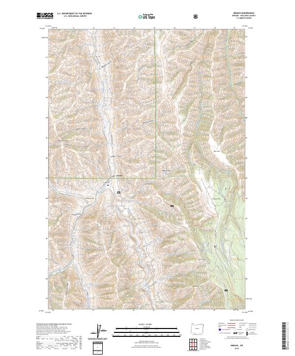 2023 Imnaha2023 Print · USGSWallowa County's canyon country remains a landscape of high ridges and river confluences in the early twenty-first century. Researchers can locate Imnaha Cem on Cemetery Hill or trace old routes like the Government Trl and Lower Imnaha Rd.
End of results
Showing maps 1-7 of 7
Frequently asked questions
- What are the different types of historical maps available for Imnaha?
- What is the oldest map of Imnaha?
- Where can I purchase historical maps of Imnaha for my home or office?
- Where can I download high-res historical maps of Imnaha?
- Are there historical topographic maps available for Imnaha?
- Is there historical aerial imagery available for Imnaha?
- Where are historical maps of Imnaha sourced from?