
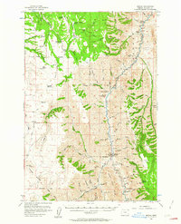
1954 Map of Imnaha
USGS Topo · Published 1958About this map
Wallowa National Forest land dominates this 1950s study of northeast Oregon, where the canyon-carved landscape of the Imnaha River meets high ridge country. The settlement at Zumwalt and its surrounding ranchlands show a pattern of isolated homesteads and public service outposts, such as the Zumwalt Sch (Aban'd) and the Chesnimnus Cow Camp. Cattle ranching is the primary footprint on the land, evidenced by several family-named properties including Berland Ranch, Steen Ranch, and Simmons Ranch.
Find a feature on this map
76 named features on this map. Tap any name to fly to it.
Don’t see what you’re looking for? This feature index may not catch every label — zoom into the map to look around manually.
Map Details
Editions of this 1954 Imnaha Map
2 editions found
Other maps of this area

1922 · He Devil
USGS Topo · 1:48,000

1954 · Kernan Point
USGS Topo · 1:62,500

1954 · Harl Butte
USGS Topo · 1:62,500

1955 · Grangeville
USGS Topo · 1:250,000

1957 · Joseph
USGS Topo · 1:62,500

1957 · He Devil
USGS Topo · 1:62,500

1957 · Elk Mountain
USGS Topo · 1:62,500

1959 · Grangeville
USGS Topo · 1:250,000

1963 · Cactus Mtn
USGS Topo · 1:24,000

1963 · Deadhorse Ridge
USGS Topo · 1:24,000