Old Maps of Joseph, Oregon for Academic Research
Study the evolution of Joseph with 10 high-resolution historic maps. Whether you're teaching, researching, or modeling changes in land use, these maps provide essential visual documentation of urban, environmental, and geographic change.
- Analyze long-term change: Track patterns in development, transportation, and natural features.
- Ideal for environmental or urban studies: Support academic projects with primary historical map data.
- Use in the classroom or lab: Educators and researchers rely on these maps to bring historical context to life.
These maps are a powerful tool for teaching, research, and visualizing how Joseph has changed over the decades.
Joseph, OR maps
(10)- 1955 Map of Grangeville, 1964 Print
 1955 Grangeville1964 Print · USGSThe high country of the Idaho-Oregon border comes alive in the mid-1950s, showing the deep river canyons and mountain peaks. Trace the Union Pacific RR through the valleys or locate settlements like Grangeville, Joseph, and the shoreline of Wallowa Lake.4 unique versions available
 - 1957 Map of Joseph
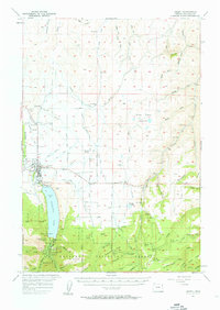 1957 Joseph1957 Print · USGSThe high valley and rugged mountain peaks of Wallowa County are captured here in the late fifties as agriculture and irrigation reshaped the landscape. Researchers can trace family sites at Pratt Sch and Liberty Grange or locate the historic Chief Joseph Cem near the shores of Wallowa Lake.3 unique versions available
 - 1959 Map of Grangeville
 1959 Grangeville1959 Print · USGSThe high alpine peaks and deep river canyons of the Idaho-Oregon borderlands are captured in the late fifties. Researchers can trace the Union Pacific RR through the valleys to settlements like Enterprise, Union, and Grangeville.2 unique versions available
 - 1986 Map of Enterprise, 1987 Print
 1986 Enterprise1987 Print · USGSThe high peaks and deep valleys of Northeast Oregon are captured in the mid-1980s, showcasing the transition from the Grande Ronde Valley to the wilderness. Researchers can trace the Union Pacific rail corridor through Telocaset or locate historic sites like Cornucopia and Medical Springs.
 - 1990 Map of Joseph
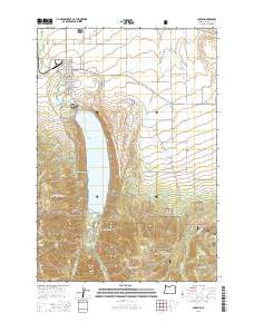
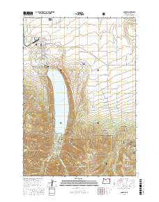
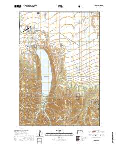
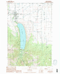 1990 Joseph1990 Print · USGSThe town of Joseph and its deep glacial lake are shown here in the 1990s as the area balanced mountain ranching with growing recreation. Researchers can find old mining sites like Transvaal Mines, the local Liberty Grange, and the Chief Joseph Cem.2 unique versions available
 - 2011 Map of Joseph, 2011 Print
 2011 Joseph2011 Print · USGSCovers Joseph, including Wallowa County, United States, and other nearby areas
 - 2014 Map of Joseph, 2014 Print
 2014 Joseph2014 Print · USGSCovers Joseph, including Wallowa County, United States, and other nearby areas
 - 2017 Map of Joseph, 2017 Print
 2017 Joseph2017 Print · USGSCovers Joseph, including Wallowa County, United States, and other nearby areas
 - 2020 Map of Joseph, 2020 Print
 2020 Joseph2020 Print · USGSCovers Joseph, including Wallowa County, United States, and other nearby areas
 - 2024 Map of Joseph, 2024 Print
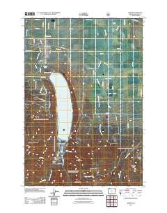
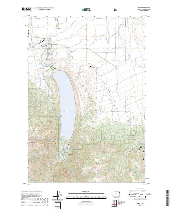 2024 Joseph2024 Print · USGSThe northern edge of the Wallowa Mountains comes alive in this current survey of the valley and its high peaks. Genealogists and researchers can trace local landmarks from Joseph down to Wallowa Lake, or locate remote sites like Wallowa Falls and the Joseph-Gem marker.
End of results
Showing maps 1-10 of 10
Top cities near Joseph
Frequently asked questions
- What are the different types of historical maps available for Joseph?
- What is the oldest map of Joseph?
- Where can I purchase historical maps of Joseph for my home or office?
- Where can I download high-res historical maps of Joseph?
- Are there historical topographic maps available for Joseph?
- Is there historical aerial imagery available for Joseph?
- Where are historical maps of Joseph sourced from?