Old Maps of Antelope, Oregon for Metal Detecting
Plan your next treasure hunt with 8 historic maps of Antelope. Find old homesites, ghost towns, trails, and gathering spots that may be lost to time — perfect for identifying promising metal detecting locations.
- Locate forgotten sites: Uncover places like long-lost settlements, abandoned rail lines, or gathering spots.
- Plan better hunts: Use map overlays combined with LiDAR or satellite views to narrow in on historically rich areas.
- Made for detectorists: Thousands of hobbyists use these maps to discover relics, coins, and hidden history.
Use these historic maps to boost your research and find new opportunities beneath the surface of Antelope.
Antelope, OR maps
(8)- 1955 Map of Bend, 1964 Print
 1955 Bend1964 Print · USGSCentral Oregon was undergoing significant growth in the mid-1960s as irrigation and infrastructure transformed the high desert. Researchers can trace the path of the Oregon Trunk Line, locate old stops like Gateway, and find landmarks like Lava Butte or the Grange.3 unique versions available
 - 1957 Map of Bend
 1957 Bend1957 Print · USGSCentral Oregon in the mid-fifties is a landscape of transition between the high Cascades and the arid volcanic plateau. Local historians can trace the rail corridors of the Oregon Trunk and locate early settlements like Ashwood, Odin Falls, and Camp Sherman.
 - 1958 Map of Bend
 1958 Bend1958 Print · USGSCentral Oregon in the late fifties was a land of high desert ranching and growing mountain towns. Researchers can trace the rail lines of the Oregon Trunk Railroad, find established settlements like Madras and Sisters, or locate landmarks such as Smith Rock and Lava Butte.
 - 1966 Map of Antelope, 1968 Print
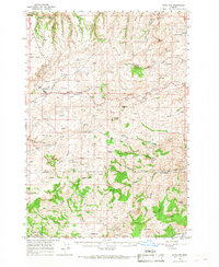 1966 Antelope1968 Print · USGSIn the mid-1960s, the high plateau of Central Oregon supported a mix of ranching and mining near the settlements of Shaniko and Antelope. Researchers can trace the mineral history of the region at the Oregon King Mine or locate early family markers at the Cemetery and Sorefoot Ranch.
 - 1981 Map of Stephenson Mountain, 1997 Print
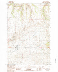
 1981 Stephenson Mountain1997 Print · USGSThe high-desert ranching and mining heart of North Central Oregon is captured here in the early eighties. Genealogists and historians can trace old settlements and mineral prospects from Shaniko to the Oregon King Mine and the John Day River canyon.
 - 1987 Map of Antelope, 1988 Print
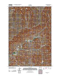
 1987 Antelope1988 Print · USGSAntelope is shown during the late 1980s, situated at the meeting point of high-desert canyons and vital watercourses. Genealogists and local historians can trace the town layout, the nearby settlement of Cold Camp, and local infrastructure like the Antelope Levee.
 - 2011 Map of Antelope, 2011 Print
 2011 Antelope2011 Print · USGSCovers Antelope, including Shaniko, Wasco County, and other nearby areas
 - 2023 Map of Antelope, 2023 Print
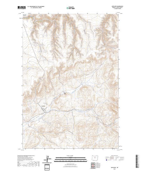 2023 Antelope2023 Print · USGSThe high desert country of Wasco County is documented here during the early twenty-first century, featuring the historic townsites of Antelope and Shaniko. You can trace local genealogy at Antelope Cem or follow the terrain from Antelope Valley through Wallace Canyon.
End of results
Showing maps 1-8 of 8
Top cities near Antelope
Frequently asked questions
- What are the different types of historical maps available for Antelope?
- What is the oldest map of Antelope?
- Where can I purchase historical maps of Antelope for my home or office?
- Where can I download high-res historical maps of Antelope?
- Are there historical topographic maps available for Antelope?
- Is there historical aerial imagery available for Antelope?
- Where are historical maps of Antelope sourced from?