Old Maps of Fossil, Oregon
Explore 22 old maps of Fossil, spanning from 1916 to today. These high-resolution historic maps reveal how streets, neighborhoods, landmarks, and natural features evolved over time — perfect for genealogy, metal detecting, research, and local history exploration.
What you can do with these maps:
- See how Fossil changed over time: Compare historical maps to modern-day views to trace roads, homesites, rail lines & more.
- View detailed metadata: Each map includes creators, publishers, year, scale, and archive source.
- Overlay maps with satellite & LiDAR: Visualize the past alongside modern tools to explore terrain & human change.
- Trusted historical sources: Maps sourced from the USGS, Library of Congress, and other archives.
- Access maps your way: View online, download high-res files, or order prints for personal or research use.
Start exploring old maps of Fossil to uncover forgotten places, hidden landmarks, and the deep history beneath your feet.
Fossil, OR maps
(22)- 1916 Map of Condon
 1916 Condon1916 Print · USGSNorth-central Oregon at the start of the twentieth century was a land of high plateaus and deep canyons centered on the Condon wheat country. Genealogists can trace a vast network of rural schoolhouses like Linville School and Buckhorn School, alongside early rail stops at Mikkalo and Gwendolen.3 unique versions available
 - 1926 Map of Mitchell
 1926 Mitchell1926 Print · USGSCentral Oregon ranching and geology are documented here in the mid-1920s, showing a landscape defined by the winding John River. Genealogists can locate family holdings like Old Frizzell Ranch and Laird Ranch alongside remote schoolhouses like Gable School.3 unique versions available
 - 1953 Map of The Dalles, 1965 Print
 1953 The Dalles1965 Print · USGSThe Columbia River Gorge at mid-century shows a region being transformed by massive hydroelectric dams and a growing highway network. Researchers can trace the development of The Dalles Dam, locate the Maryhill Museum, and find old rail stops in Rufus, Wishram, and Arlington.3 unique versions available
 - 1955 Map of Bend, 1964 Print
 1955 Bend1964 Print · USGSCentral Oregon was undergoing significant growth in the mid-1960s as irrigation and infrastructure transformed the high desert. Researchers can trace the path of the Oregon Trunk Line, locate old stops like Gateway, and find landmarks like Lava Butte or the Grange.3 unique versions available
 - 1956 Map of The Dalles
 1956 The Dalles1956 Print · USGSThe Columbia River Gorge and the high Cascades are captured in the mid-1950s, showing a vital corridor of rail and road. Researchers can trace the original path of The Old Oregon Trail or locate historical landmarks like the Maryhill Museum and Mount Hood.
 - 1957 Map of Bend
 1957 Bend1957 Print · USGSCentral Oregon in the mid-fifties is a landscape of transition between the high Cascades and the arid volcanic plateau. Local historians can trace the rail corridors of the Oregon Trunk and locate early settlements like Ashwood, Odin Falls, and Camp Sherman.
 - 1957 Map of The Dalles
 1957 The Dalles1957 Print · USGSThe Columbia River Gorge and the high plateaus of the mid-1950s come alive on this detailed survey of northern Oregon and southern Washington. Researchers can trace the path of the Oregon Trail and The Old Barlow Road alongside river towns like The Dalles and Wishram.
 - 1958 Map of Bend
 1958 Bend1958 Print · USGSCentral Oregon in the late fifties was a land of high desert ranching and growing mountain towns. Researchers can trace the rail lines of the Oregon Trunk Railroad, find established settlements like Madras and Sisters, or locate landmarks such as Smith Rock and Lava Butte.
 - 1966 Map of Kinzua, 1968 Print
 1966 Kinzua1968 Print · USGSWheeler County timber and river life are captured here in the mid-1960s, showing the intersection of logging and ranching. Trace the path of the Kinzua Pine Mills Co RR or locate family sites like Sutton Ranch and the IOOF Cem.
 - 1970 Map of Fossil North, 1973 Print
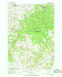
 1970 Fossil North1973 Print · USGSNorth of the Wheeler County seat in the early 1970s, the plateau gives way to the deep drainages of the John Day country. Researchers can locate the Mayville Cem, trace the winding Condon Kinzua & Southern railroad, and find local landmarks like Black Butte.
 - 1981 Map of Stephenson Mountain, 1997 Print
 1981 Stephenson Mountain1997 Print · USGSThe high-desert ranching and mining heart of North Central Oregon is captured here in the early eighties. Genealogists and historians can trace old settlements and mineral prospects from Shaniko to the Oregon King Mine and the John Day River canyon.
 - 1981 Map of Condon, 1997 Print
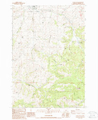
 1981 Condon1997 Print · USGSNorth-central Oregon in the early eighties reveals a vast plateau landscape defined by the deep canyons of the John Day and Deschutes rivers. Researchers can trace the rural legacy of the region through small hubs like Condon, Fossil, and the Old Railroad Grade.2 unique versions available
 - 1987 Map of Fossil South, 1988 Print
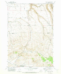
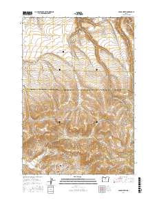
 1987 Fossil South1988 Print · USGSThe town of Fossil and its surrounding canyonlands are documented here during the late eighties, showing a landscape defined by ranching and forestry. Researchers can trace local landmarks like the Cem, Fossil Butte, and the State Forestry Headquarters.
 - 2011 Map of Fossil South, 2011 Print
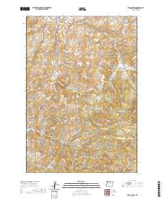
 2011 Fossil South2011 Print · USGSCovers Fossil, including Wheeler County, United States, and other nearby areas
 - 2011 Map of Fossil North, 2011 Print
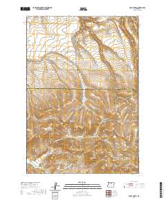
 2011 Fossil North2011 Print · USGSCovers Fossil, including Mayville, Wheeler County, and other nearby areas
 - 2014 Map of Fossil North, 2014 Print
 2014 Fossil North2014 Print · USGSCovers Fossil, including Mayville, Wheeler County, and other nearby areas
 - 2014 Map of Fossil South, 2014 Print
 2014 Fossil South2014 Print · USGSCovers Fossil, including Wheeler County, United States, and other nearby areas
 - 2017 Map of Fossil North, 2017 Print
 2017 Fossil North2017 Print · USGSCovers Fossil, including Mayville, Wheeler County, and other nearby areas
 - 2020 Map of Fossil North, 2020 Print
 2020 Fossil North2020 Print · USGSCovers Fossil, including Mayville, Wheeler County, and other nearby areas
 - 2020 Map of Fossil South, 2020 Print
 2020 Fossil South2020 Print · USGSCovers Fossil, including Wheeler County, United States, and other nearby areas
 - 2023 Map of Fossil South, 2023 Print
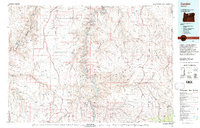
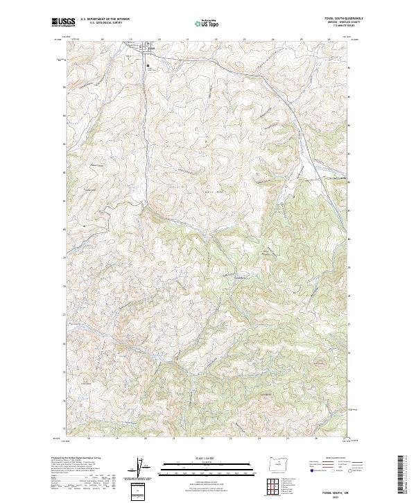 2023 Fossil South2023 Print · USGSThe high country of Wheeler County comes into focus in this contemporary survey of the area surrounding Fossil. Researchers can locate the Wheeler County Courthouse, trace family roots at the Fossil IOOF Cem, or explore names like Schoolhouse Canyon and Old Mill Canyon.
 - 2023 Map of Fossil North, 2023 Print
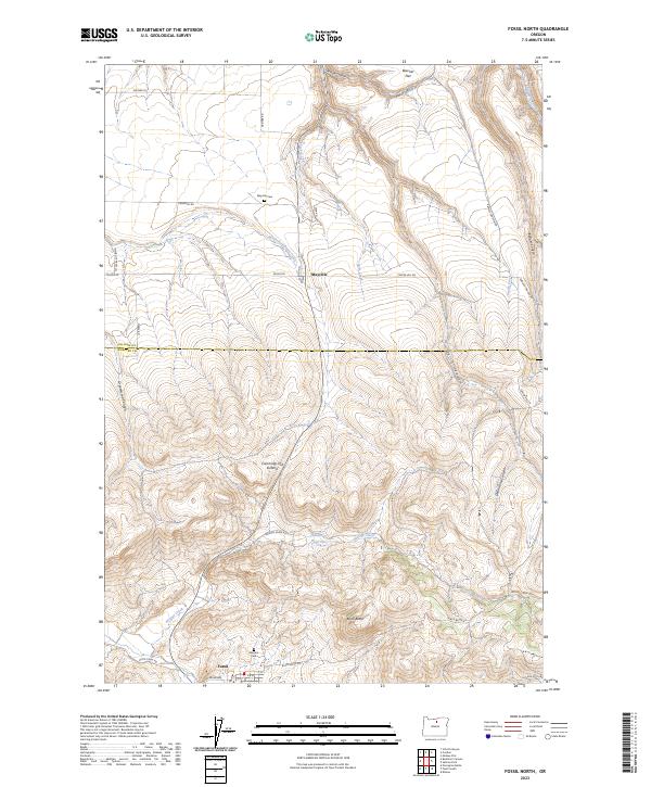 2023 Fossil North2023 Print · USGSThe high plateau of Gilliam and Wheeler counties comes into focus in this recent survey of Fossil and its northern reaches. Researchers can trace land use around Mayville, locate the Masonic Cem, and follow the winding course of Hoover Creek.
End of results
Showing maps 1-22 of 22
Frequently asked questions
- What are the different types of historical maps available for Fossil?
- What is the oldest map of Fossil?
- Where can I purchase historical maps of Fossil for my home or office?
- Where can I download high-res historical maps of Fossil?
- Are there historical topographic maps available for Fossil?
- Is there historical aerial imagery available for Fossil?
- Where are historical maps of Fossil sourced from?