2020s Maps of Penn Hills, Pennsylvania
Explore 3 historic maps of Penn Hills from the 2020s. These maps offer a rare glimpse into what life looked like during the 2020s — showing old roads, neighborhoods, homes, and landmarks that have changed or disappeared over time.
Whether you're researching your family's past, planning a metal detecting trip, or studying how Penn Hills's landscape evolved across the 2020s, these high-resolution maps are a powerful tool for exploring the history of this region.
- Focus on a specific era: All maps on this page are from the 2020s, giving you a focused view of this time period.
- See what’s changed: Compare century-old streets, trails, and buildings to today's modern landscape using overlays and satellite layers.
- Research with precision: Use these maps for genealogy, historical research, land use analysis, or educational projects.
- View, download, or print: Maps are fully viewable online in high resolution, and can be downloaded or printed for your own records.
Start exploring Penn Hills's history through authentic maps from the 2020s. This is your window into the past.
Penn Hills, PA maps
(3)- 2023 Map of Pittsburgh East, 2023 Print
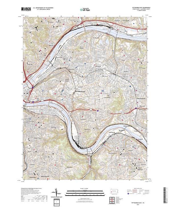 2023 Pittsburgh East2023 Print · USGSAllegheny County's industrial heart and urban neighborhoods are shown in extensive detail as they appear in the early twenty-first century. Genealogists and researchers can trace dozens of religious sites and burial grounds like Homewood Cem and the Saint Paul of the Cross Monastery.
 - 2023 Map of New Kensington West, 2023 Print
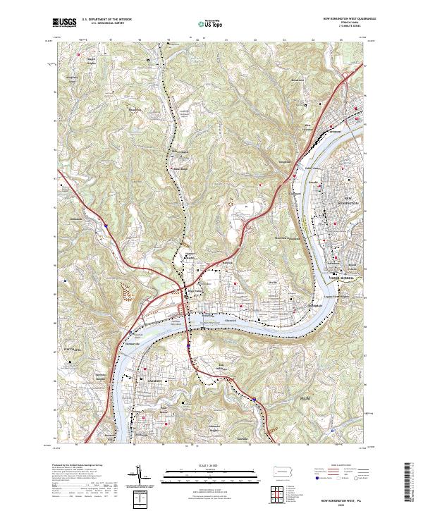 2023 New Kensington West2023 Print · USGSThe industrial corridor of the Allegheny River valley is captured here in the contemporary era, showing the dense suburban development of Oakmont and New Kensington. Researchers can trace local history through numerous sites like Oakmont Verona Cem, the Pittsburgh Northeast Airport, and islands such as Fourteen Mile Island.
 - 2023 Map of Braddock, 2023 Print
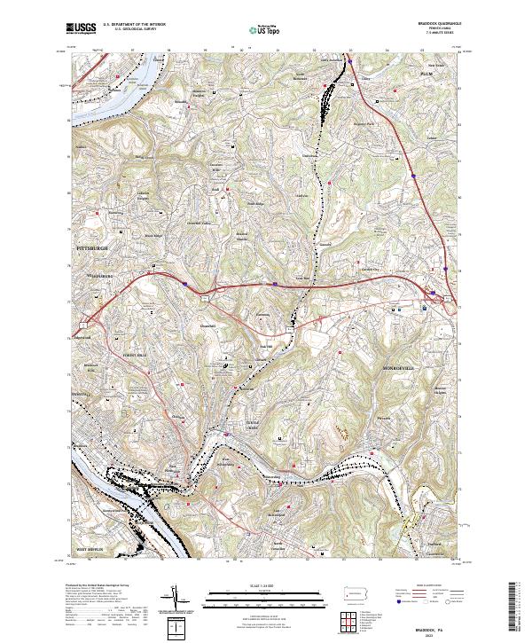 2023 Braddock2023 Print · USGSEastern Allegheny County is shown here in the 2020s, where riverfront industry meets sprawling residential hillsides. Genealogy researchers can trace family plots at Richey Family Cem or study rail history at Unity Junction.
End of results
Showing maps 1-3 of 3
Top cities near Penn Hills
- Pittsburgh historical maps
- Bethel Park historical maps
- Ross Township historical maps
- Mount Lebanon historical maps
- McCandless historical maps
- Monroeville historical maps
See more
Top neighborhoods of Penn Hills
- Hunter Heights historical maps
- Milltown historical maps
- Sandy Creek historical maps
- Government Center historical maps
- Churchill Valley historical maps
- Eastwood historical maps
See more
Frequently asked questions
- What are the different types of historical maps available for Penn Hills?
- What is the oldest map of Penn Hills?
- Where can I purchase historical maps of Penn Hills for my home or office?
- Where can I download high-res historical maps of Penn Hills?
- Are there historical topographic maps available for Penn Hills?
- Is there historical aerial imagery available for Penn Hills?
- Where are historical maps of Penn Hills sourced from?