Old Maps of South Shore, Pittsburgh
Explore 27 old maps of South Shore, spanning from 1904 to today. These high-resolution historic maps reveal how streets, neighborhoods, landmarks, and natural features evolved over time — perfect for genealogy, metal detecting, research, and local history exploration.
What you can do with these maps:
- See how South Shore changed over time: Compare historical maps to modern-day views to trace roads, homesites, rail lines & more.
- View detailed metadata: Each map includes creators, publishers, year, scale, and archive source.
- Overlay maps with satellite & LiDAR: Visualize the past alongside modern tools to explore terrain & human change.
- Trusted historical sources: Maps sourced from the USGS, Library of Congress, and other archives.
- Access maps your way: View online, download high-res files, or order prints for personal or research use.
Start exploring old maps of South Shore to uncover forgotten places, hidden landmarks, and the deep history beneath your feet.
South Shore, Pittsburgh maps
(27)- 1904 Map of Mc Keesport
 1904 Mc Keesport1904 Print · USGSCovers South Shore, including Pittsburgh, Penn Hills, and other nearby areas2 unique versions available
 - 1904 Map of Carnegie, 1954 Print
 1904 Carnegie1954 Print · USGSCovers South Shore, including Pittsburgh, Bethel Park, and other nearby areas
 - 1906 Map of Carnegie
 1906 Carnegie1906 Print · USGSCovers South Shore, including Pittsburgh, Bethel Park, and other nearby areas7 unique versions available
 - 1907 Map of Pittsburg
 1907 Pittsburg1907 Print · USGSCovers South Shore, including Pittsburgh, Penn Hills, and other nearby areas10 unique versions available
 - 1908 Map of Carnegie, 1910 Print
 1908 Carnegie1910 Print · USGSCovers South Shore, including Pittsburgh, Bethel Park, and other nearby areas
 - 1948 Map of Pittsburgh West, 1954 Print
 1948 Pittsburgh West1954 Print · USGSCovers South Shore, including Pittsburgh, Ross Township, and other nearby areas
 - 1951 Map of Pittsburgh West
 1951 Pittsburgh West1951 Print · USGSCovers South Shore, including Pittsburgh, Ross Township, and other nearby areas3 unique versions available
 - 1951 Map of Pittsburg East
 1951 Pittsburg East1951 Print · USGSCovers South Shore, including Pittsburgh, Penn Hills, and other nearby areas3 unique versions available
 - 1951 Map of Canton
 1951 Canton1951 Print · USGSCovers South Shore, including Pittsburgh, Akron, and other nearby areas
 - 1953 Map of Pittsburgh
 1953 Pittsburgh1953 Print · USGSCovers South Shore, including Pittsburgh, Penn Hills, and other nearby areas
 - 1953 Map of Canton
 1953 Canton1953 Print · USGSCovers South Shore, including Pittsburgh, Akron, and other nearby areas
 - 1954 Map of Pittsburgh
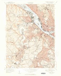
 1954 Pittsburgh1954 Print · USGSCovers South Shore, including Pittsburgh, Penn Hills, and other nearby areas2 unique versions available
 - 1956 Map of Pittsburgh East, 1959 Print
 1956 Pittsburgh East1959 Print · USGSCovers South Shore, including Pittsburgh, Penn Hills, and other nearby areas
 - 1956 Map of Pittsburgh West, 1959 Print
 1956 Pittsburgh West1959 Print · USGSCovers South Shore, including Pittsburgh, Ross Township, and other nearby areas
 - 1957 Map of Canton, 1971 Print
 1957 Canton1971 Print · USGSCovers South Shore, including Pittsburgh, Akron, and other nearby areas3 unique versions available
 - 1958 Map of Pittsburgh
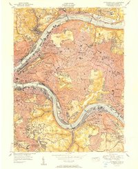
 1958 Pittsburgh1958 Print · USGSCovers South Shore, including Pittsburgh, Penn Hills, and other nearby areas5 unique versions available
 - 1959 Map of Pittsburgh
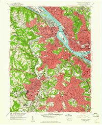
 1959 Pittsburgh1959 Print · USGSCovers South Shore, including Pittsburgh, Penn Hills, and other nearby areas
 - 1960 Map of Pittsburgh West, 1961 Print
 1960 Pittsburgh West1961 Print · USGSCovers South Shore, including Pittsburgh, Ross Township, and other nearby areas4 unique versions available
 - 1960 Map of Pittsburgh East, 1961 Print
 1960 Pittsburgh East1961 Print · USGSCovers South Shore, including Pittsburgh, Penn Hills, and other nearby areas4 unique versions available
 - 1962 Map of Canton
 1962 Canton1962 Print · USGSCovers South Shore, including Pittsburgh, Akron, and other nearby areas2 unique versions available
 - 1964 Map of Pittsburgh
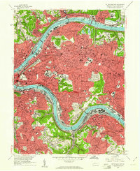
 1964 Pittsburgh1964 Print · USGSCovers South Shore, including Pittsburgh, Penn Hills, and other nearby areas
 - 1986 Map of Pittsburgh West
 1986 Pittsburgh West1986 Print · USGSCovers South Shore, including Pittsburgh, Bethel Park, and other nearby areas3 unique versions available
 - 1986 Map of Pittsburgh East
 1986 Pittsburgh East1986 Print · USGSCovers South Shore, including Pittsburgh, Penn Hills, and other nearby areas3 unique versions available
 - 1993 Map of Pittsburgh West, 1994 Print
 1993 Pittsburgh West1994 Print · USGSCovers South Shore, including Pittsburgh, Ross Township, and other nearby areas2 unique versions available
 - 1993 Map of Pittsburgh East, 1994 Print
 1993 Pittsburgh East1994 Print · USGSCovers South Shore, including Pittsburgh, Penn Hills, and other nearby areas2 unique versions available
Showing maps 1-25 of 27
Frequently asked questions
- What are the different types of historical maps available for South Shore?
- What is the oldest map of South Shore?
- Where can I purchase historical maps of South Shore for my home or office?
- Where can I download high-res historical maps of South Shore?
- Are there historical topographic maps available for South Shore?
- Is there historical aerial imagery available for South Shore?
- Where are historical maps of South Shore sourced from?