Old Maps of Mahoning Township, Pennsylvania for Academic Research
Study the evolution of Mahoning Township with 33 high-resolution historic maps. Whether you're teaching, researching, or modeling changes in land use, these maps provide essential visual documentation of urban, environmental, and geographic change.
- Analyze long-term change: Track patterns in development, transportation, and natural features.
- Ideal for environmental or urban studies: Support academic projects with primary historical map data.
- Use in the classroom or lab: Educators and researchers rely on these maps to bring historical context to life.
These maps are a powerful tool for teaching, research, and visualizing how Mahoning Township has changed over the decades.
Mahoning Township, PA maps
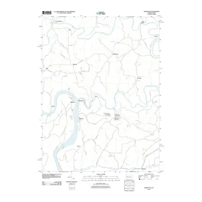
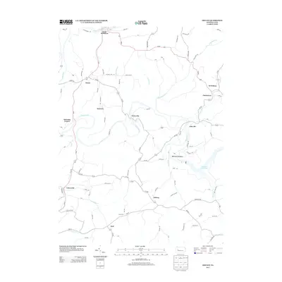
(33)- 1901 Map of Rural Valley, 1957 Print
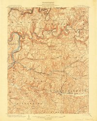
 1901 Rural Valley1957 Print · USGSArmstrong County’s river valleys and iron-working hamlets are captured here at the start of the twentieth century. Researchers can trace the legacy of early industry at Mahoning Furnace or follow the path of the Pennsylvania R.R. through Templeton.2 unique versions available
 - 1903 Map of Rural Valley
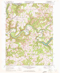
 1903 Rural Valley1903 Print · USGSArmstrong County at the dawn of the twentieth century shows a landscape defined by iron furnaces and winding river valleys. Genealogists can trace family roots in early settlements like Templeton, Goheenville, and Putneyville or locate landmarks such as Mahoning Furnace and Stone House.6 unique versions available
 - 1906 Map of Clarion
 1906 Clarion1906 Print · USGSClarion County at the turn of the century is defined by its deep river valleys and a bustling network of narrow-gauge railroads and coal mines. Genealogists and historians can trace dozens of rural schoolhouses and churches, from Concord Church to the Burma (Five Points) School and the early mines of Rimersburg.2 unique versions available
 - 1907 Map of Clarion
 1907 Clarion1907 Print · USGSClarion County at the dawn of the twentieth century shows a landscape shaped by coal mining and a complex rail network. Genealogists can locate specific family landmarks like Acme Mines, Concord Church, and rural outposts such as Limestone P.O..5 unique versions available
 - 1953 Map of Pittsburgh
 1953 Pittsburgh1953 Print · USGSWestern Pennsylvania's industrial landscape at the start of the fifties shows the steel and rail corridors between Pittsburgh and Altoona. Trace family roots in river towns like Tarentum or follow the Pennsylvania Turnpike across Laurel Hill.
 - 1954 Map of Pittsburgh
 1954 Pittsburgh1954 Print · USGSWestern Pennsylvania in the early fifties remains a powerhouse of heavy industry and vital transit corridors. Genealogists and historians can trace the rail-and-river network connecting Pittsburgh, Johnstown, and Altoona via the Pennsylvania RR and the Lincoln Highway.2 unique versions available
 - 1957 Map of Warren, 1964 Print
 1957 Warren1964 Print · USGSThe northern Pennsylvania oil and timber country comes into focus in the mid-fifties, showing the region before modern highway expansions. Trace the industrial rail networks of the Pennsylvania RR and the early Allegheny River Reservoir near Warren and Oil City.4 unique versions available
 - 1958 Map of Pittsburgh
 1958 Pittsburgh1958 Print · USGSWestern Pennsylvania in the late fifties shows an industrial heartland defined by the confluence of the Allegheny River and Monongahela River. Researchers can trace the sprawling rail networks of the Pennsylvania RR and find established towns like Butler, Latrobe, and Windber.5 unique versions available
 - 1958 Map of Warren
 1958 Warren1958 Print · USGSNorthern Pennsylvania’s timber and oil country is captured here during the late fifties, showing the interplay of industrial valleys and vast state forests. Genealogists can trace family connections across the Cornplanter Indian Reservation or through rail hubs like Oil City and Saint Marys.
 - 1959 Map of Warren
 1959 Warren1959 Print · USGSNorthern Pennsylvania's oil and timber country comes alive in this late-fifties study of the forest-clad plateaus. Trace the historic Cornplanter (Indian Reservation), the sprawling Oil Field, and the rail lines of the Pennsylvania RR.2 unique versions available
 - 1959 Map of Pittsburgh
 1959 Pittsburgh1959 Print · USGSWestern Pennsylvania in the late fifties is captured here at the height of its industrial era. Genealogists and historians can trace the riverfront growth of Pittsburgh, the rail works at Altoona, and the mountain gaps of Laurel Hill.
 - 1964 Map of Pittsburgh
 1964 Pittsburgh1964 Print · USGSWestern Pennsylvania in the late fifties and early sixties shows a landscape of powerful river industries and expanding highways. Genealogists and historians can trace the rail corridors of the Pennsylvania RR through industrial hubs like Johnstown, Altoona, and Nanty Glo.
 - 1969 Map of Distant, 1972 Print
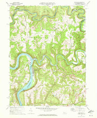
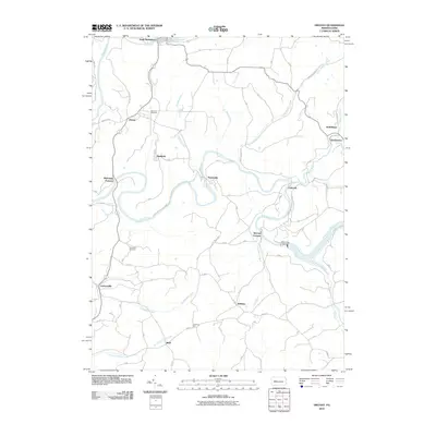
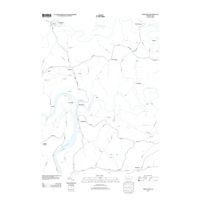
 1969 Distant1972 Print · USGSArmstrong County is shaped by heavy industry and deep river valleys in the late sixties, just as the regional landscape was being transformed by resource extraction. Genealogists can trace family roots through sites like Oakland Cem or Jerusalem Ch while following the path of the Penn Central through South Bethlehem.3 unique versions available
 - 1969 Map of Templeton, 1972 Print
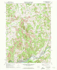
 1969 Templeton1972 Print · USGSArmstrong and Clarion Counties are mapped here in the late sixties, showing a landscape defined by mining and river commerce. Researchers can trace the rail paths of the Pittsburg and Shawmut, locate old Coke Ovens, and find family sites like Duncan Cem.4 unique versions available
 - 1969 Map of New Bethlehem, 1972 Print
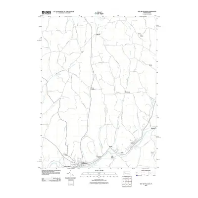
 1969 New Bethlehem1972 Print · USGSThe Redbank Creek valley in the late 1960s was a bustling hub of rail and industry. Researchers can trace the legacy of the Gas Field and Strip Mine workings surrounding New Bethlehem, Hawthorn, and Fairmount City.2 unique versions available
 - 1971 Map of Warren
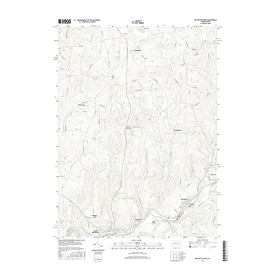
 1971 Warren1971 Print · USGSNorth Central Pennsylvania is captured here in the early seventies, showing a landscape defined by industrial centers and massive state forests. Genealogists and historians can trace the rail lines of the Penn Central and Erie Lackawanna connecting towns like Warren, Kane, and Du Bois.
 - 1983 Map of Indiana
 1983 Indiana1983 Print · USGSWestern Pennsylvania in the early eighties shows a landscape of industrial river towns and expanding university campuses. Genealogists can trace family roots through Lucernemines and Spring Church, or locate ancestors in Oakland Cemetery.
 - 1983 Map of Oil City, 1984 Print
 1983 Oil City1984 Print · USGSThe Allegheny and Clarion river valleys are shown in the early eighties as a hub of rail lines and conservation lands. Genealogists can trace family connections in Oil City and Franklin or locate rural sites like the Pennsylvania State Hospital and School and Coal City.
 - 2010 Map of Templeton, 2010 Print
 2010 Templeton2010 Print · USGSCovers Mahoning Township, including Mahoning, Washington Township, and other nearby areas
 - 2010 Map of Distant, 2010 Print
 2010 Distant2010 Print · USGSCovers Mahoning Township, including South Bethlehem, Belknap, and other nearby areas
 - 2010 Map of New Bethlehem, 2010 Print
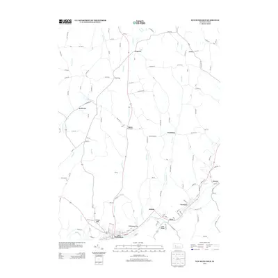
 2010 New Bethlehem2010 Print · USGSCovers Mahoning Township, including Limestone Township, New Bethlehem, and other nearby areas
 - 2013 Map of New Bethlehem, 2013 Print
 2013 New Bethlehem2013 Print · USGSCovers Mahoning Township, including Limestone Township, New Bethlehem, and other nearby areas
 - 2013 Map of Distant, 2013 Print
 2013 Distant2013 Print · USGSCovers Mahoning Township, including South Bethlehem, Belknap, and other nearby areas
 - 2013 Map of Templeton, 2013 Print
 2013 Templeton2013 Print · USGSCovers Mahoning Township, including Mahoning, Washington Township, and other nearby areas
 - 2016 Map of New Bethlehem, 2016 Print
 2016 New Bethlehem2016 Print · USGSCovers Mahoning Township, including Limestone Township, New Bethlehem, and other nearby areas
Showing maps 1-25 of 33
Top cities near Mahoning Township
- Kittanning historical maps
- Rayne Township historical maps
- Ford City historical maps
- North Buffalo Township historical maps
- Limestone Township historical maps
- West Kittanning historical maps
See more
Top neighborhoods of Mahoning Township
- Distant historical maps
- Mahoning Furnace historical maps
- Putneyville historical maps
- Seminole historical maps
- Climax historical maps
Frequently asked questions
- What are the different types of historical maps available for Mahoning Township?
- What is the oldest map of Mahoning Township?
- Where can I purchase historical maps of Mahoning Township for my home or office?
- Where can I download high-res historical maps of Mahoning Township?
- Are there historical topographic maps available for Mahoning Township?
- Is there historical aerial imagery available for Mahoning Township?
- Where are historical maps of Mahoning Township sourced from?