Old Maps of Hamburg, Pennsylvania
Explore 21 old maps of Hamburg, spanning from 1889 to today. These high-resolution historic maps reveal how streets, neighborhoods, landmarks, and natural features evolved over time — perfect for genealogy, metal detecting, research, and local history exploration.
What you can do with these maps:
- See how Hamburg changed over time: Compare historical maps to modern-day views to trace roads, homesites, rail lines & more.
- View detailed metadata: Each map includes creators, publishers, year, scale, and archive source.
- Overlay maps with satellite & LiDAR: Visualize the past alongside modern tools to explore terrain & human change.
- Trusted historical sources: Maps sourced from the USGS, Library of Congress, and other archives.
- Access maps your way: View online, download high-res files, or order prints for personal or research use.
Start exploring old maps of Hamburg to uncover forgotten places, hidden landmarks, and the deep history beneath your feet.
Hamburg, PA maps
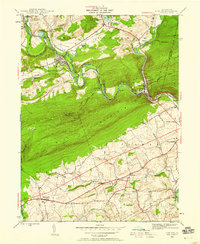
(21)- 1889 Map of Pottsville, 1964 Print
 1889 Pottsville1964 Print · USGSCovers Hamburg, including Pottsville, Schuylkill Haven, and other nearby areas
 - 1891 Map of Pottsville
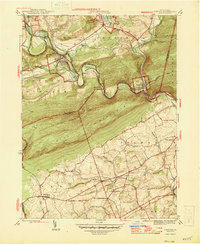
 1891 Pottsville1891 Print · USGSCovers Hamburg, including Pottsville, Schuylkill Haven, and other nearby areas10 unique versions available
 - 1909 Map of Hamburg, 1957 Print
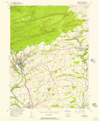
 1909 Hamburg1957 Print · USGSCovers Hamburg, including Maxatawny Township, Kutztown, and other nearby areas
 - 1911 Map of Hamburg
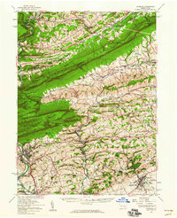
 1911 Hamburg1911 Print · USGSCovers Hamburg, including Maxatawny Township, Kutztown, and other nearby areas5 unique versions available
 - 1944 Map of Newark, 1971 Print
 1944 Newark1971 Print · USGSCovers Hamburg, including New York, Philadelphia, and other nearby areas5 unique versions available
 - 1945 Map of Auburn, 1958 Print
 1945 Auburn1958 Print · USGSCovers Hamburg, including Auburn, Port Clinton, and other nearby areas6 unique versions available
 - 1946 Map of Auburn
 1946 Auburn1946 Print · USGSCovers Hamburg, including Auburn, Port Clinton, and other nearby areas2 unique versions available
 - 1949 Map of Newark
 1949 Newark1949 Print · USGSCovers Hamburg, including New York, Philadelphia, and other nearby areas3 unique versions available
 - 1950 Map of Harrisburg, 1952 Print
 1950 Harrisburg1952 Print · USGSCovers Hamburg, including Lancaster, Harrisburg, and other nearby areas
 - 1956 Map of Newark
 1956 Newark1956 Print · USGSCovers Hamburg, including New York, Philadelphia, and other nearby areas2 unique versions available
 - 1956 Map of Hamburg, 1957 Print
 1956 Hamburg1957 Print · USGSCovers Hamburg, including Albany Township, Shoemakersville, and other nearby areas10 unique versions available
 - 1956 Map of Hamburg, 1960 Print
 1956 Hamburg1960 Print · USGSCovers Hamburg, including Maxatawny Township, Kutztown, and other nearby areas2 unique versions available
 - 1957 Map of Harrisburg
 1957 Harrisburg1957 Print · USGSCovers Hamburg, including Lancaster, Harrisburg, and other nearby areas7 unique versions available
 - 1957 Map of Newark
 1957 Newark1957 Print · USGSCovers Hamburg, including New York, Philadelphia, and other nearby areas
 - 1960 Map of Newark
 1960 Newark1960 Print · USGSCovers Hamburg, including New York, Philadelphia, and other nearby areas3 unique versions available
 - 1961 Map of Harrisburg
 1961 Harrisburg1961 Print · USGSCovers Hamburg, including Lancaster, Harrisburg, and other nearby areas2 unique versions available
 - 1964 Map of Newark
 1964 Newark1964 Print · USGSCovers Hamburg, including New York, Philadelphia, and other nearby areas2 unique versions available
 - 1964 Map of Harrisburg
 1964 Harrisburg1964 Print · USGSCovers Hamburg, including Lancaster, Harrisburg, and other nearby areas
 - 1984 Map of Allentown, 1985 Print
 1984 Allentown1985 Print · USGSCovers Hamburg, including Allentown, Bethlehem, and other nearby areas3 unique versions available
 - 1984 Map of Sunbury, 1985 Print
 1984 Sunbury1985 Print · USGSCovers Hamburg, including Bloomsburg, Pottsville, and other nearby areas2 unique versions available
 - 1999 Map of Auburn, 2001 Print
 1999 Auburn2001 Print · USGSCovers Hamburg, including Auburn, Port Clinton, and other nearby areas
End of results
Showing maps 1-21 of 21
Top cities near Hamburg
- Reading historical maps
- Muhlenberg Park historical maps
- Pottsville historical maps
- Maxatawny Township historical maps
- Tamaqua historical maps
- Schuylkill Haven historical maps
See more
Frequently asked questions
- What are the different types of historical maps available for Hamburg?
- What is the oldest map of Hamburg?
- Where can I purchase historical maps of Hamburg for my home or office?
- Where can I download high-res historical maps of Hamburg?
- Are there historical topographic maps available for Hamburg?
- Is there historical aerial imagery available for Hamburg?
- Where are historical maps of Hamburg sourced from?