Old Maps of Bensalem Township, Pennsylvania
Explore 23 old maps of Bensalem Township, spanning from 1890 to today. These high-resolution historic maps reveal how streets, neighborhoods, landmarks, and natural features evolved over time — perfect for genealogy, metal detecting, research, and local history exploration.
What you can do with these maps:
- See how Bensalem Township changed over time: Compare historical maps to modern-day views to trace roads, homesites, rail lines & more.
- View detailed metadata: Each map includes creators, publishers, year, scale, and archive source.
- Overlay maps with satellite & LiDAR: Visualize the past alongside modern tools to explore terrain & human change.
- Trusted historical sources: Maps sourced from the USGS, Library of Congress, and other archives.
- Access maps your way: View online, download high-res files, or order prints for personal or research use.
Start exploring old maps of Bensalem Township to uncover forgotten places, hidden landmarks, and the deep history beneath your feet.
Bensalem Township, PA maps
(23)- 1890 Map of Burlington
 1890 Burlington1890 Print · USGSCovers Bensalem Township, including Philadelphia, Hamilton Township, and other nearby areas
 - 1893 Map of Burlington
 1893 Burlington1893 Print · USGSCovers Bensalem Township, including Philadelphia, Hamilton Township, and other nearby areas3 unique versions available
 - 1904 Map of Burlington, 1958 Print
 1904 Burlington1958 Print · USGSCovers Bensalem Township, including Philadelphia, Hamilton Township, and other nearby areas
 - 1906 Map of Burlington
 1906 Burlington1906 Print · USGSCovers Bensalem Township, including Philadelphia, Hamilton Township, and other nearby areas6 unique versions available
 - 1907 Map of Trenton
 1907 Trenton1907 Print · USGSCovers Bensalem Township, including Philadelphia, Hamilton Township, and other nearby areas4 unique versions available
 - 1942 Map of Burlington
 1942 Burlington1942 Print · USGSCovers Bensalem Township, including Philadelphia, Hamilton Township, and other nearby areas
 - 1944 Map of Langhorne, 1947 Print
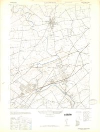 1944 Langhorne1947 Print · USGSCovers Bensalem Township, including Philadelphia, Middletown Township, and other nearby areas
 - 1944 Map of Newark, 1971 Print
 1944 Newark1971 Print · USGSCovers Bensalem Township, including New York, Philadelphia, and other nearby areas5 unique versions available
 - 1947 Map of Langhorne
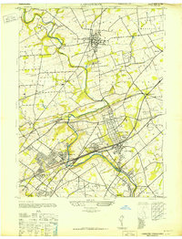 1947 Langhorne1947 Print · USGSCovers Bensalem Township, including Philadelphia, Middletown Township, and other nearby areas
 - 1947 Map of Beverly
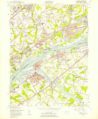
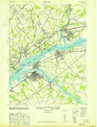 1947 Beverly1947 Print · USGSCovers Bensalem Township, including Philadelphia, Mount Laurel Township, and other nearby areas
 - 1949 Map of Newark
 1949 Newark1949 Print · USGSCovers Bensalem Township, including New York, Philadelphia, and other nearby areas3 unique versions available
 - 1953 Map of Langhorne, 1955 Print
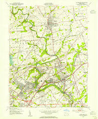 1953 Langhorne1955 Print · USGSCovers Bensalem Township, including Philadelphia, Middletown Township, and other nearby areas2 unique versions available
 - 1955 Map of Beverly, 1957 Print
 1955 Beverly1957 Print · USGSCovers Bensalem Township, including Philadelphia, Mount Laurel Township, and other nearby areas3 unique versions available
 - 1956 Map of Newark
 1956 Newark1956 Print · USGSCovers Bensalem Township, including New York, Philadelphia, and other nearby areas2 unique versions available
 - 1957 Map of Newark
 1957 Newark1957 Print · USGSCovers Bensalem Township, including New York, Philadelphia, and other nearby areas
 - 1960 Map of Newark
 1960 Newark1960 Print · USGSCovers Bensalem Township, including New York, Philadelphia, and other nearby areas3 unique versions available
 - 1964 Map of Newark
 1964 Newark1964 Print · USGSCovers Bensalem Township, including New York, Philadelphia, and other nearby areas2 unique versions available
 - 1966 Map of Langhorne, 1968 Print
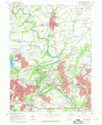 1966 Langhorne1968 Print · USGSCovers Bensalem Township, including Philadelphia, Middletown Township, and other nearby areas2 unique versions available
 - 1966 Map of Beverly, 1969 Print
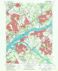 1966 Beverly1969 Print · USGSCovers Bensalem Township, including Philadelphia, Mount Laurel Township, and other nearby areas5 unique versions available
 - 1982 Map of Trenton, 1983 Print
 1982 Trenton1983 Print · USGSCovers Bensalem Township, including New York, Philadelphia, and other nearby areas
 - 1986 Map of Trenton, 1987 Print
 1986 Trenton1987 Print · USGSCovers Bensalem Township, including New York, Philadelphia, and other nearby areas
 - 1993 Map of Langhorne, 1998 Print
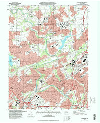 1993 Langhorne1998 Print · USGSCovers Bensalem Township, including Philadelphia, Middletown Township, and other nearby areas
 - 1995 Map of Beverly, 2000 Print
 1995 Beverly2000 Print · USGSCovers Bensalem Township, including Philadelphia, Mount Laurel Township, and other nearby areas
End of results
Showing maps 1-23 of 23
Top cities near Bensalem Township
- Philadelphia historical maps
- Hamilton Township historical maps
- Trenton historical maps
- Camden historical maps
- Cherry Hill Township historical maps
- Abington Township historical maps
See more
Top neighborhoods of Bensalem Township
- La Trappe historical maps
- Trevose historical maps
- Echo Beach historical maps
- Eddington Park historical maps
- Ellerslie historical maps
- Flushing historical maps
See more
Frequently asked questions
- What are the different types of historical maps available for Bensalem Township?
- What is the oldest map of Bensalem Township?
- Where can I purchase historical maps of Bensalem Township for my home or office?
- Where can I download high-res historical maps of Bensalem Township?
- Are there historical topographic maps available for Bensalem Township?
- Is there historical aerial imagery available for Bensalem Township?
- Where are historical maps of Bensalem Township sourced from?