2020s Maps of Elmora, West Carroll Township
Explore 1 historic maps of Elmora from the 2020s. These maps offer a rare glimpse into what life looked like during the 2020s — showing old roads, neighborhoods, homes, and landmarks that have changed or disappeared over time.
Whether you're researching your family's past, planning a metal detecting trip, or studying how Elmora's landscape evolved across the 2020s, these high-resolution maps are a powerful tool for exploring the history of this region.
- Focus on a specific era: All maps on this page are from the 2020s, giving you a focused view of this time period.
- See what’s changed: Compare century-old streets, trails, and buildings to today's modern landscape using overlays and satellite layers.
- Research with precision: Use these maps for genealogy, historical research, land use analysis, or educational projects.
- View, download, or print: Maps are fully viewable online in high resolution, and can be downloaded or printed for your own records.
Start exploring Elmora's history through authentic maps from the 2020s. This is your window into the past.
Elmora, West Carroll Township maps
(1)- 2023 Map of Carrolltown, 2023 Print
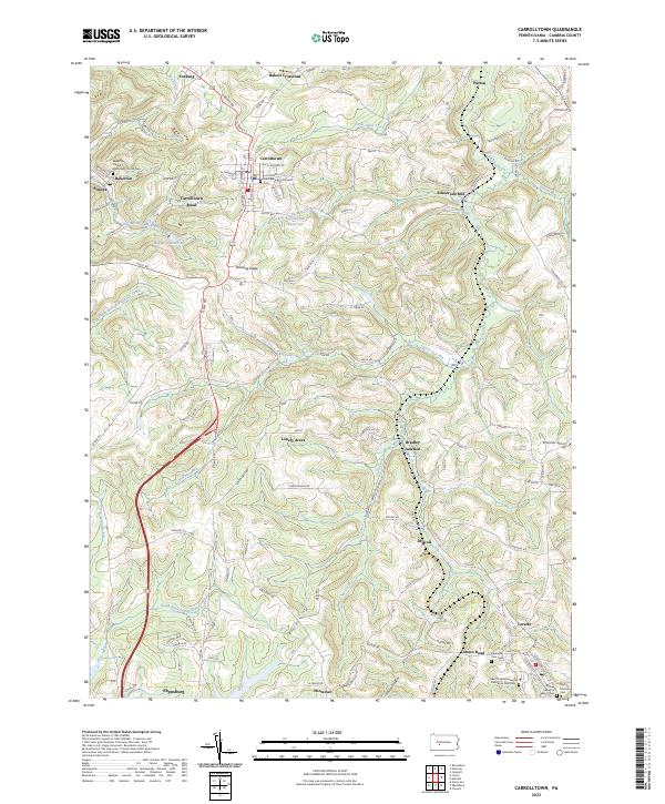 2023 Carrolltown2023 Print · USGSThe northern Cambria County hills appear in great detail on this modern survey of the Allegheny Plateau. Genealogists can trace family heritage through sites like the Saint Benedicts Catholic Cem and United Methodist Church Cem, while mapping out the roads connecting Carrolltown to Loretto.
End of results
Showing maps 1-1 of 1
Top cities near Elmora
- Northern Cambria historical maps
- Ebensburg historical maps
- Portage historical maps
- Nanty Glo historical maps
- Patton historical maps
- Beccaria Township historical maps
See more
Frequently asked questions
- What are the different types of historical maps available for Elmora?
- What is the oldest map of Elmora?
- Where can I purchase historical maps of Elmora for my home or office?
- Where can I download high-res historical maps of Elmora?
- Are there historical topographic maps available for Elmora?
- Is there historical aerial imagery available for Elmora?
- Where are historical maps of Elmora sourced from?