Old Maps of State College, Pennsylvania
Explore 24 old maps of State College, spanning from 1908 to today. These high-resolution historic maps reveal how streets, neighborhoods, landmarks, and natural features evolved over time — perfect for genealogy, metal detecting, research, and local history exploration.
What you can do with these maps:
- See how State College changed over time: Compare historical maps to modern-day views to trace roads, homesites, rail lines & more.
- View detailed metadata: Each map includes creators, publishers, year, scale, and archive source.
- Overlay maps with satellite & LiDAR: Visualize the past alongside modern tools to explore terrain & human change.
- Trusted historical sources: Maps sourced from the USGS, Library of Congress, and other archives.
- Access maps your way: View online, download high-res files, or order prints for personal or research use.
Start exploring old maps of State College to uncover forgotten places, hidden landmarks, and the deep history beneath your feet.
State College, PA maps
(24)- 1908 Map of Bellefonte, 1956 Print
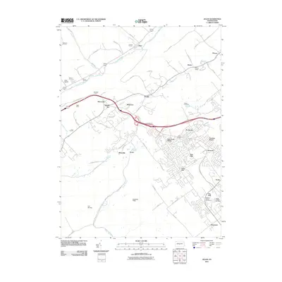
 1908 Bellefonte1956 Print · USGSCentre County at the opening of the twentieth century is a landscape of thriving rail hubs and early academic growth. Genealogists and local historians can trace the foundations of Pennsylvania State College and locate vanished rural landmarks like the Silverdale School or Scotia Benore PO.3 unique versions available
 - 1909 Map of Bellefonte
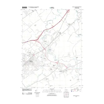
 1909 Bellefonte1909 Print · USGSCentre County at the turn of the century shows a burgeoning academic and industrial landscape centered on the early campus of Pennsylvania State College. Genealogists can trace family names through rural landmarks like Scotia Benore PO, Fairview Church, and the Silverdale School.7 unique versions available
 - 1943 Map of Lewistown
 1943 Lewistown1943 Print · USGSCentral Pennsylvania's rugged ridge-and-valley landscape is documented here during the mid-forties, showing the deep integration of rail lines and mountain gaps. Genealogists can trace family footprints through numerous rural landmarks like Emma Chapel, Mattern Junction, and the McNitt School.
 - 1950 Map of Harrisburg, 1952 Print
 1950 Harrisburg1952 Print · USGSMid-century Central Pennsylvania comes alive through its dense rail networks and river valley settlements during the post-war industrial era. Genealogists and historians can trace family roots through hubs like Harrisburg, locate Carlisle Barracks, or follow the Pennsylvania RR through the Lebanon Valley.
 - 1957 Map of Harrisburg
 1957 Harrisburg1957 Print · USGSMid-century Central Pennsylvania comes into focus as a bustling network of rail, river, and mountain ridges. Genealogists and historians can trace the development of the State Capitol and surrounding hubs like Middletown, Columbia, and Pottsville.7 unique versions available
 - 1961 Map of Harrisburg
 1961 Harrisburg1961 Print · USGSCentral Pennsylvania is shown at a mid-century peak of industrial and military activity, from the Susquehanna water gaps to the fertile Dutch Country. Genealogists and historians can trace the rail corridors of the Pennsylvania RR and find landmarks like Carlisle Barracks or the Anthracite Coal Fields.2 unique versions available
 - 1962 Map of State College, 1964 Print
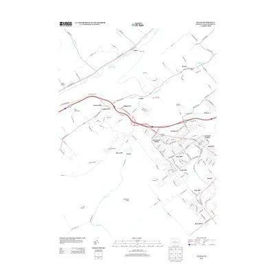
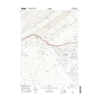
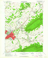 1962 State College1964 Print · USGSState College and the Penn State campus are shown in the early sixties during a period of significant collegiate and local growth. Researchers can trace historic campus buildings like Old Main or locate outlying villages such as Boalsburg and Linden Hall.5 unique versions available
 - 1962 Map of Julian, 1965 Print
 1962 Julian1965 Print · USGSCentre County centers on the growth of State College and The Pennsylvania State University in the early sixties. Researchers can find old transportation routes like the Old Railroad Grade and local landmarks including Pine Hall and the State College Air Depot.5 unique versions available
 - 1964 Map of Harrisburg
 1964 Harrisburg1964 Print · USGSCentral Pennsylvania in the mid-fifties reveals a landscape shaped by ridge-and-valley geology and critical Cold War infrastructure. Researchers can trace the massive Indiantown Gap Military Reservation or the rail corridors of the Pennsylvania RR and Reading RR.
 - 1977 Map of State College, 1979 Print
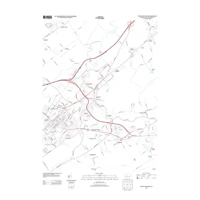
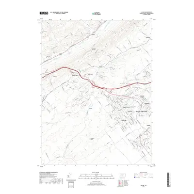
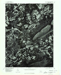 1977 State College1979 Print · USGSState College and the Nittany Valley are captured in this late-seventies aerial survey during a period of steady expansion. Genealogists and local historians can trace the development of Lemont, Houserville, and the residential blocks surrounding State College.
 - 1977 Map of Julian, 1979 Print
 1977 Julian1979 Print · USGSCentre County in the late seventies is captured here at a moment of transition between its deep agricultural roots and rapid suburban growth. Researchers can trace the development of STATE COLLEGE and the rural layout of JULIAN along Bald Eagle Creek.
 - 1984 Map of State College, 1985 Print
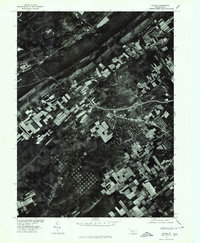
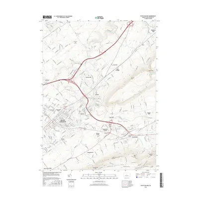
 1984 State College1985 Print · USGSCentral Pennsylvania’s Ridge-and-Valley province is captured here in the mid-eighties, showing the deep connection between the mountain terrain and the region's historic settlements. Researchers can trace the layout of Pennsylvania State University and follow old rail corridors like the Bellefonte Historical RR and Conrail.
 - 1988 Map of State College, 1989 Print
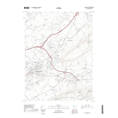
 1988 State College1989 Print · USGSCentral Pennsylvania in the late eighties shows the sprawling influence of Pennsylvania State University against a backdrop of ancient ridges. Genealogists can trace family landmarks like Church Hill Church and the Bellefonte Cemetery across the deep valleys.
 - 1994 Map of Julian, 1999 Print
 1994 Julian1999 Print · USGSCentre County in the mid-1990s shows the suburban expansion of State College toward the wooded heights of Bald Eagle Mountain. Researchers can trace old family burial sites at Campbell Cem, the history of the iron industry at Scotia, and early educational landmarks like Matternville Sch.
 - 2010 Map of Julian, 2010 Print
 2010 Julian2010 Print · USGSCovers State College, including Benner Township, Krumrine, and other nearby areas
 - 2010 Map of State College, 2010 Print
 2010 State College2010 Print · USGSCovers State College, including Boalsburg, Pleasant Gap, and other nearby areas
 - 2013 Map of Julian, 2013 Print
 2013 Julian2013 Print · USGSCovers State College, including Benner Township, Krumrine, and other nearby areas
 - 2013 Map of State College, 2013 Print
 2013 State College2013 Print · USGSCovers State College, including Boalsburg, Pleasant Gap, and other nearby areas
 - 2016 Map of Julian, 2016 Print
 2016 Julian2016 Print · USGSCovers State College, including Benner Township, Krumrine, and other nearby areas
 - 2016 Map of State College, 2016 Print
 2016 State College2016 Print · USGSCovers State College, including Boalsburg, Pleasant Gap, and other nearby areas
 - 2019 Map of State College, 2019 Print
 2019 State College2019 Print · USGSCovers State College, including Boalsburg, Pleasant Gap, and other nearby areas
 - 2019 Map of Julian, 2019 Print
 2019 Julian2019 Print · USGSCovers State College, including Benner Township, Krumrine, and other nearby areas
 - 2023 Map of Julian, 2023 Print
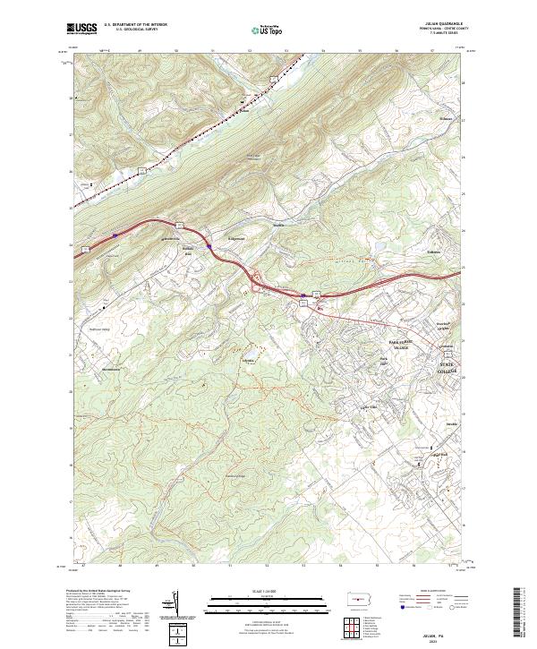 2023 Julian2023 Print · USGSThe outskirts of State College and the rural ridges of the Nittany Valley come together in this modern survey. Genealogists and historians can locate family burial sites at Old Pine Hall Cem and Campbell Cem or trace the old rail bed of the Bellefonte Central Rail Trl.
 - 2023 Map of State College, 2023 Print
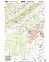
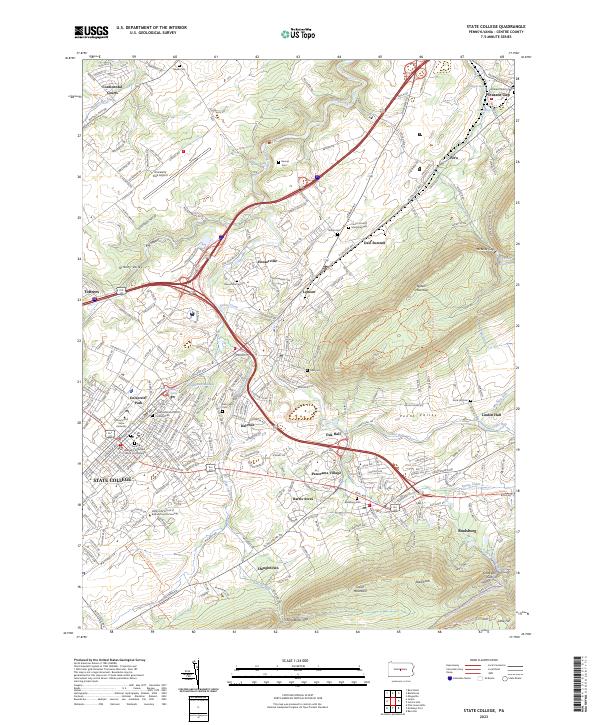 2023 State College2023 Print · USGSCentre County is captured here at a moment of significant academic and suburban growth within the Nittany Valley. Researchers can trace the evolution of local townships through landmarks like Boalsburg, Houserville, and the historic Linden Hall.
End of results
Showing maps 1-24 of 24
Top cities near State College
- Bellefonte historical maps
- Granville Township historical maps
- Boalsburg historical maps
- Pleasant Gap historical maps
- Menno Township historical maps
- Houserville historical maps
See more
Top neighborhoods of State College
- College Heights historical maps
- State College South historical maps
- Downtown State College historical maps
- Holmes-Foster Historic District historical maps
- Orchard Park historical maps
- Greentree historical maps
See more
Frequently asked questions
- What are the different types of historical maps available for State College?
- What is the oldest map of State College?
- Where can I purchase historical maps of State College for my home or office?
- Where can I download high-res historical maps of State College?
- Are there historical topographic maps available for State College?
- Is there historical aerial imagery available for State College?
- Where are historical maps of State College sourced from?