2000s (21st Century) Maps of Bald Eagle Township, Pennsylvania
Explore 5 historic maps of Bald Eagle Township from the 2000s (21st Century). These maps offer a rare glimpse into what life looked like during the 2000s — showing old roads, neighborhoods, homes, and landmarks that have changed or disappeared over time.
Whether you're researching your family's past, planning a metal detecting trip, or studying how Bald Eagle Township's landscape evolved across the 2000s, these high-resolution maps are a powerful tool for exploring the history of this region.
- Focus on a specific era: All maps on this page are from the 2000s, giving you a focused view of this time period.
- See what’s changed: Compare century-old streets, trails, and buildings to today's modern landscape using overlays and satellite layers.
- Research with precision: Use these maps for genealogy, historical research, land use analysis, or educational projects.
- View, download, or print: Maps are fully viewable online in high resolution, and can be downloaded or printed for your own records.
Start exploring Bald Eagle Township's history through authentic maps from the 2000s. This is your window into the past.
Bald Eagle Township, PA maps
(5)- 2023 Map of Howard NW, 2023 Print
 2023 Howard NW2023 Print · USGSClinton County’s high plateau is documented here in the early twenty-first century, showing a landscape defined by deep hollows and vast trail networks. Researchers can trace historic paths and landmarks like Eagleton Fields, the Chuck Keiper Trl, and Bear Swamp.
 - 2023 Map of Mill Hall, 2023 Print
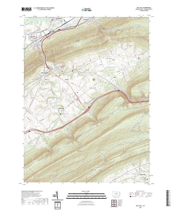 2023 Mill Hall2023 Print · USGSThe Nittany Valley and its surrounding ridges appear in detail during the early 2020s, showing a landscape defined by deep gaps and limestone springs. Local researchers can locate several rural burial grounds like East End Amish Cem and traces of the Pennsylvania Canal.
 - 2023 Map of Lock Haven, 2023 Print
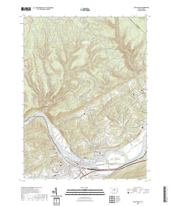 2023 Lock Haven2023 Print · USGSLock Haven and the Susquehanna River valley are captured in this recent survey, showcasing a landscape of riverfront commerce and steep mountain ridges. Researchers can trace historic cemeteries such as Highland Cem, the grounds of Lock Haven University of Pennsylvania, and the path of the Pennsylvania Canal.
 - 2023 Map of Farrandsville, 2023 Print
 2023 Farrandsville2023 Print · USGSClinton County's river-and-rail corridor is documented here in the early twenty-first century as it evolves into a mountain recreation hub. Trace the riverfront hamlets of Farrandsville and Riverview, or explore ridge-top routes like Hyner Mountain Snowmobile Trails Trl and Beech Creek Snowmobile Trails Trl.
 - 2023 Map of Beech Creek, 2023 Print
 2023 Beech Creek2023 Print · USGSClinton and Centre counties are shown here as they appeared recently, centered on the gap where Beech Creek meets the Bald Eagle Creek valley. Family historians can locate numerous burial sites like the Bossert Family Cem or trace landmarks such as Washington Furnace Spring.
End of results
Showing maps 1-5 of 5
Top cities near Bald Eagle Township
- Lock Haven historical maps
- Bellefonte historical maps
- Lamar historical maps
- Mill Hall historical maps
- Flemington historical maps
- Castanea Township historical maps
See more
Top neighborhoods of Bald Eagle Township
Frequently asked questions
- What are the different types of historical maps available for Bald Eagle Township?
- What is the oldest map of Bald Eagle Township?
- Where can I purchase historical maps of Bald Eagle Township for my home or office?
- Where can I download high-res historical maps of Bald Eagle Township?
- Are there historical topographic maps available for Bald Eagle Township?
- Is there historical aerial imagery available for Bald Eagle Township?
- Where are historical maps of Bald Eagle Township sourced from?