Old Maps of Summerhill Township, Pennsylvania for Metal Detecting
Plan your next treasure hunt with 15 historic maps of Summerhill Township. Find old homesites, ghost towns, trails, and gathering spots that may be lost to time — perfect for identifying promising metal detecting locations.
- Locate forgotten sites: Uncover places like long-lost settlements, abandoned rail lines, or gathering spots.
- Plan better hunts: Use map overlays combined with LiDAR or satellite views to narrow in on historically rich areas.
- Made for detectorists: Thousands of hobbyists use these maps to discover relics, coins, and hidden history.
Use these historic maps to boost your research and find new opportunities beneath the surface of Summerhill Township.
Summerhill Township, PA maps
(15)- 1900 Map of Girard
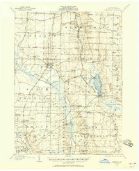
 1900 Girard1900 Print · USGSNorthwestern Pennsylvania at the dawn of the twentieth century was a vital rail corridor defined by the shoreline of Lake Erie. You can trace the path of historic rail lines through Thornton Junction and locate vanished local landmarks like Lundys Lane and Paperville.5 unique versions available
 - 1906 Map of Linesville, 1958 Print
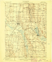
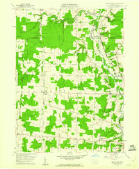
 1906 Linesville1958 Print · USGSCrawford County at the turn of the century is defined by its massive wetland systems and the busy rail corridors crossing the Pymatuning Swamp. Researchers can trace the early layout of Exposition Park on Conneaut Lake or locate old rural centers like Espyville Station and Center Road Station.
 - 1908 Map of Linesville
 1908 Linesville1908 Print · USGSCrawford County at the turn of the century is a landscape of expansive wetlands and rising rail towns. Genealogists can trace family roots through numerous country schools like Brush College School or locate the historic Steamboat Route on Conneaut Lake.4 unique versions available
 - 1950 Map of Cleveland
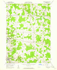
 1950 Cleveland1950 Print · USGSCovers Summerhill Township, including Cleveland, Akron, and other nearby areas
 - 1956 Map of Cleveland, 1967 Print
 1956 Cleveland1967 Print · USGSNortheast Ohio and Western Pennsylvania are shown at their industrial height during the mid-fifties, from the steel mills to the lakeshore. Researchers can trace the massive Ravenna Arsenal, the Ohio Turnpike, and vanished rail sidings of the B & O RR.3 unique versions available
 - 1959 Map of Conneautville, 1960 Print
 1959 Conneautville1960 Print · USGSCrawford County's agricultural and rail-oriented landscape is captured here in the late fifties, showcasing the vital Bessemer & Lake Erie line. Researchers can trace family history through local landmarks like St Nicholas Ch, Rundell, and the Conneaut Valley High Sch.6 unique versions available
 - 1959 Map of Harmonsburg, 1960 Print
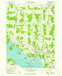
 1959 Harmonsburg1960 Print · USGSCrawford County's lake district is captured here in the late fifties, centered on the recreational and rail hub near the northern tip of the lake. Local historians can trace the paths of the Bessemer and Lake Erie Extension Canal and locate family landmarks like Oak Hill Cem and Dicksonburg.4 unique versions available
 - 1959 Map of Beaver Center, 1960 Print
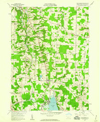
 1959 Beaver Center1960 Print · USGSIn the rural hills of Crawford County during the late fifties, the landscape is defined by the winding Conneaut Creek and a network of small rail towns. You can trace family roots through White Cem or locate the old Drive-in Theater and the historic Shadeland station.4 unique versions available
 - 1959 Map of Linesville, 1961 Print
 1959 Linesville1961 Print · USGSLinesville and the Crawford County countryside are shown here in the late fifties as the local landscape adapted to the Pymatuning impoundment. Researchers can trace numerous small burial grounds like Manning Cem and Quaker Cem or find landmarks like the State Fish Hatchery.3 unique versions available
 - 1962 Map of Cleveland
 1962 Cleveland1962 Print · USGSNortheast Ohio and the Pennsylvania borderlands appear here during the industrial peak of the early sixties. Genealogists and historians can trace the expansive rail lines of the Nickel Plate Road and the growth of suburbs from Parma to Lyndhurst.
 - 1986 Map of Ashtabula
 1986 Ashtabula1986 Print · USGSThe Lake Erie shoreline and the rural borderlands of Ohio and Pennsylvania are captured here as they appeared in the 1980s. You can trace industrial rail lines like the BESSEMER AND LAKE ERIE or locate family sites near Kelloggsville Cem and Pymatuning State Park.2 unique versions available
 - 2023 Map of Beaver Center, 2023 Print
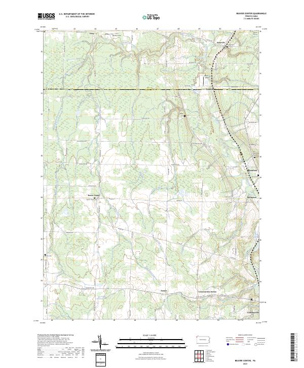 2023 Beaver Center2023 Print · USGSSettled along the creeks of Crawford County, this recent survey captures the rural landscape near Springboro and Beaver Center. Genealogists can locate family landmarks like Saint Sava Cem, Brooks Cem, and Keepville Cem.
 - 2023 Map of Conneautville, 2023 Print
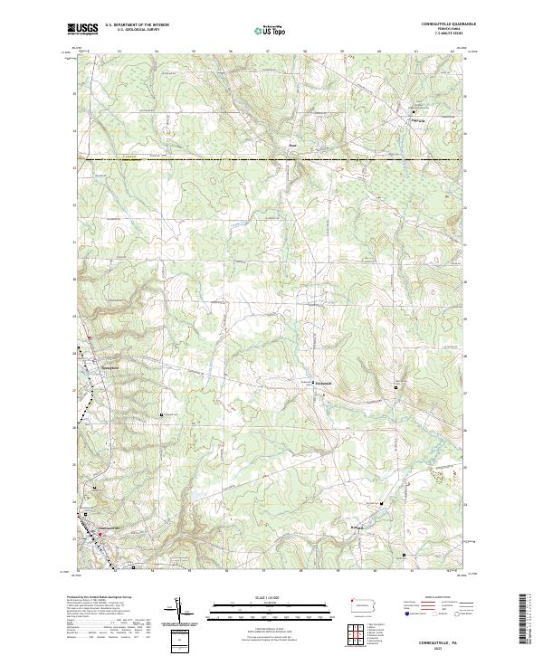 2023 Conneautville2023 Print · USGSCrawford County settlements and rural watercourses are documented here in the early 2020s. Genealogists can trace family landmarks across Conneautville and Springboro, including the Coblentz Cem and Rundell Cem.
 - 2023 Map of Linesville, 2023 Print
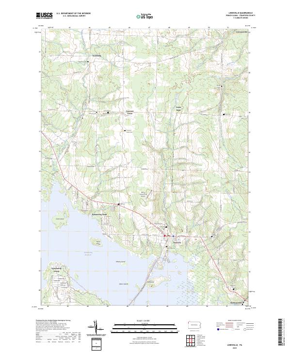 2023 Linesville2023 Print · USGSCrawford County at the start of the 2020s shows a landscape where lakeside recreation at the Pymatuning Reservoir meets deep-rooted rural history. Researchers can trace family sites through numerous burial grounds like Sacred Heart Cem and Frey Cem or locate the small airfields and hamlets of Linesville and Steamburg.
 - 2023 Map of Harmonsburg, 2023 Print
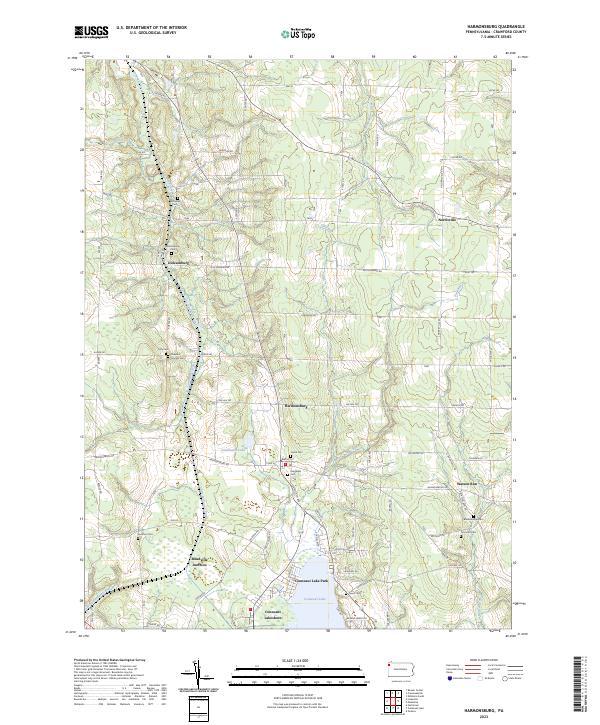 2023 Harmonsburg2023 Print · USGSCrawford County's landscape preserves the path of the Erie Extension Canal alongside rural villages like Harmonsburg. Genealogists can trace family heritage through numerous burial sites including Dicksonburg Cem and Johnston Cem near Watson Run.
End of results
Showing maps 1-15 of 15
Top cities near Summerhill Township
- Meadville historical maps
- Conneaut historical maps
- Edinboro historical maps
- Spring Township historical maps
- Albion historical maps
- Andover historical maps
See more
Top neighborhoods of Summerhill Township
Frequently asked questions
- What are the different types of historical maps available for Summerhill Township?
- What is the oldest map of Summerhill Township?
- Where can I purchase historical maps of Summerhill Township for my home or office?
- Where can I download high-res historical maps of Summerhill Township?
- Are there historical topographic maps available for Summerhill Township?
- Is there historical aerial imagery available for Summerhill Township?
- Where are historical maps of Summerhill Township sourced from?