2020s Maps of Jones Township, Pennsylvania
Explore 7 historic maps of Jones Township from the 2020s. These maps offer a rare glimpse into what life looked like during the 2020s — showing old roads, neighborhoods, homes, and landmarks that have changed or disappeared over time.
Whether you're researching your family's past, planning a metal detecting trip, or studying how Jones Township's landscape evolved across the 2020s, these high-resolution maps are a powerful tool for exploring the history of this region.
- Focus on a specific era: All maps on this page are from the 2020s, giving you a focused view of this time period.
- See what’s changed: Compare century-old streets, trails, and buildings to today's modern landscape using overlays and satellite layers.
- Research with precision: Use these maps for genealogy, historical research, land use analysis, or educational projects.
- View, download, or print: Maps are fully viewable online in high resolution, and can be downloaded or printed for your own records.
Start exploring Jones Township's history through authentic maps from the 2020s. This is your window into the past.
Jones Township, PA maps
(7)- 2023 Map of Wilcox, 2023 Print
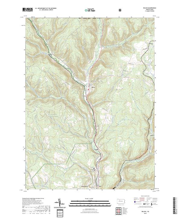 2023 Wilcox2023 Print · USGSElk County’s river valleys and forested uplands are captured in this modern survey of the Wilcox area. Researchers can trace family history through the Wilcox Cem and Wardville Cem or locate old settlements like Dahoga, Tambine, and Ketner.
 - 2023 Map of Crosby, 2023 Print
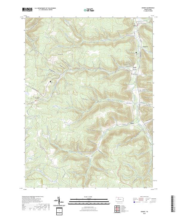 2023 Crosby2023 Print · USGSMcKean County's deep hollows and creek-side hamlets are documented in this modern survey of the Pennsylvania high country. Local historians can trace the foundations of settlements like Clermont and Betula or locate family burial sites at Norwich Cem.
 - 2023 Map of Hazel Hurst, 2023 Print
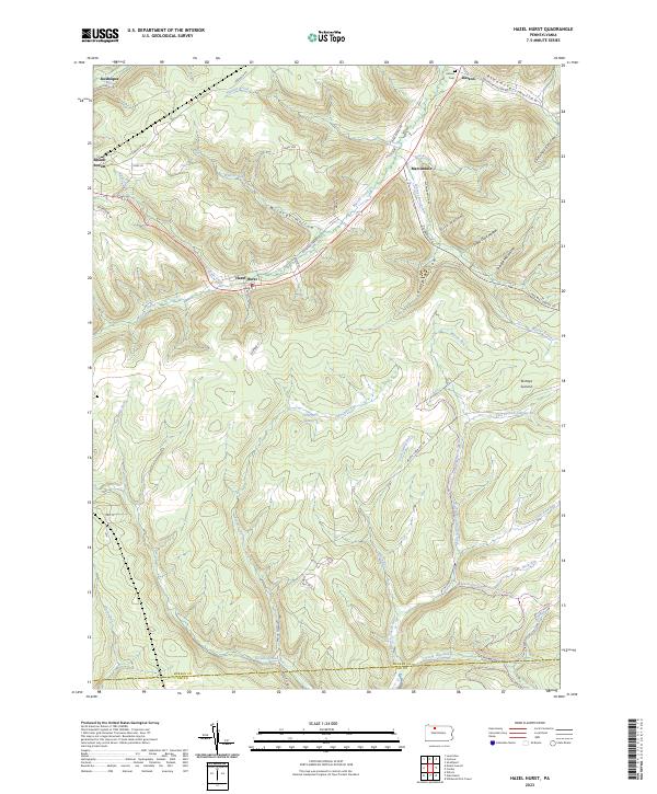 2023 Hazel Hurst2023 Print · USGSModern McKean County at the edge of the Elk County line shows a landscape of deep timbered hollows and high summits. Genealogists and hikers can trace old routes like Railroad Grade Rd, find the Kasson Cem, or explore the upper East Branch Clarion River.
 - 2023 Map of Mount Jewett, 2023 Print
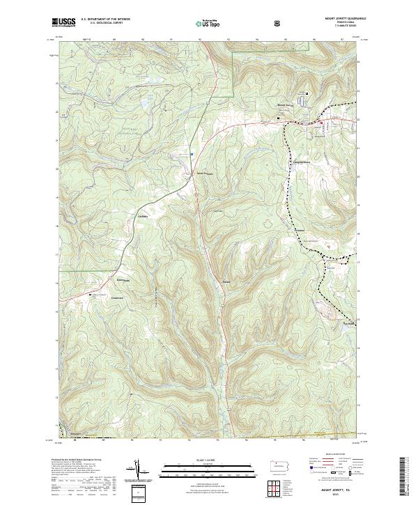 2023 Mount Jewett2023 Print · USGSThe borough of Mount Jewett and the surrounding woodlands of the Allegheny National Forest are shown here as they appear today. Researchers can trace family sites at Nebo Lutheran Chapel and Cem and old settlements like Kanesholm and Hutchins.
 - 2023 Map of James City, 2023 Print
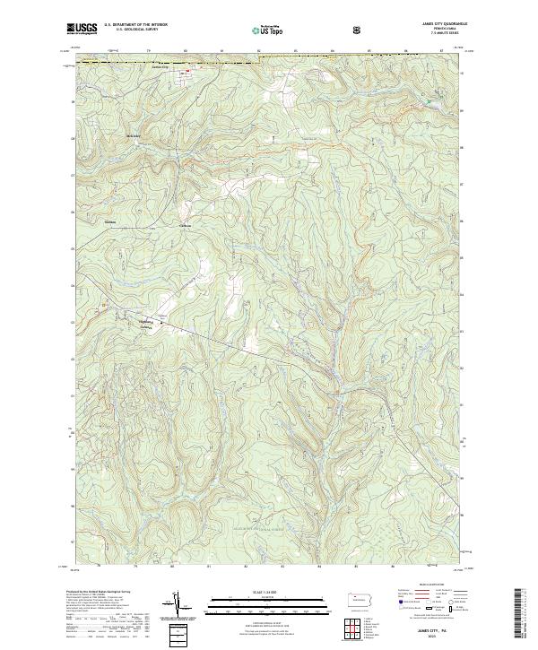 2023 James City2023 Print · USGSElk County's northern timberlands and small settlements are mapped here in the early twenty-first century as part of the Allegheny National Forest. Family historians can locate Highland Cem and trace old routes through James City, McKinley, and Nansen.
 - 2023 Map of Glen Hazel, 2023 Print
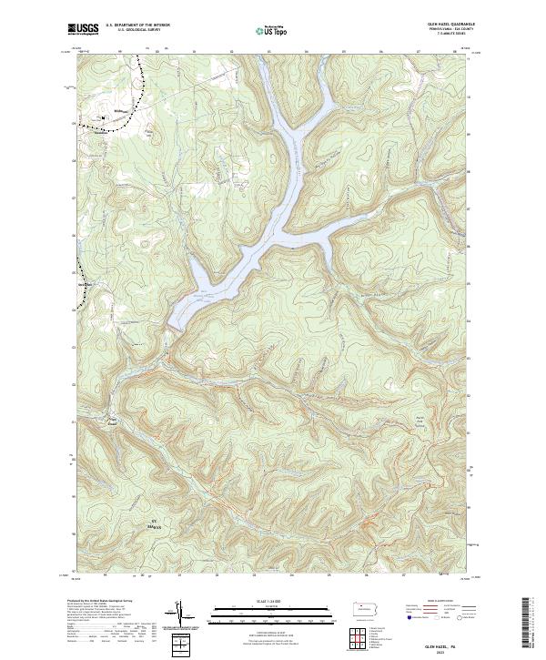 2023 Glen Hazel2023 Print · USGSElk County's high ridges and river valleys are shown in detail as they appeared recently, centered on the East Branch Clarion River Lake. Genealogists and hikers can trace old roads and cemeteries like Holy Cross Cem or follow the Shawmut Grade Rd Trl through Glen Hazel.
 - 2023 Map of Wildwood Fire Tower, 2023 Print
 2023 Wildwood Fire Tower2023 Print · USGSThe Elk and Cameron County borderlands appear here in the 2020s, showing a terrain defined by deep hollows and high ridges. Trace family history and land use through St. Marys, the remote settlement of Straight Creek, and landmarks like Jarrets Summit.
End of results
Showing maps 1-7 of 7
Top cities near Jones Township
- Saint Marys historical maps
- Ridgway historical maps
- Kane historical maps
- Johnsonburg historical maps
- Lafayette Township historical maps
- Mount Jewett historical maps
See more
Top neighborhoods of Jones Township
- Dahoga historical maps
- Instanter historical maps
- Glen Hazel historical maps
- Straight Creek historical maps
- Streights historical maps
- Tambine historical maps
See more
Frequently asked questions
- What are the different types of historical maps available for Jones Township?
- What is the oldest map of Jones Township?
- Where can I purchase historical maps of Jones Township for my home or office?
- Where can I download high-res historical maps of Jones Township?
- Are there historical topographic maps available for Jones Township?
- Is there historical aerial imagery available for Jones Township?
- Where are historical maps of Jones Township sourced from?