2020s Maps of Ridgway Township, Pennsylvania
Explore 6 historic maps of Ridgway Township from the 2020s. These maps offer a rare glimpse into what life looked like during the 2020s — showing old roads, neighborhoods, homes, and landmarks that have changed or disappeared over time.
Whether you're researching your family's past, planning a metal detecting trip, or studying how Ridgway Township's landscape evolved across the 2020s, these high-resolution maps are a powerful tool for exploring the history of this region.
- Focus on a specific era: All maps on this page are from the 2020s, giving you a focused view of this time period.
- See what’s changed: Compare century-old streets, trails, and buildings to today's modern landscape using overlays and satellite layers.
- Research with precision: Use these maps for genealogy, historical research, land use analysis, or educational projects.
- View, download, or print: Maps are fully viewable online in high resolution, and can be downloaded or printed for your own records.
Start exploring Ridgway Township's history through authentic maps from the 2020s. This is your window into the past.
Ridgway Township, PA maps
(6)- 2023 Map of Wilcox, 2023 Print
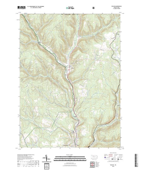 2023 Wilcox2023 Print · USGSElk County’s river valleys and forested uplands are captured in this modern survey of the Wilcox area. Researchers can trace family history through the Wilcox Cem and Wardville Cem or locate old settlements like Dahoga, Tambine, and Ketner.
 - 2023 Map of Carman, 2023 Print
 2023 Carman2023 Print · USGSThe Elk and Jefferson county border comes into focus in this recent survey, centered on the Clarion River and Little Toby Creek valleys. Researchers can trace the legacy of old mountain settlements and cemeteries like Saint Tobias Cemetery and Croyland.
 - 2023 Map of Portland Mills, 2023 Print
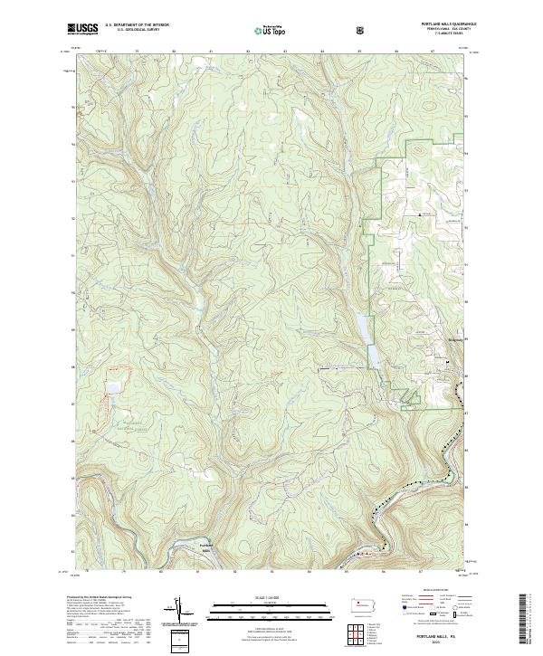 2023 Portland Mills2023 Print · USGSElk County’s deep forest and river valleys are captured here in the modern era, showing the intersection of local industry and recreation. Genealogists and hikers can trace family sites like Ott Cem or explore the extensive Laurel Mill Ski Trl and Historical Path Trl.
 - 2023 Map of James City, 2023 Print
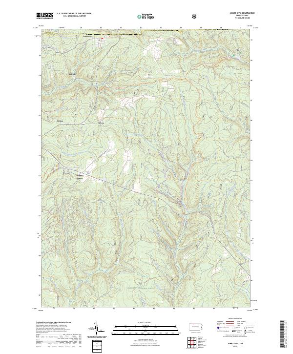 2023 James City2023 Print · USGSElk County's northern timberlands and small settlements are mapped here in the early twenty-first century as part of the Allegheny National Forest. Family historians can locate Highland Cem and trace old routes through James City, McKinley, and Nansen.
 - 2023 Map of Brandy Camp, 2023 Print
 2023 Brandy Camp2023 Print · USGSThe Elk County coal and timber country around the 2020s is defined by its legacy of small company towns and valley hamlets. Genealogists can trace family names and local landmarks like Holy Cross Cem, Horton City, and Brandy Camp.
 - 2023 Map of Ridgway, 2023 Print
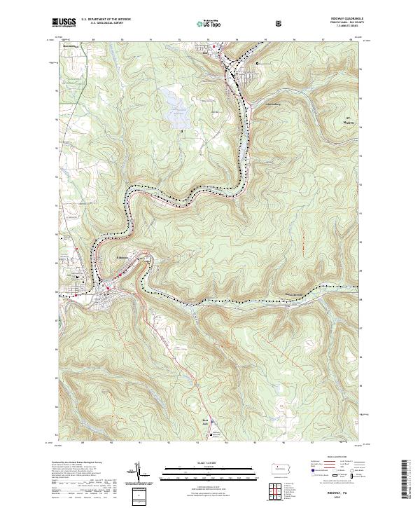 2023 Ridgway2023 Print · USGSElk County's river valleys and forest lands are captured in this modern survey of the Allegheny highlands. Genealogists and local historians can trace the streets of Ridgway and Johnsonburg, locating the Elk County Courthouse and family plots at Laurel Hill Cem.
End of results
Showing maps 1-6 of 6
Top cities near Ridgway Township
- Saint Marys historical maps
- Sandy Township historical maps
- Ridgway historical maps
- Kane historical maps
- Johnsonburg historical maps
- Sheffield Township historical maps
See more
Top neighborhoods of Ridgway Township
- Montmorenci historical maps
- Tapawingo historical maps
- Boot Jack historical maps
- Daguscahonda historical maps
- Whistletown historical maps
Frequently asked questions
- What are the different types of historical maps available for Ridgway Township?
- What is the oldest map of Ridgway Township?
- Where can I purchase historical maps of Ridgway Township for my home or office?
- Where can I download high-res historical maps of Ridgway Township?
- Are there historical topographic maps available for Ridgway Township?
- Is there historical aerial imagery available for Ridgway Township?
- Where are historical maps of Ridgway Township sourced from?