Old Maps of Erie, Pennsylvania for Academic Research
Study the evolution of Erie with 28 high-resolution historic maps. Whether you're teaching, researching, or modeling changes in land use, these maps provide essential visual documentation of urban, environmental, and geographic change.
- Analyze long-term change: Track patterns in development, transportation, and natural features.
- Ideal for environmental or urban studies: Support academic projects with primary historical map data.
- Use in the classroom or lab: Educators and researchers rely on these maps to bring historical context to life.
These maps are a powerful tool for teaching, research, and visualizing how Erie has changed over the decades.
Erie, PA maps
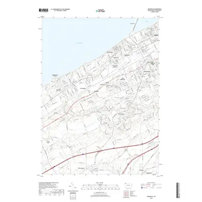
(28)- 1899 Map of Erie, 1956 Print
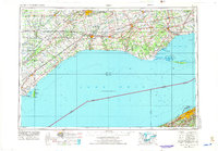
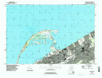
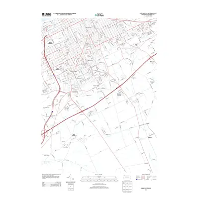
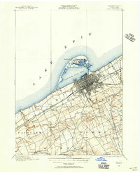 1899 Erie1956 Print · USGSThe industrial and maritime hub of Erie thrived at the turn of the century, anchored by its protected bay and extensive rail networks. Genealogists can trace family footprints through the street grids of ERIE and outlying hamlets like Wesleyville, Swanville, and Middleboro.
 - 1900 Map of Erie
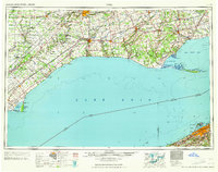
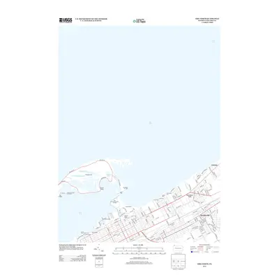
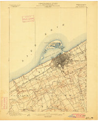 1900 Erie1900 Print · USGSLake Erie's shoreline and the growing industrial port of Erie are captured here at the end of the nineteenth century. Researchers can trace the early rail corridors and find local landmarks like West Library, Sterrettania, and the Presque Isle L.H..8 unique versions available
 - 1950 Map of Erie, 1953 Print
 1950 Erie1953 Print · USGSThe northern and southern shores of the Great Lakes meet in the mid-twentieth century, showcasing the vital shipping and rail corridors between Ontario and Pennsylvania. Trace the routes of the Michigan Central railroad or locate coastal landmarks like Presque Isle Light and the settlement of Iona Station.
 - 1957 Map of Erie South, 1959 Print
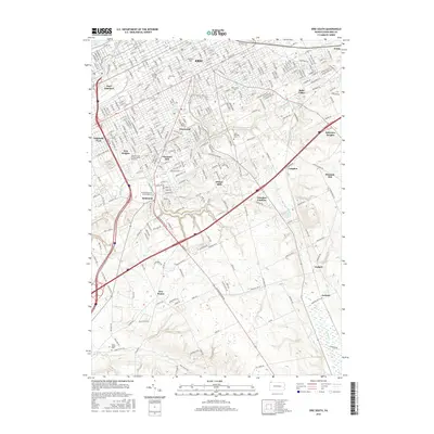
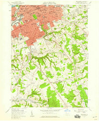 1957 Erie South1959 Print · USGSMid-century Erie shows its southern expansion toward the hills of Summit Township just as suburban growth began to accelerate. Genealogists and local researchers can locate numerous parish schools, the sprawling Erie Cemetery, and rural landmarks like St Matthews Ch and Five Points.4 unique versions available
 - 1957 Map of Swanville, 1959 Print
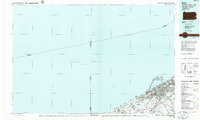
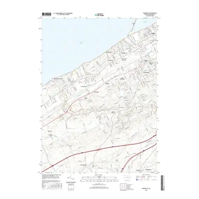
 1957 Swanville1959 Print · USGSThe western suburbs of Erie and the Lake Erie shoreline are captured in the late fifties as residential growth moved toward the countryside. Genealogists and local historians can trace family locations near Waldameer Park, Middleboro, and the historic Weis Library.5 unique versions available
 - 1957 Map of Erie North, 1959 Print
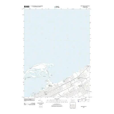
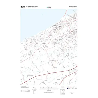
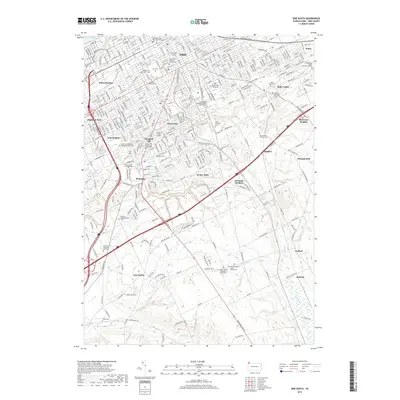
 1957 Erie North1959 Print · USGSErie and its surrounding lakefront communities thrive during the late fifties, defined by the industrial pulse of the lakefront and the protected waters of Presque Isle Bay. Researchers can trace the footprints of old schools and parishes like St James Sch and St Benedicts Academy or locate landmarks such as the State Soldiers and Sailors Home.4 unique versions available
 - 1959 Map of Erie, 1974 Print
 1959 Erie1974 Print · USGSCoastal communities and busy international rail lines define the North Shore and Pennsylvania lakefront during the late fifties and early seventies. Researchers can trace historic docklands and depot sites in Erie, Port Burwell, and Simcoe alongside the extensive reaches of Long Point.2 unique versions available
 - 1965 Map of Erie
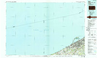
 1965 Erie1965 Print · USGSSouthern Ontario and the Pennsylvania shore are captured in the late fifties, showcasing a robust rail-and-water economy. Trace family roots and old harbor towns like Port Stanley or explore the Six Nations Indian Reserve.
 - 1985 Map of Erie, 1986 Print
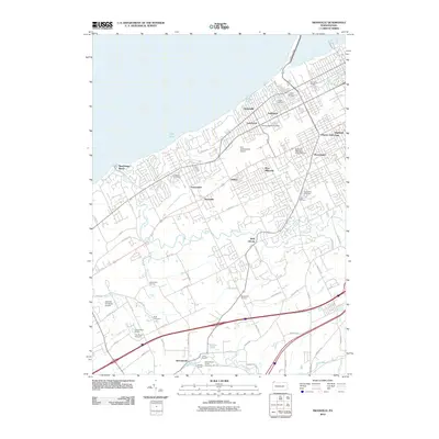
 1985 Erie1986 Print · USGSThe Pennsylvania lakefront and the city of Erie are documented here in the mid-eighties, highlighting the region's transition from industrial hub to regional center. Genealogists and researchers can trace the neighborhoods of Wesleyville and Lake City or locate landmarks like Waldameer Park and the Conrail lines.
 - 1988 Map of Erie, 1989 Print
 1988 Erie1989 Print · USGSThe Lake Erie shoreline in the late eighties reveals a landscape of industrial hubs and coastal recreation. Genealogists and local historians can trace the footprints of Millcreek, the protected waters of Misery Bay, and the historic Lighthouse at the edge of the lake.
 - 1996 Map of Erie North
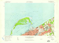
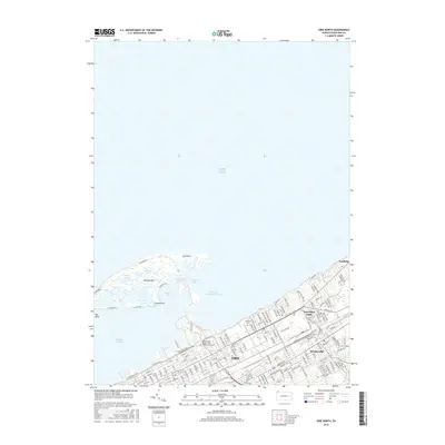
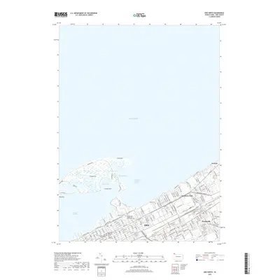
 1996 Erie North1996 Print · USGSThe Pennsylvania lakefront at the end of the century shows a bustling maritime hub defined by the unique arc of Presque Isle. Genealogists and local historians can trace civic life through Lakeside Cemetery, Gannon University, and the many neighborhood parochial schools.
 - 1996 Map of Erie South, 1997 Print
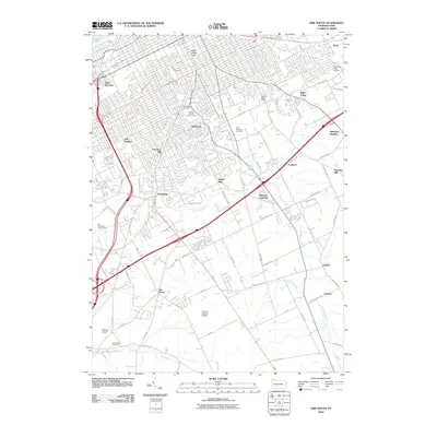
 1996 Erie South1997 Print · USGSGreater Erie in the late nineties shows a city in transition, where established neighborhoods meet the expanding suburbs of Summit Township. Genealogists can trace family sites from Erie Cem and Wintergreen Gorge Cem to schools like McKinley Sch and Tech High Sch.
 - 1998 Map of Swanville, 1999 Print
 1998 Swanville1999 Print · USGSThe Lake Erie shoreline and the expanding suburbs of Erie are captured here in the late nineties as modern infrastructure began to reshape the landscape. Genealogists and local historians can locate Trinity Cem, Villa Maria Academy, and the early layout of Swanville.
 - 2010 Map of Erie North, 2010 Print
 2010 Erie North2010 Print · USGSCovers Erie, including Harborcreek Township, Lawrence Park Township, and other nearby areas
 - 2010 Map of Swanville, 2010 Print
 2010 Swanville2010 Print · USGSCovers Erie, including Fairview Township, Weis Library, and other nearby areas
 - 2010 Map of Erie South, 2010 Print
 2010 Erie South2010 Print · USGSCovers Erie, including Harborcreek Township, Pleasant Hill, and other nearby areas
 - 2013 Map of Erie South, 2013 Print
 2013 Erie South2013 Print · USGSCovers Erie, including Harborcreek Township, Pleasant Hill, and other nearby areas
 - 2013 Map of Erie North, 2013 Print
 2013 Erie North2013 Print · USGSCovers Erie, including Harborcreek Township, Lawrence Park Township, and other nearby areas
 - 2013 Map of Swanville, 2013 Print
 2013 Swanville2013 Print · USGSCovers Erie, including Fairview Township, Weis Library, and other nearby areas
 - 2016 Map of Erie North, 2016 Print
 2016 Erie North2016 Print · USGSCovers Erie, including Harborcreek Township, Lawrence Park Township, and other nearby areas
 - 2016 Map of Erie South, 2016 Print
 2016 Erie South2016 Print · USGSCovers Erie, including Harborcreek Township, Pleasant Hill, and other nearby areas
 - 2016 Map of Swanville, 2016 Print
 2016 Swanville2016 Print · USGSCovers Erie, including Fairview Township, Weis Library, and other nearby areas
 - 2019 Map of Erie North, 2019 Print
 2019 Erie North2019 Print · USGSCovers Erie, including Harborcreek Township, Lawrence Park Township, and other nearby areas
 - 2019 Map of Erie South, 2019 Print
 2019 Erie South2019 Print · USGSCovers Erie, including Harborcreek Township, Pleasant Hill, and other nearby areas
 - 2019 Map of Swanville, 2019 Print
 2019 Swanville2019 Print · USGSCovers Erie, including Fairview Township, Weis Library, and other nearby areas
Showing maps 1-25 of 28
Top cities near Erie
- Harborcreek Township historical maps
- Fairview Township historical maps
- Lawrence Park Township historical maps
- Wesleyville historical maps
- Union City historical maps
- Waterford historical maps
See more
Top neighborhoods of Erie
- Dock Junction historical maps
- Weigelville historical maps
- Federal Hill historical maps
- Eastlawn Hills historical maps
- Bay Lights historical maps
- Bayfront historical maps
See more
Frequently asked questions
- What are the different types of historical maps available for Erie?
- What is the oldest map of Erie?
- Where can I purchase historical maps of Erie for my home or office?
- Where can I download high-res historical maps of Erie?
- Are there historical topographic maps available for Erie?
- Is there historical aerial imagery available for Erie?
- Where are historical maps of Erie sourced from?