2020s Maps of Cumberland Township, Pennsylvania
Explore 4 historic maps of Cumberland Township from the 2020s. These maps offer a rare glimpse into what life looked like during the 2020s — showing old roads, neighborhoods, homes, and landmarks that have changed or disappeared over time.
Whether you're researching your family's past, planning a metal detecting trip, or studying how Cumberland Township's landscape evolved across the 2020s, these high-resolution maps are a powerful tool for exploring the history of this region.
- Focus on a specific era: All maps on this page are from the 2020s, giving you a focused view of this time period.
- See what’s changed: Compare century-old streets, trails, and buildings to today's modern landscape using overlays and satellite layers.
- Research with precision: Use these maps for genealogy, historical research, land use analysis, or educational projects.
- View, download, or print: Maps are fully viewable online in high resolution, and can be downloaded or printed for your own records.
Start exploring Cumberland Township's history through authentic maps from the 2020s. This is your window into the past.
Cumberland Township, PA maps
(4)- 2023 Map of Mather, 2023 Print
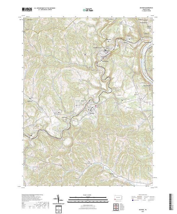 2023 Mather2023 Print · USGSThe Monongahela River valley and the Tenmile Creek forks define this southwestern Pennsylvania landscape in the twenty-first century. Researchers can trace family history through local landmarks like Moredock Cem, Rices Landing, and the Greene County Airport.
 - 2023 Map of Carmichaels, 2023 Print
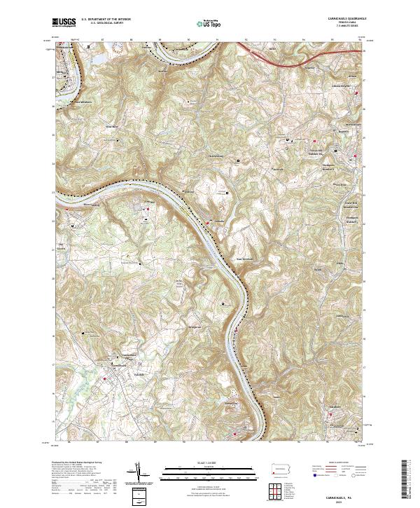 2023 Carmichaels2023 Print · USGSThe Monongahela River valley comes alive in this contemporary view of its historic coal towns and riverside landings. Genealogists and researchers can trace family lines through Greene Academy Cem or explore the layouts of Rices Landing and Crucible.
 - 2023 Map of Masontown, 2023 Print
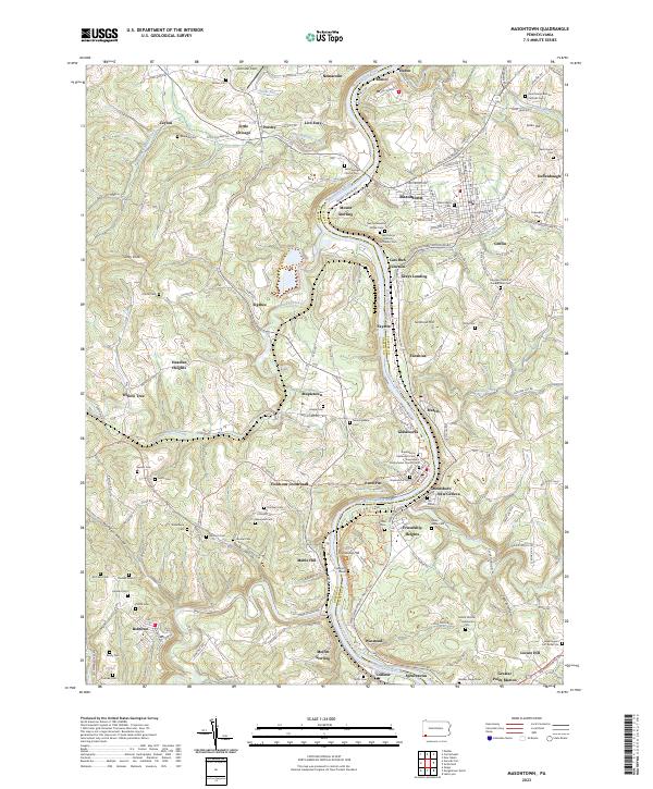 2023 Masontown2023 Print · USGSThe Monongahela River valley comes alive in this contemporary survey of the Fayette and Greene county border. Genealogists can trace family heritage through Sophia's Grave, Swearingen's Fort Burial Site, and the Friendship Hill National Historic Site.
 - 2023 Map of Garards Fort, 2023 Print
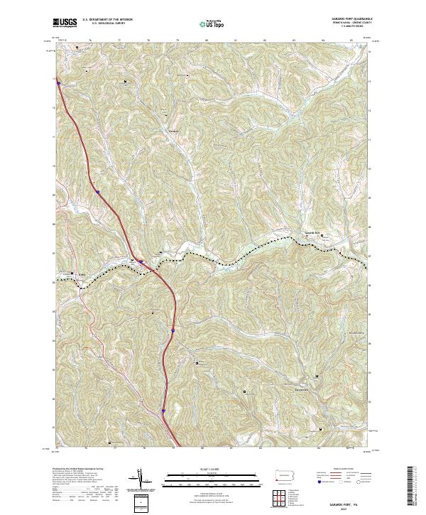 2023 Garards Fort2023 Print · USGSGreene County is shown here in the early twenty-first century, preserving a landscape of family-run farms and small hamlets. Genealogists can trace ancestral sites at Garards Fort Cem, the Hickman Family Cem, and the historic Warrior Trl.
End of results
Showing maps 1-4 of 4
Top cities near Cumberland Township
- Morgantown historical maps
- California historical maps
- Luzerne Township historical maps
- Redstone historical maps
- Waynesburg historical maps
- Masontown historical maps
See more
Top neighborhoods of Cumberland Township
- Ceylon historical maps
- Crucible historical maps
- Little Chicago historical maps
- Live Easy historical maps
- Neil Corner historical maps
- Nemacolin historical maps
See more
Frequently asked questions
- What are the different types of historical maps available for Cumberland Township?
- What is the oldest map of Cumberland Township?
- Where can I purchase historical maps of Cumberland Township for my home or office?
- Where can I download high-res historical maps of Cumberland Township?
- Are there historical topographic maps available for Cumberland Township?
- Is there historical aerial imagery available for Cumberland Township?
- Where are historical maps of Cumberland Township sourced from?