Old Maps of Pitt Gas, Jefferson Township
Explore 13 old maps of Pitt Gas, spanning from 1901 to today. These high-resolution historic maps reveal how streets, neighborhoods, landmarks, and natural features evolved over time — perfect for genealogy, metal detecting, research, and local history exploration.
What you can do with these maps:
- See how Pitt Gas changed over time: Compare historical maps to modern-day views to trace roads, homesites, rail lines & more.
- View detailed metadata: Each map includes creators, publishers, year, scale, and archive source.
- Overlay maps with satellite & LiDAR: Visualize the past alongside modern tools to explore terrain & human change.
- Trusted historical sources: Maps sourced from the USGS, Library of Congress, and other archives.
- Access maps your way: View online, download high-res files, or order prints for personal or research use.
Start exploring old maps of Pitt Gas to uncover forgotten places, hidden landmarks, and the deep history beneath your feet.
Pitt Gas, Jefferson Township maps
(13)- 1901 Map of Waynesburg, 1958 Print
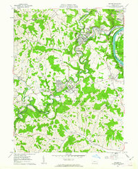
 1901 Waynesburg1958 Print · USGSGreene County at the start of the twentieth century shows a landscape of deep valleys and rising townships connected by the South Fork of Tenmile Creek. Genealogists can trace family names through landmarks like Rees Mill, Gump, and the dual settlement of Kirby Newtown.
 - 1904 Map of Waynesburg
 1904 Waynesburg1904 Print · USGSGreene County was a landscape of deeply carved creek valleys and rural crossroads at the start of the twentieth century. Genealogists and local historians can trace early property settings near Waynesburg, Rees Mill, and the riverside borough of Rices Landing.5 unique versions available
 - 1949 Map of Clarksburg
 1949 Clarksburg1949 Print · USGSThe upper Ohio River valley and the industrial heart of West Virginia come into focus during this post-war period. Genealogists and researchers can trace the rail corridors of the Baltimore and Ohio and locate centers like Fairmont, Grafton, and Waynesburg.
 - 1956 Map of Clarksburg, 1966 Print
 1956 Clarksburg1966 Print · USGSThe Ohio River valley and the industrial heart of West Virginia are seen here in the mid-1950s as rail and river commerce thrived. Researchers can trace historic transport lines like the Baltimore and Ohio RR and locate ancestral homes in Clarksburg, Moundsville, or Parkersburg.2 unique versions available
 - 1961 Map of Clarksburg
 1961 Clarksburg1961 Print · USGSThe mid-century industrial and river landscapes of West Virginia and Ohio are detailed here, centered on the Ohio River. Researchers can trace the Baltimore and Ohio rail lines connecting towns like Parkersburg, Clarksburg, and Monongah.
 - 1961 Map of Mather, 1963 Print
 1961 Mather1963 Print · USGSThe industrial coal and river economy of Greene County is on full display in the early 1960s. Researchers can trace the layout of mining-era housing like Braden Plan, locate the Emerald Mine, or find ancestors at Pollock Cem and Mt Zion Cem & Ch.3 unique versions available
 - 1984 Map of Moundsville
 1984 Moundsville1984 Print · USGSThe Ohio River valley and the Appalachian interior meet in the mid-eighties as a hub of rail and river commerce. Genealogists and historians can trace the development of river towns like New Martinsville, inland hubs like Waynesburg, and the path of the B & O RR.
 - 1988 Map of Clarksburg, 1989 Print
 1988 Clarksburg1989 Print · USGSThe central Appalachians are documented in detail during the late eighties, showing the industrial and river-based economies of West Virginia, Ohio, and Pennsylvania. Researchers can trace historic rail routes like the B & O RR and locate river towns from St Marys to Parkersburg.
 - 2010 Map of Mather, 2010 Print
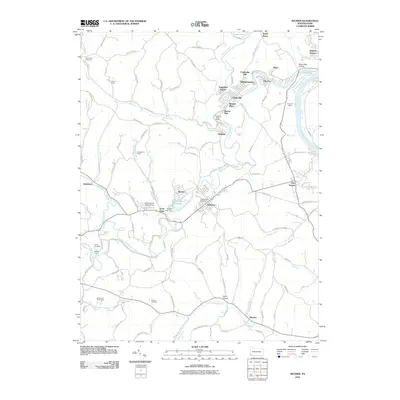 2010 Mather2010 Print · USGSCovers Pitt Gas, including Luzerne Township, Jefferson, and other nearby areas
 - 2013 Map of Mather, 2013 Print
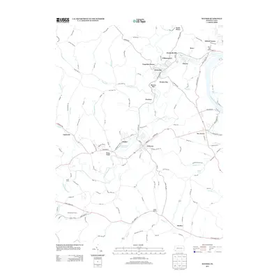 2013 Mather2013 Print · USGSCovers Pitt Gas, including Luzerne Township, Jefferson, and other nearby areas
 - 2016 Map of Mather, 2016 Print
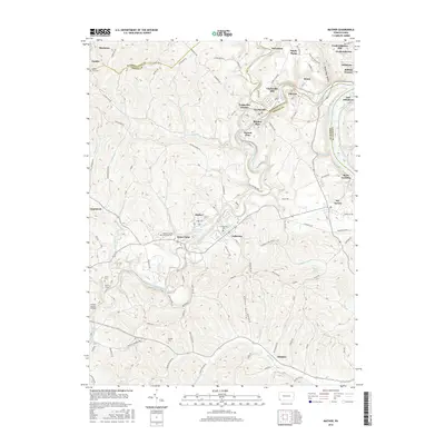 2016 Mather2016 Print · USGSCovers Pitt Gas, including Luzerne Township, Jefferson, and other nearby areas
 - 2019 Map of Mather, 2019 Print
 2019 Mather2019 Print · USGSCovers Pitt Gas, including Luzerne Township, Jefferson, and other nearby areas
 - 2023 Map of Mather, 2023 Print
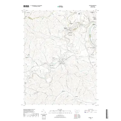
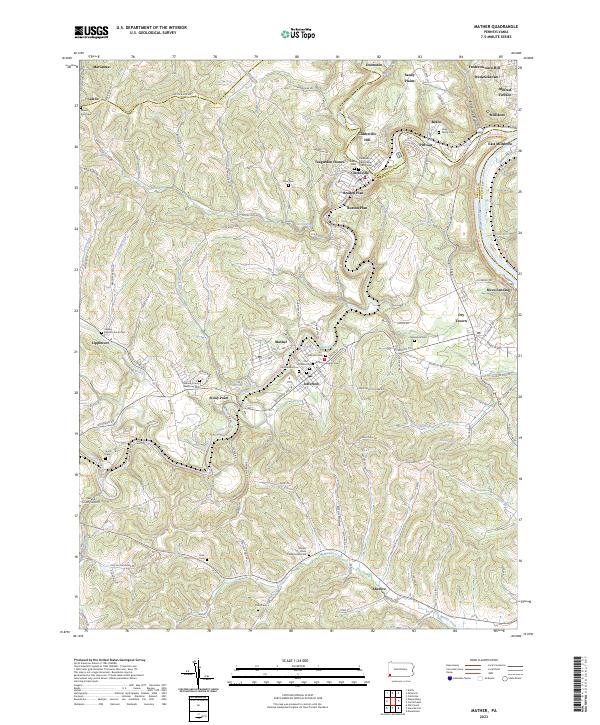 2023 Mather2023 Print · USGSThe Monongahela River valley and the Tenmile Creek forks define this southwestern Pennsylvania landscape in the twenty-first century. Researchers can trace family history through local landmarks like Moredock Cem, Rices Landing, and the Greene County Airport.
End of results
Showing maps 1-13 of 13
Top cities near Pitt Gas
- Washington historical maps
- South Strabane Township historical maps
- Monessen historical maps
- California historical maps
- Luzerne Township historical maps
- Redstone historical maps
See more
Frequently asked questions
- What are the different types of historical maps available for Pitt Gas?
- What is the oldest map of Pitt Gas?
- Where can I purchase historical maps of Pitt Gas for my home or office?
- Where can I download high-res historical maps of Pitt Gas?
- Are there historical topographic maps available for Pitt Gas?
- Is there historical aerial imagery available for Pitt Gas?
- Where are historical maps of Pitt Gas sourced from?